- Share via
It appeared like a swirling specter off the coast of California.
For days, forecasters warned of life-threatening effects as an atmospheric river prepared to unleash a firehose of moisture from Northern California to the Mexican border.
By Monday, those warnings had largely come to pass as the storm lashed the state — damaging homes, crumbling hillsides, flooding neighborhoods and knocking out power to more than 875,000 people. At least three people were killed by falling trees in Northern California, state officials said.
The hazards were also acute in Los Angeles, where the slow-moving system parked itself for more than 24 hours and delivered record-setting precipitation with no signs of letting up. It prompted a state of emergency declaration from Gov. Gavin Newsom, as well as a local emergency declaration from Los Angeles Mayor Karen Bass.
Falling trees killed at least three people in Northern California as a winter storm walloped the state. The system is slowly moving across L.A. and Orange counties.
Experts said the monster storm was the culmination of a variety of factors, including El Niño, climate change and regular winter weather patterns. California typically receives the bulk of its rainfall between January and March, so by that metric, the storm was right on schedule.
But it also fed off unusually warm ocean waters as it grew, which added more moisture to its swelling payload. And as it zeroed in on the coast, the storm reached bombogenesis — or “bomb cyclone” — status, indicating a sustained drop in pressure and a rapid strengthening.
“It did bomb out,” said Alison Bridger, an atmospheric scientist with the Department of Meteorology and Climate Science at San Jose State.
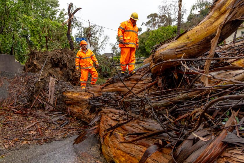
The distinction is significant, Bridger said, as a drop in central pressure helps drive blustery winds. Some parts of the San Francisco Bay Area recorded peak gusts of nearly 100 mph during the storm, leading to those fatal tree falls and other local hazards.
Southern California rain totals from the last five days topped 14 inches in some areas, easily besting the average for the entire month of February.
But there was more to this storm. El Niño, a climate pattern in the tropical Pacific, arrived in June and strengthened through January. The pattern is associated with warm, wet conditions in Southern California, and has been behind some of the region’s biggest rain and flood events, including the wet winters of 1982-83 and 1997-98.
“A strong El Niño event tilts the odds toward wetter-than-average conditions in Central and Southern California in particular,” said Daniel Swain, a climate scientist with UCLA. “And although a lot of people were skeptical that that might happen this year, I think this storm essentially clinches that seasonal prediction this year.”
El Niño tends to enhance the Pacific jet stream and shift it farther to the east, Swain said during a briefing Monday. Such a shift not only allows more storms to move into Central and Southern California, but also to maintain intensity — or even grow more intense — near the coast.
“That is a key reason why this storm became as large of a windstorm and as intense of a rainstorm as it has,” Swain said. “We can’t say that El Niño caused the storm, but a strong El Niño event like this one definitely makes it easier for the atmosphere to produce the kind of pattern conducive for this sort of system.”
As the storm raged Sunday, downtown Los Angeles received a record 4.1 inches of rain — 1.55 inches more than the previous daily record set Feb. 4, 1927. It was the area’s 10th wettest day overall since records began in 1877.
Some parts of the county saw even greater totals, including more than 10 inches in Topanga and Bel-Air overnight Sunday into Monday.
“It’s just a tremendous amount of rain in the last 24 hours,” said Ryan Kittell, a National Weather Service meteorologist in Oxnard.
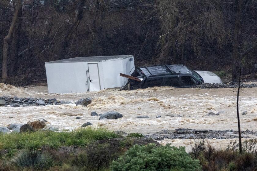
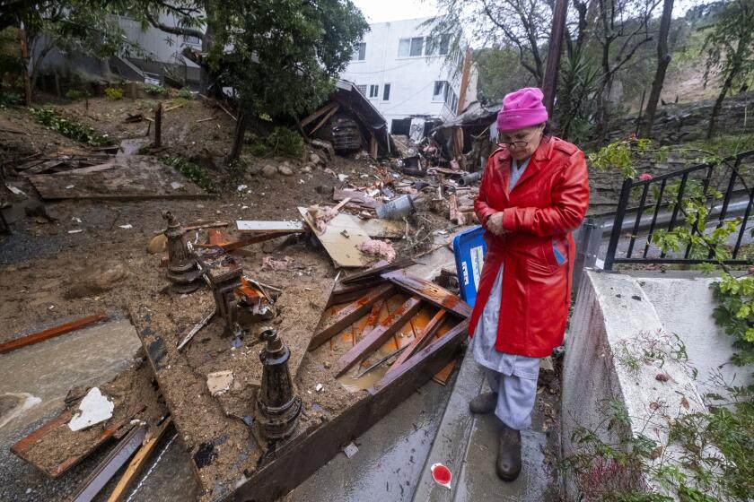
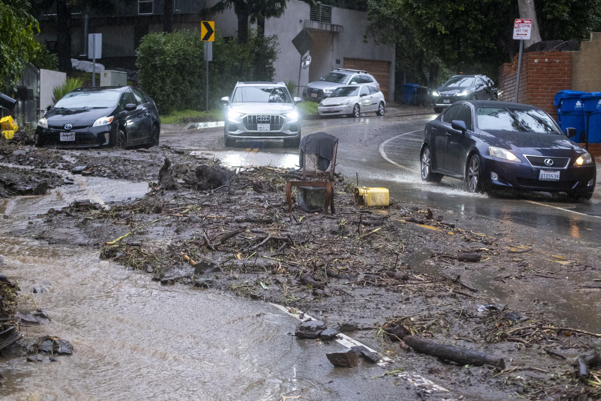
The storm left a trail of damage, including freeway closures across the Southland and submerged vehicles in Calabasas and Agoura Hills. Landslides were reported in the Hollywood Hills and the Santa Monica Mountains, and evacuation orders and warnings were issued for residents in and around wildfire burn scars in Sun Valley, Topanga, Juniper Hills and other areas.
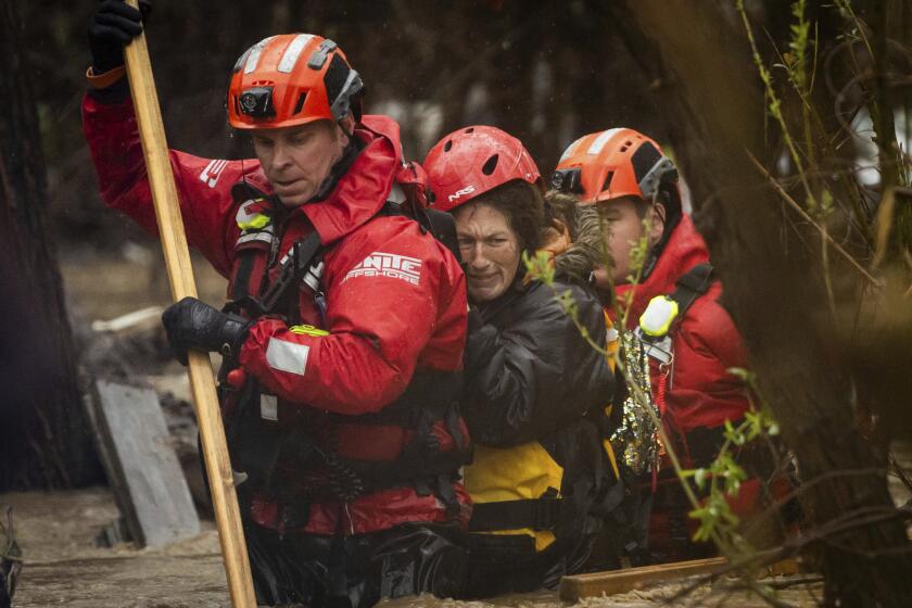
As the storm churned, multiple homes were damaged around Los Angeles and dozens of people were forced to flee. By Monday afternoon, the Los Angeles Fire Department had responded to 130 flooding incidents, 49 mud and debris flows, half a dozen structure fires and several water rescues for stranded motorists, Fire Chief Kristin Crowley said Monday.
“The hazards of this storm have not passed,” Crowley said.
Indeed, additional records are expected to be broken as the storm lingers over Los Angeles and Orange counties into at least Tuesday. As much as 6 additional inches of rain are possible in the foothills of the Santa Monica and San Gabriel mountains.
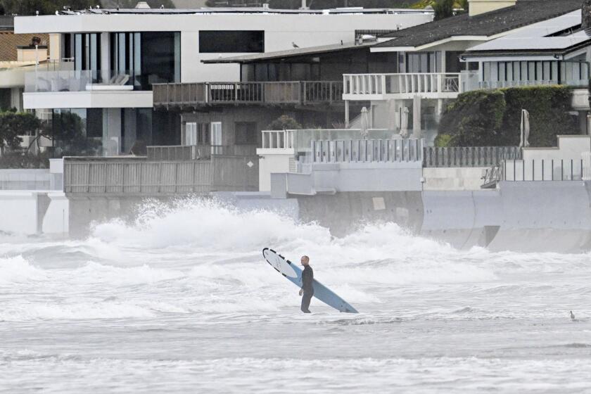
Chilling rain, swirling gray clouds and blustery winds rolled into Southern California on Sunday as what was anticipated as the strongest storm of the season promised near-record rainfall and flash flooding through Tuesday.
Although El Niño may have contributed to the powerful storm, it wasn’t the only ingredient.
Human-caused climate change driven by the burning of fossil fuels is warming the planet’s land and sea temperatures, with 2023 earning the grim designation as the planet’s hottest year on record. The simmering year saw record-warm ocean temperatures, according to the National Oceanic and Atmospheric Administration.
In fact, ocean temperatures are now 2 to 5 degrees above average off the coast of California and all the way to Hawaii, where the atmospheric river began to form. And because warmer atmospheres have a higher capacity to hold water vapor, the storm was able to pull in more moisture as it grew, ultimately leading to more rainfall.
“It makes complete sense that it’s going to have just a little bit more water vapor to it than it would have done 40 years ago,” Bridger said Monday. “And then if you have a storm come along and squeeze that moisture out — which is what’s happening over L.A. today — it makes sense that you could get a little bit more rainfall.”
The additional rainfall poses real challenges for the state’s water infrastructure, which was built to accommodate a completely different climate, Swain said.
What’s more, the warmer atmosphere means more storms are producing rain instead of snow, which could have disastrous consequences for the state’s water supply. California typically relies on the slow, steady melting of snowpack each spring and summer to provide about one-third of its water in a given year.
“There’s fingerprints of human-caused warming all over events like this,” Swain said. “It doesn’t mean that climate change is the only thing at play … but all of these are playing out in a warmer atmosphere, with a warmer ocean, with more water vapor to work with, and therefore greater precipitation intensity.”
Two ‘thousand-year events’ pummeled San Diego and Ventura. Officials say El Niño, climate change and seasonal patterns make similar storms more likely.
Climate change is also upping the frequency of such events. Already this winter, Southern California has seen two “thousand-year” storms — or events with 0.1% likelihood in a given year.
In December, a storm that barreled through Oxnard delivered a month’s worth of rain in less than an hour.
Last month, a similarly historic event drenched San Diego with more rain in a few hours than the area typically sees in all of January.
Bridger said such extremes are consistent with climate modeling, and there’s every expectation that they will continue.
“In the wintertime, it might be an extreme rainstorm with unusual flooding in San Diego. In summertime it could be temperatures going up to 125 [degrees] in the L.A. Basin,” she said. “We shouldn’t assume we’re protected from that kind of craziness anymore.”
The latest storm could continue to deliver periods of rain, mountain snow and thunderstorms in the Los Angeles area through Wednesday night, the National Weather Service said.
There also remains “a considerable flood threat” in Orange County, the western parts of the Inland Empire and the coastal slopes of the San Bernardino Mountains as the storm pushes south and east, with a more localized threat for the deserts and all of San Diego County.
Such storms can also have silver linings, however. Statewide precipitation is now 90% of average for this time of year, and the state’s largest reservoirs are at 116% of their historical average, state data show.
“These extreme events are more likely now than they used to be,” Bridger said. “Whether we like it or not.”
Times staff writer Grace Toohey contributed to this report.
