Five days, up to 14 inches of rain: See the totals from a drenching few days in Southern California
- Share via
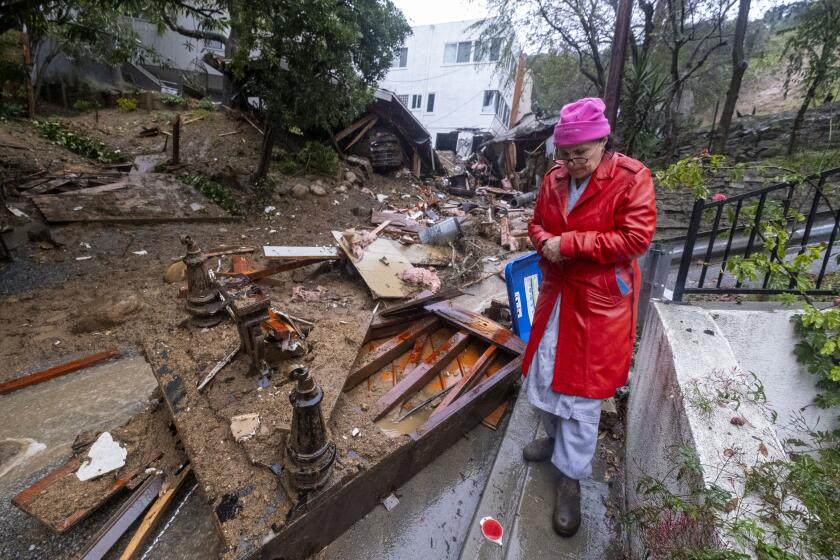
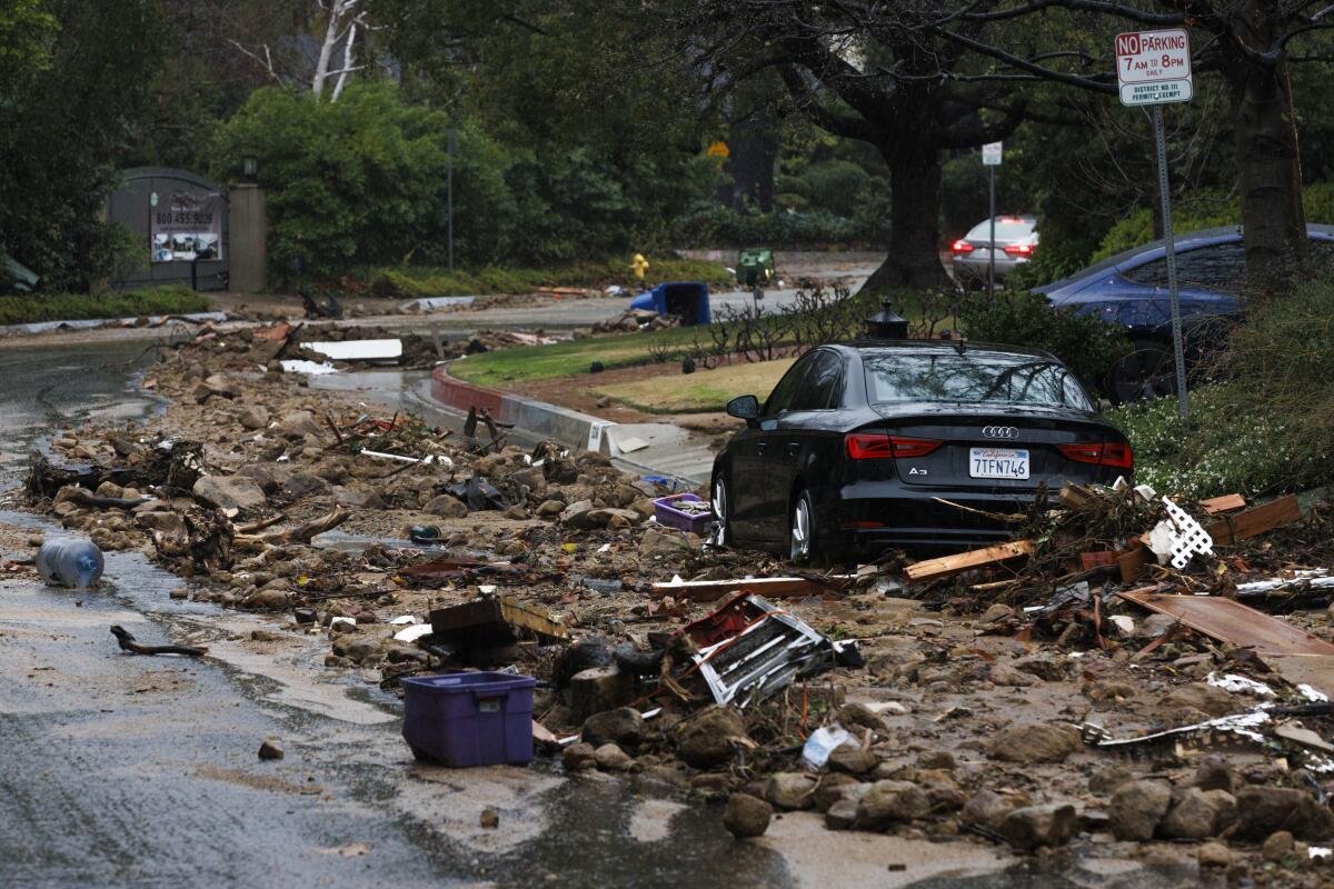
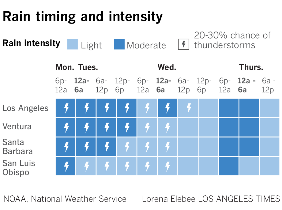
An atmospheric river that drenched Southern California over the last few days forced evacuations, caused more than 500 mudslides and flooded roadways across the region as the storm remained parked over the Los Angeles area for days.
Then Wednesday — just as it seemed the major atmospheric river system was moving out — a smaller, colder system brought an additional blast of precipitation, pushing eye-popping rain totals even higher.
Rain totals from the last five days topped 14 inches in parts of the Santa Monica and San Gabriel mountains, including in Topanga (14.2) and Cogswell Dam north of Monrovia (14.88), according to the National Weather Service’s latest counts. The five-day total at Lytle Creek reached 15.45 inches.
The rain easily broke daily records on Sunday and Monday, dumping nearly half the average seasonal precipitation in just two days, according to a weather service analysis.
And although no rainfall records were doused Tuesday or Wednesday, downtown Los Angeles did tally a whopping 9.03 inches of rain over a five-day period ending early Thursday.
As Californians face non-stop rain from an atmospheric river this week see how rainfall totals in your area compares to other regions and previous years.
The bulk of that rain, however, fell over a three-day stretch from Sunday to Tuesday, during which 8.51 inches fell on downtown Los Angeles.
That’s the second-highest amount of rain in such a span in downtown L.A. since the weather service began keeping records in 1877. The tally is bested only by a storm in 1938 that delivered 9.21 inches in three days, said John Dumas, a meteorologist with the National Weather Service in Oxnard.
The February rainfall average for downtown is 3.80 inches.
Downtown L.A. has now recorded the seventh wettest February on record, with 10.57 inches of rain having fallen over just the first eight days of this month. The all-time record for the wettest February came in 1998, when 13.68 inches fell.
Since Oct. 1, the beginning of the water year, downtown L.A. has reported 15.80 inches of rain. That’s 118% of its average annual rainfall. The precipitation it normally gets annually averages 14.25 inches, Dumas said.
The recent storm totals mean that downtown L.A. has now received more than a year’s worth of rain since the 2023-24 water season began Oct. 1.
On Sunday, 4.1 inches of rain fell in downtown L.A., representing the rainiest calendar day the area has seen since Dec. 28, 2004, when 5.5 inches of rain fell.
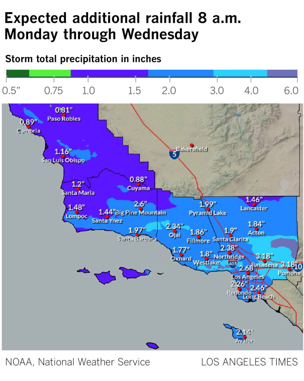
Here are the highest rain tallies for select locations across Southern California as of Thursday morning. The totals include rain that began late Saturday, according to the National Weather Service.
Los Angeles County
- Santa Monica Mountains, at the Topanga fire station: 14.2 inches
- Bel-Air: 13.65 inches
- Woodland Hills: 12.88 inches
- San Gabriel Dam: 11.73 inches
- Porter Ranch: 11.18 inches
- Agoura Hills: 9.69 inches
- Beverly Hills: 9.81 inches
- Alhambra: 9.53 inches
- Van Nuys Airport: 9 inches
- Downtown Los Angeles: 9.03 inches
- Pasadena: 9.34 inches
- Sierra Madre: 9.52 inches
- Calabasas: 8.62 inches
- Culver City: 8.60 inches
- Hollywood Reservoir: 8.63 inches
- Northridge: 8.04 inches
- Newhall: 8.19 inches
- Chatsworth Reservoir: 7.73 inches
- La Cañada Flintridge: 7.97 inches
- Eagle Rock Reservoir: 7.75 inches
- Santa Monica: 7.38 inches
- Los Angeles International Airport: 5.68 inches
Chilling rain, swirling gray clouds and blustery winds rolled into Southern California on Sunday as what was anticipated as the strongest storm of the season promised near-record rainfall and flash flooding through Tuesday.
Areas with higher elevation saw greater totals as the hills and mountains act as a ramp to push air up and squeeze out the storm’s moisture.
Meanwhile, cities along the coast recorded some of the lowest totals, with 4.61 inches reported at Leo Carrillo State Park.
Santa Barbara and Ventura counties:
- Matilija Canyon near Ojai: 9.69 inches
- Thousand Oaks: 8.03 inches
- Santa Barbara: 5.85 inches
- Ojai: 5.1 inches
- Santa Barbara Airport: 4.01 inches
- Oxnard Civic Center: 3.67 inches
- Carpinteria: 3.71 inches
San Diego, Orange, Riverside and San Bernardino counties
- Lytle Creek: 15.45 inches
- Santiago Peak: 11.34 inches
- Cal State San Bernardino: 9.3 inches
- Coto de Caza: 8.35 inches
- San Onofre: 8.13 inches
- Garden Grove: 5.71 inches
- Prado Dam: 5.73 inches
Times staff writer Rong-Gong Lin II contributed to this report.
More to Read
Sign up for Essential California
The most important California stories and recommendations in your inbox every morning.
You may occasionally receive promotional content from the Los Angeles Times.
