After historic flooding, Death Valley gears up for ‘a long, hard recovery’
- Share via
Reporting from Death Valley National Park — It’s not unusual for thunderstorms to drench Death Valley this time of year, but this October was different.
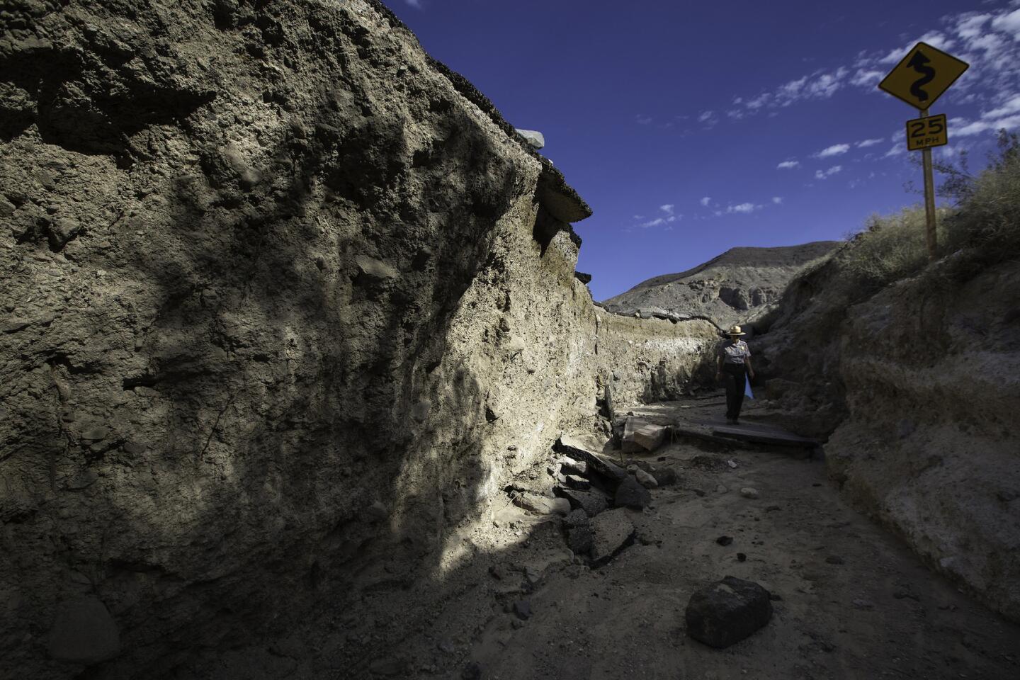
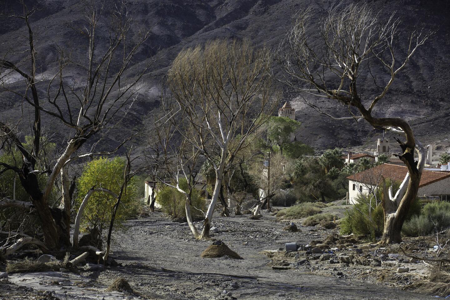
The northern section of the park was hammered by back-to-back storms, followed by a powerful weather system that dropped nearly 3 inches of rain in five hours, triggering a 1,000-year flood event that battered historic structures, chewed through roadways and altered the rugged landscape with layers of mud and rocks.
It was the wettest October on record in the area, which normally receives about 4 inches of rain a year.
Water and Power is The Times’ guide to the drought. Sign up to get the free newsletter >>
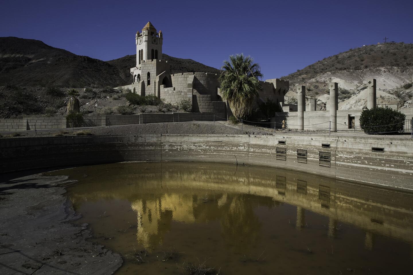
Hardest hit was one of the park’s best-known tourist stops, the area surrounding Scotty’s Castle, a rambling medieval-style villa erected in steep and narrow Grapevine Canyon in the 1920s.
The floodwaters in Grapevine Canyon flowed at an estimated rate of about 93,000 cubic feet a second, 10 times that of a 100-year flood, official said. Damage estimates are in the tens of millions of dollars.
Death Valley District Ranger Paul Forward was among three staffers and two dozen visitors temporarily stranded by the torrent.
“It started with heavy hail,” he recalled. “Three hours later, the dry wash was transformed into floodwaters 100 feet wide with 20-foot waves. The air was filled with the sounds of massive boulders grinding against each other as they rolled down the canyon.”
Now, park Supt. Mike Reynolds said, “we’re gearing up for a long, hard recovery.”
This week, federal appraisers fanned out to take a full accounting of the destruction as utility crews continued the massive job of hauling away mountains of muck from roads, utility easements and the Scotty’s Castle area, which is visited annually by 120,000 people and generates about $550,000 in fees a year.
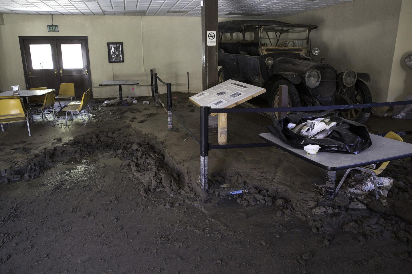
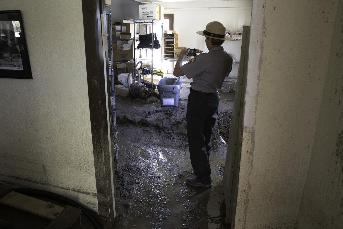
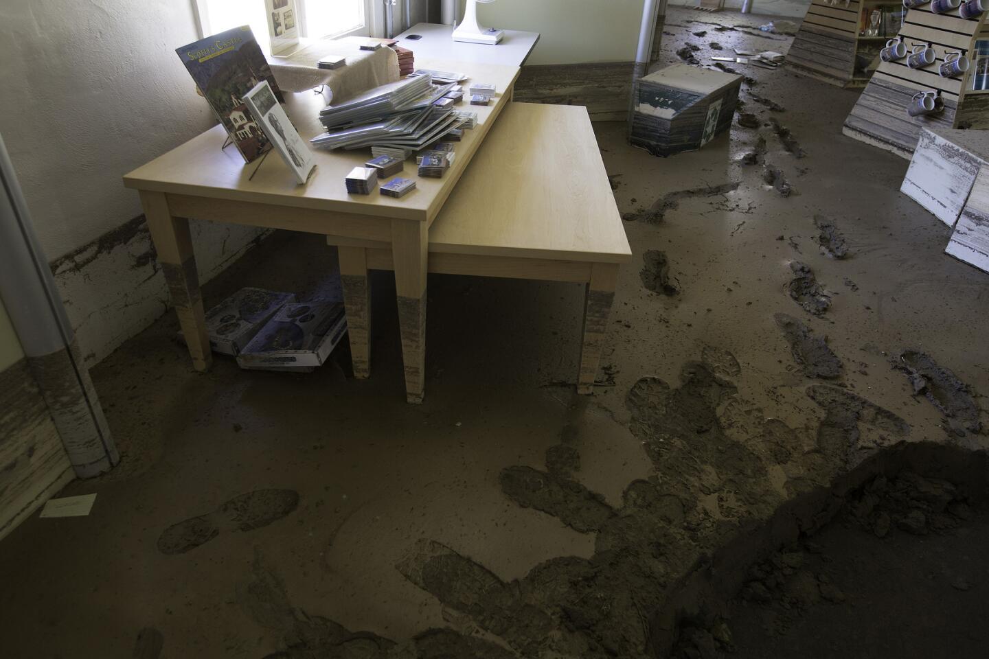
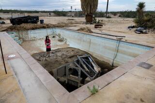
The villa suffered relatively minor damage. But the adjacent visitors center, bookstore and administrative offices were swamped with mud up to 4 feet deep. Some exterior walls are listing under the pressure of debris piled as high as door handles. An outdoor swimming pool, which was never completed in the 1920s, for the first time is filled with water, albeit muddy.
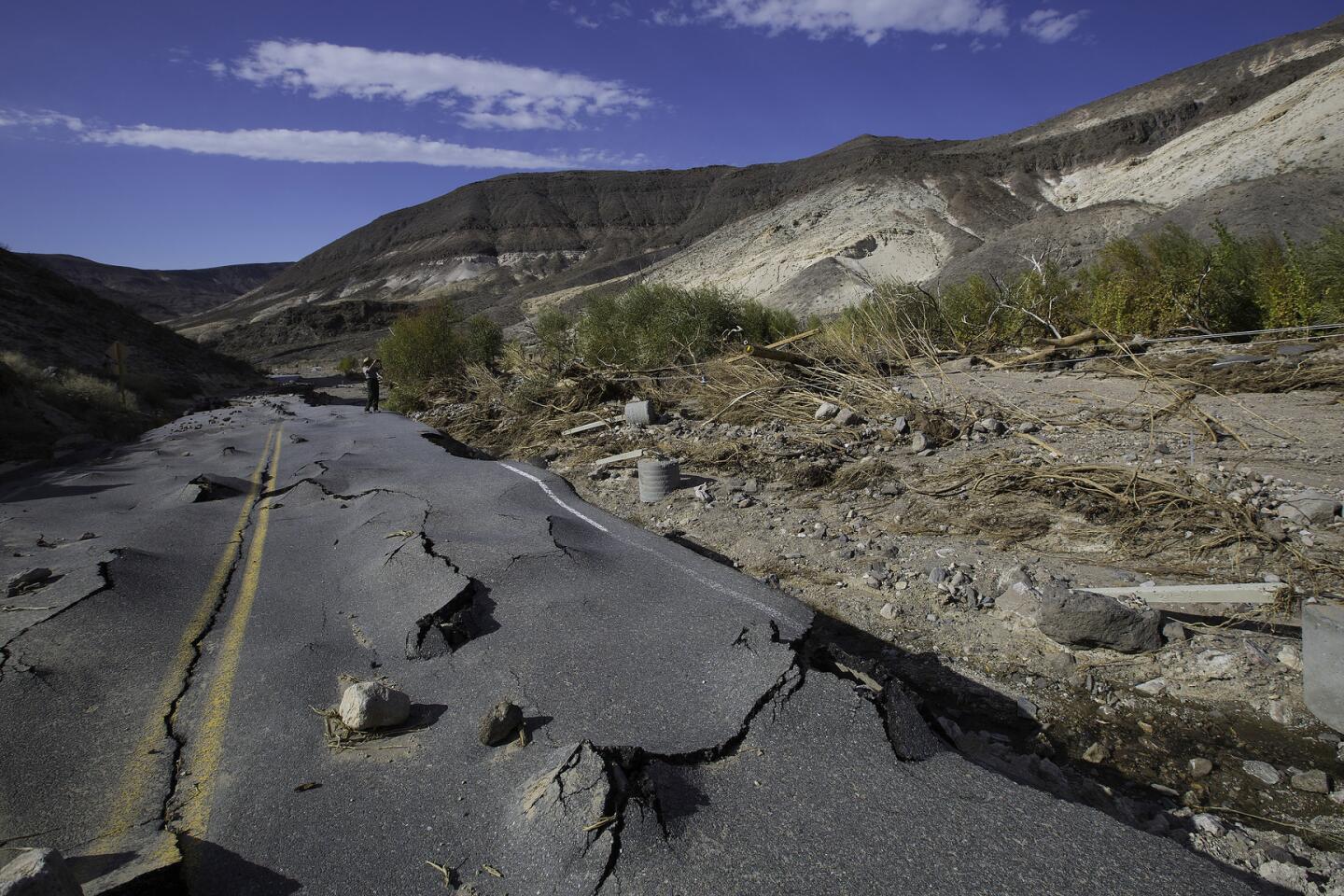
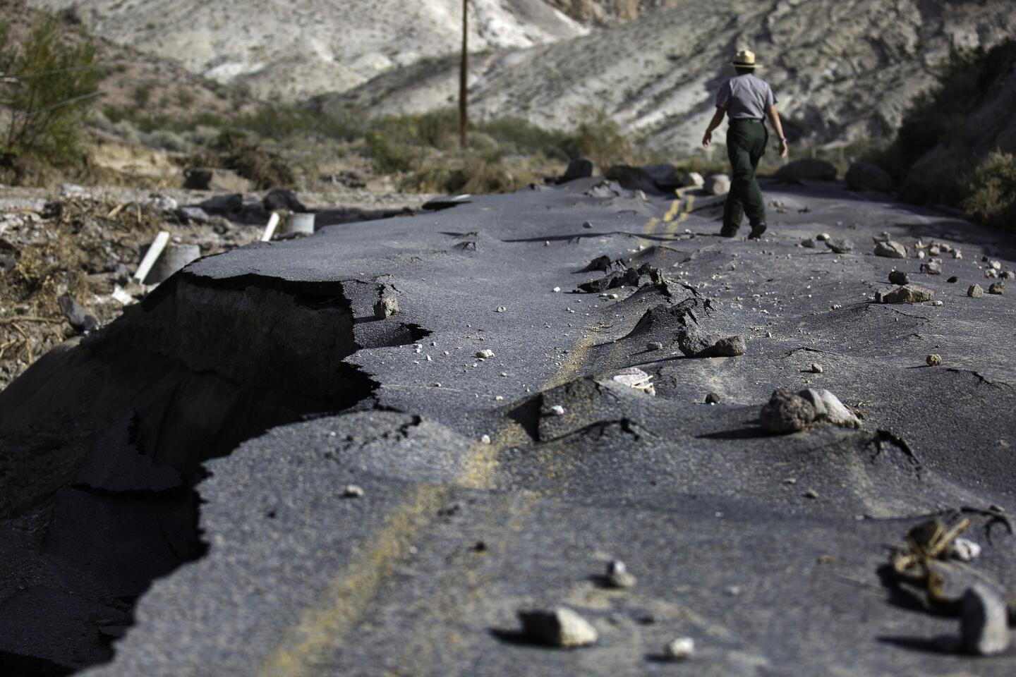
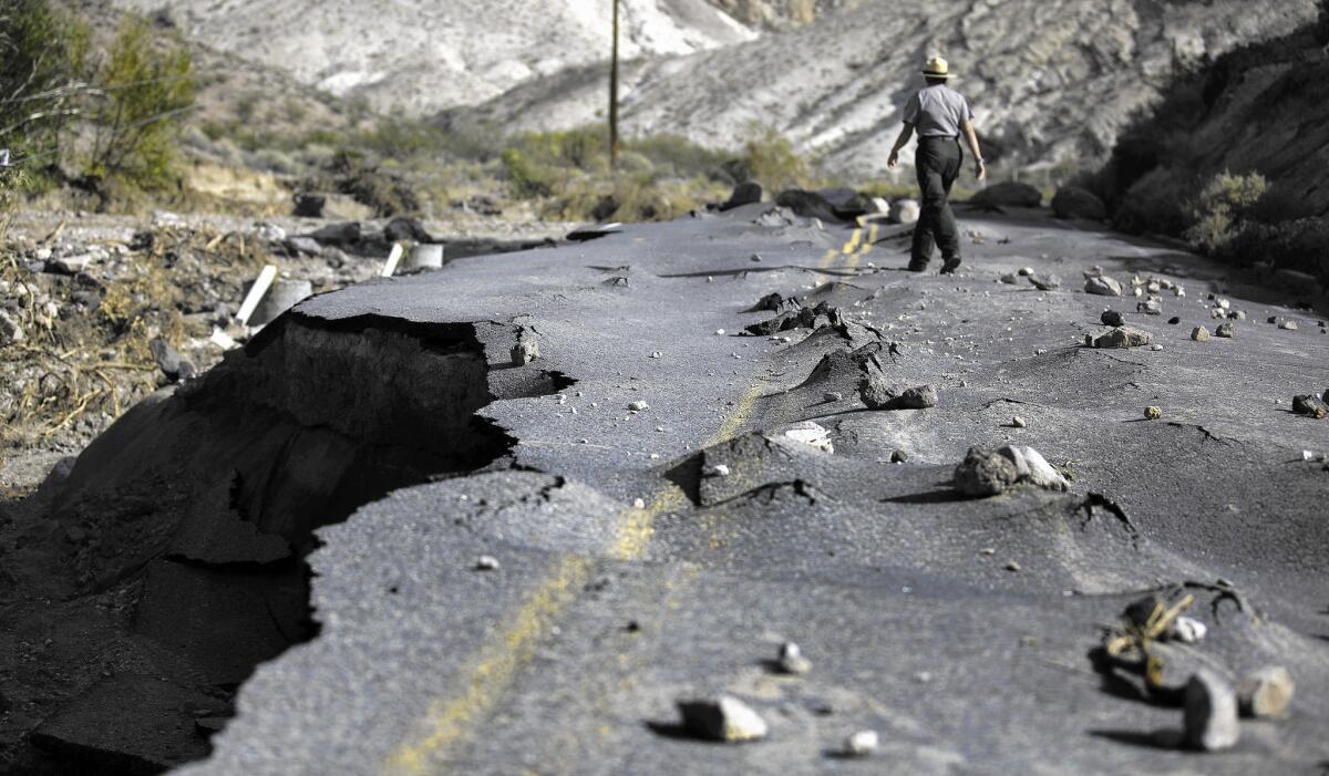
Flooding destroyed the area’s water treatment facility and sewage system, swept away miles of fencing and reduced 24 power poles to splintered stumps. Just north of Scotty’s Castle, a 100-yard-long section of a newly paved two-lane road designed to withstand severe flooding was lifted up by roiling water, then slammed down on a nearby boulder field.
It reminds me of the surreal imagery of melting objects in Salvador Dali’s paintings.
— Dana Dierkes, a National Park Service spokeswoman, about flood-damaged Highway 267
Dana Dierkes, a National Park Service spokeswoman, shook her head in amazement as she strode across the dislocated asphalt that had bubbled and warped around the rocks beneath it. “It reminds me of the surreal imagery of melting objects in Salvador Dali’s paintings,” Dierkes said.
More than 100 people from 22 national parks and National Park Service support services have been deployed to help stabilize infrastructure, salvage furnishings and office equipment, and restore public access in the Scotty’s Castle area.
By Wednesday, 70% of the roads closed because of flooding in October had reopened, along with a majority of attractions in the 3.3-million acre park, which draws about 1 million visitors a year.
Grapevine Canyon and Scotty’s Castle, however, are closed indefinitely, officials said.
Lucy Craft, 27, an interpretive guide at Scotty’s Castle, has been shoveling mud out of historic buildings she normally leads tours in. It’s strenuous and seemingly endless labor, but Craft paced herself by heaving mud into wheelbarrows to the rhythm of a mantra: “Out of sight, out of mind.”
“What happened here makes me sad,” Craft said. “But we’re incredibly grateful that no one was hurt.”
The National Weather Service said October’s storms were not related to El Niño weather patterns. Instead, they were spawned by moist air that frequently drifts across Southern California in August, September and October. Energized by the heat of the desert, the moisture condenses into massive thunderheads that dump large volumes of water in a brief period of time.
“With El Niño approaching, it is possible that more flooding could occur in the park this winter and spring,” Dierkes said.
The good news: More thunderstorms could transform this unforgiving desert of splintery rock towers, dunes and scruffy mountains into panoramic displays of spring wildflowers.
That’s because heavy rains dissolve the waxy protective coatings of millions of seeds that have lain dormant for years in terrain where the temperature can soar to 200 degrees. More flowers will mean more pollinators and birds that feast on them. More seeds will mean more rodents for hungry birds of prey, coyotes, foxes and snakes.
“It’s the paradox of existence in the hottest, driest and lowest place in the United States,” said Linda Slater, a spokeswoman for Death Valley. “Everywhere you look are barren lands carved by torrential rains and flash-flooding, and wildlife taking advantage of the wet weather.
“If trends continue, there will be a ton of wildflowers here in 2016.”
Next year is the National Park Service’s centennial.
ALSO
Embattled SeaWorld to overhaul killer whale show
University of Missouri shakeup in wake of racial turmoil
Supreme Court gives police using deadly force in chases more immunity
