Recent storms give drought-weary California cause for hope, but will they continue?

- Share via
Winter storms that doused California with much-needed rain and snow over the last week have managed to ease some dire drought conditions, but experts warned that the state still has a long way to go to truly reverse its historic dry streak.
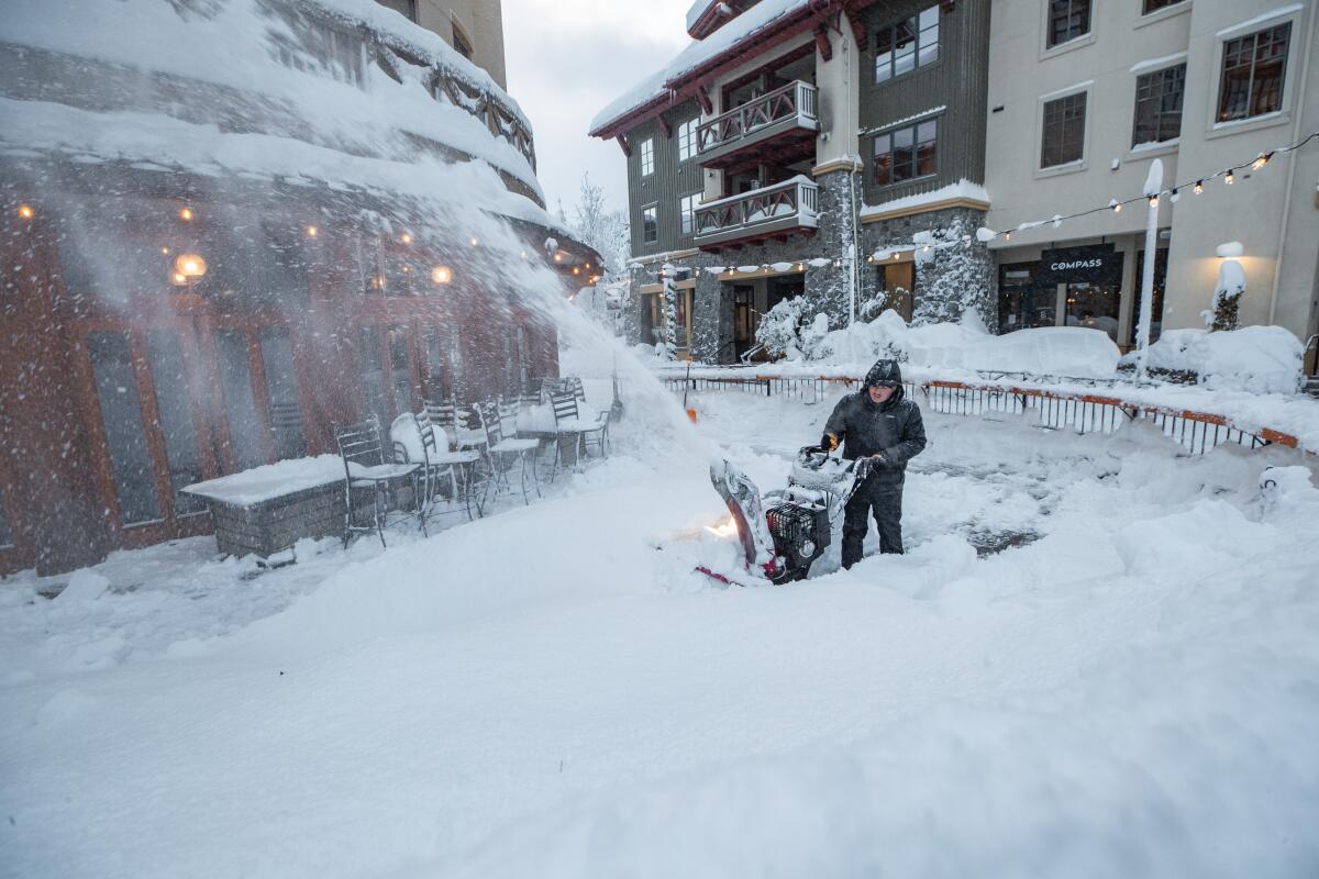
For many, the massive storm system that soaked swaths of the West Coast with inches of rain and feet of snow was a reminder of seasons past as it snarled traffic, triggered rock slides and sparked a blizzard of “winter wonderland” posts on social media.
But as the state’s climate grows warmer and drier, sustained periods of winter rain and snow are becoming increasingly sporadic, experts say. Many fear a repeat of last year, when a similarly soggy December gave way to California’s driest January through March on record.
A storm that broke rainfall records over the weekend continued to move across California, bringing additional rain to the Southland and snow to mountains across the state, leading to weather advisories and dangerous roadway conditions.
“December has started off obviously very well in terms of building snowpack and even soaking other areas with rainfall,” said David Rizzardo, hydrology section manager for the California Department of Water Resources. But “it’s definitely too early to tell, especially when right now it seems like we’re getting similar signals of a possible dry stretch ahead.”
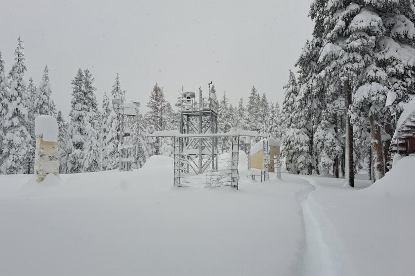
There was some cause for relief, though. Rizzardo said reservoir levels had inched up from the storms, including capacity gains at Lake Shasta and Lake Oroville of about 1% over the week prior. The statewide snow water equivalent, or the amount of water contained in the snowpack, was at 223% of normal as of Monday.
“There’s no doubt it’s all beneficial, and the alternative is certainly not what we want,” he said.
David Simeral, a research climatologist at the Western Regional Climate Center and one of the authors of the U.S. Drought Monitor, said Thursday’s report will almost certainly show “some chipping away at the drought,” at least in the southern two-thirds of the state. Last Thursday’s update showed 85% of the state under severe, extreme or exceptional drought conditions, the three worst categories.
“The back-to-back storms we’ve had over the past several weeks have definitely made an impact in terms of the drought, although they haven’t erased the deficits,” he said. “We’re going to wait and see how things play out moving forward, but I definitely would say there are some things to be optimistic about.”
Simeral said soil moisture levels had also improved from the storms, especially around the coastal and transverse mountain ranges that run from the Bay Area down to just above Los Angeles, which received a good deal of rain. Moisture levels there now range from the 80th to 95th percentile, he said.
“These are really, really good numbers, but I don’t want to get too excited,” he said. “I’m cautiously optimistic as we move further into the winter months, but as we know, particularly from last year, we can have good early-season storms come in, and then the tap gets turned off in early January.”
A repeat of last year’s swing from wet December to bone-dry January was a common concern among experts.
“We’re reminded of this point last year — the end of December when we had really abundant snowfall,” said Rizzardo, of the Department of Water Resources. “The weather and climate outlook was looking rather dry to start off the calendar year, and that’s indeed what happened. We quickly fell back into ‘good try, but still in the drought,’ and that’s kind of the feeling right now.”
It’s something UCLA climate scientist Daniel Swain referred to as “hydroclimate whiplash,” and he said it’s certainly possible again this year. Just weeks ago, conditions were so dry that state water officials said they may only be able to allocate 5% of requested supplies to urban water agencies in 2023.
“We did have some decent early season water, and now December is looking good for most of the state just based on what’s already happened,” Swain said. But there is a “tilt in the odds toward drier-than-average conditions January through spring.”
Indeed, seasonal outlooks issued by the National Oceanic and Atmospheric Administration still lean toward a dry start to the year across much of the West. Bolstering that prediction is the rare third appearance of La Niña, a climate pattern in the tropical Pacific associated with drier-than-average conditions in California, particularly the southern part of the state.
But while La Niña tends to be a somewhat reliable harbinger of overall conditions, it “sometimes gets overwritten by other factors that are much more difficult to predict,” Swain said, including when and where high pressure systems manifest.
Adding to that uncertainty are disruptions to the jet stream, or the fast-flowing air currents in the upper level of the atmosphere that guide weather systems from west to east. Swain said the jet stream pattern is currently “topsy-turvy” because of ridges of extreme high pressure in the Arctic, contributing to wider forecast variations than normal.
A storm brought 3 to 4 feet of snow in the Sierra Nevada and heavy rains across California. The state would need more storms to begin to ease the drought.
Though many metrics do look healthier than a week ago, Swain also noted that reversing the state’s significant dryness in today’s warming climate is no longer just a matter of rain and snow. Evaporative demand — or the amount of water lost from the Earth’s surface to the atmosphere — is increasing as the state gets warmer and more dry.
“We’re realizing it isn’t just a question of precipitation,” he said. “As things get warmer, and as the atmosphere increasingly demands more water from the landscape, unless we’re getting a lot more water on average falling from the sky than we used to, then it’s not going to be in balance.”
That didn’t stop many Californians from celebrating the arrival of wintry weather, however. Many people took to social media to share images of snow-capped mountains, misty foothills, fresh powder and frolicking pets. Even the Los Angeles River, so often reduced to a trickle, turned out some flow.
The researchers said moisture of any kind was welcome. A thorough dousing early in December can prevent soil from stealing too much water later in the season, and at the same time, heavy snowpack can mean more reliable supplies later in the year.
“It was a nice cold storm — one where places didn’t struggle to see snow in the mountains, as has been so common in recent years and decades,” Swain said. “We see fewer of those storms in a warming climate, but they do sometimes happen, and this was one of them.”


