Sailor’s Deep Love of the Sea Results in Map
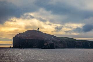
Alone on his 40-foot boat Iris, sailing toward San Miguel Island on the coldest and foggiest of days, Fred Gamble finds himself most at peace.
“There, you can enjoy yourself in solitude,” said Gamble, 55, of his numerous trips to the most remote of the Channel Islands.
For almost a lifetime, the self-described introvert has navigated coastal waters solo, concentrating in the last few years on the Santa Barbara Channel. He’s become something of an expert on the area’s islands, waters and wildlife.
With the knowledge he had gained from his excursions, his conversations with local fishermen and sailors, as well as studies of government maps, Gamble teamed up with map designer Ann Ricchiazzi recently to produce a nautical chart on the Santa Barbara Channel.
Nautical enthusiasts as well as non-sailors have been snatching up the maps at shops as diverse as Conejo Custom Tackle in Thousand Oaks, the Studio Gallery in Oxnard and Channel Islands National Park visitors center in Ventura. Another map focusing on Santa Cruz Island is due in stores this week.
Though government nautical charts typically focus on the waters between land masses, Gamble’s Santa Cruz maps pay particular attention to the shores. The chart includes depths, danger points, anchorages and surfing areas surrounding the land mass. Small illustrations of wildlife such as sea lions and barracudas show where the animals are known to dwell.
The Santa Barbara Channel map, which covers the area from Point Arguello to Port Hueneme, also carefully maps out many of the oil rigs, which are missing from some government charts but are crucial to navigators.
“My motivation for all this,” says Gamble in his deep, hoarse voice, “is I think it’s good for people to go out there. If you go out there and spend some time in nature, you realize how isolated we have become from it.”
Near the islands, boaters can witness the simple beauties such as the sight of fog, he said.
“It comes rolling in like a big marshmallow and crawls over the island and backside,” he said, standing on the docks without an umbrella as the rain fell. “It’s interesting to watch.”
More to Read
Sign up for The Wild
We’ll help you find the best places to hike, bike and run, as well as the perfect silent spots for meditation and yoga.
You may occasionally receive promotional content from the Los Angeles Times.


