Best California places for summer 2021 post-COVID vacations - Los Angeles Times
Advertisement
Filters

Neighborhood

Category

Entertainment

Other

Parks & Trails

Restaurants

Travel

Sort by

Showing  Places
Filters
Map
List
Graphic that says "The Outdoor California List"
(Ana Gómez Bernaus / For The Times)

The 40 best California outdoor experiences. Period.

Share via
Presented by

This is the California we’ve been pining for — 40 summer destinations that call to us loudly in good times and bad.

To build this list, I thought about the places I was most eager to see, hear, feel, smell and taste again after decades of traveling the state and 14 months of staying home. There are no deserts here, because we’re talking about summer. And no theme parks, because they get enough attention. But what epic, irresistible wonders there are! I’ve road-tested them all, except for one spot 14,505 feet above sea level. (Fortunately, my colleague Mary Forgione, of “The 50 Best Hikes in L.A.,†has that summit covered.)

If you’re getting to know California, these 40 are great places to begin. But we’ve tried to make this list more than a starter kit. Even if you’re an old hand, there will be destinations that you’ve missed, and I’ve added a pro tip to every destination.

Has the pandemic changed these places? Yes. Scores of restaurants and other businesses are gone. Among those remaining, there are smaller staffs, more patio seats, shorter hours and tighter crowd limits. All those circumstances are evolving, so check websites.

Advertisement

If you have a nomination for this collection, send it to @mrcsreynolds (Twitter or Instagram), [email protected] or tell us here. Like us in the face of adversity, this list needs to grow and change.

Now let’s get back on the road.
Showing  Places
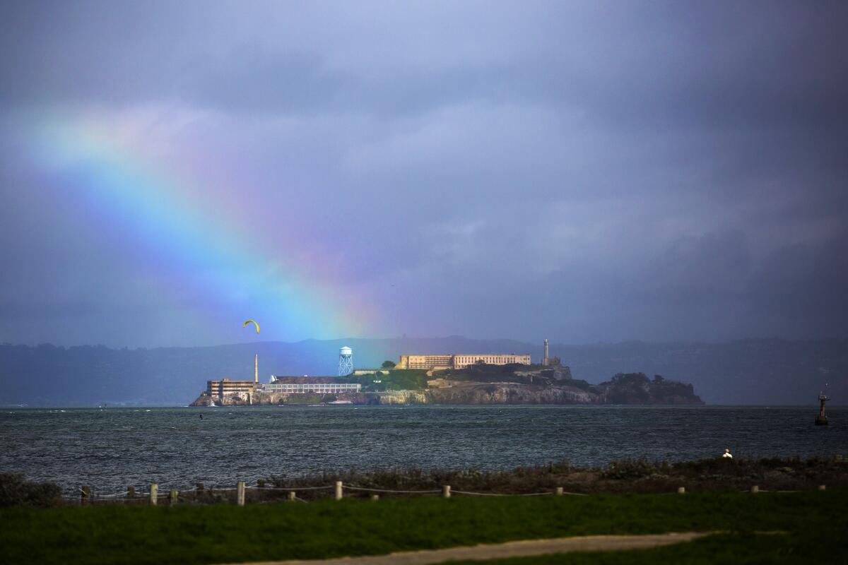
A rainbow over Alcatraz Island in a view from Crissy Field at the Golden Gate National Recreation Area.
(Brian van der Brug / Los Angeles Times)

Alcatraz

San Francisco Attraction
From 1934-1963, Alcatraz was our nation’s most dramatically sited penitentiary, home to gangsters from Al Capone to Whitey Bulger. But it has important civil rights history, too. You reach the island by Alcatraz Cruises ferry from San Francisco’s Pier 33, and the first thing you see on the island is graffiti from 1969-71, when Native American protesters occupied the island. The National Park Service opened the site to the public in 1973. Tours begin at $41 per adult and often sell out weeks in advance.

Pro tip: It doesn’t get massive crowds, but nearby Angel Island State Park (served Fridays-Sundays by the Blue & Gold ferry at Pier 41) is a key landmark in Asian American history. Today, many visit just to hike or ride bikes. But from 1910-40, this was the U.S. entry point for about 175,000 Chinese immigrants, who typically spent weeks or months locked up on Angel Island. Some etched poetry on walls in the Immigration Station and barracks, a 1.5-mile walk from the ferry landing. (As of late May, the interiors were still closed as a pandemic safety measure.)
Read All Read Less
Route Details
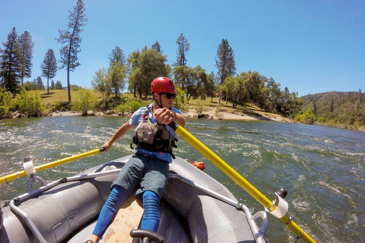
A river guide rows a raft on the South Fork of the American River.
(Christopher Reynolds / Los Angeles Times)

American River by raft

El Dorado County Activity
Running a river is a signature thrill in California’s Gold Country — and if it’s early summer you can expect a few splashes of cold water on your face. Guides say the South Fork of the American River is a perfect introduction to river-rafting, thanks to its evocative scenery and relatively mild Class III rapids. Rookies should sign on with a licensed, experienced company. Family-friendly river floats typically begin north of Placerville below the Chili Bar Reservoir. Once you are more experienced, whiter water awaits along the middle and north forks of the American. Half-day and all-day rafting trips typically cost $100-$180 per person.

Pro tip: Marshall Gold Discovery State Historic Park, where the Gold Rush began, is a less than a mile from many of Coloma’s river outfitters along California 49. Placerville, handy to the river, is a pleasant town for a stroll and meal.
Read All Read Less
Route Details
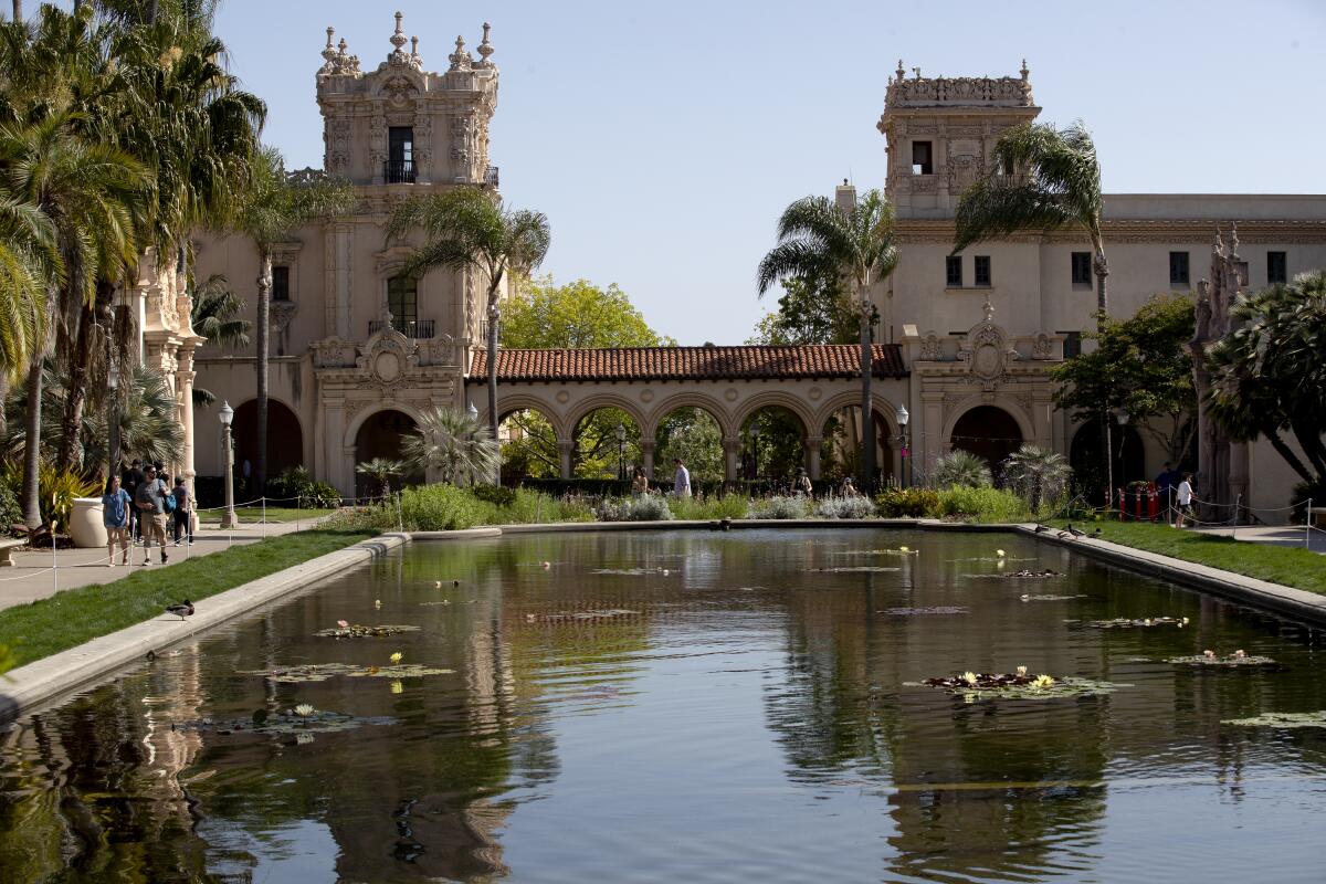
El Prado and the Lily Pond in Balboa Park
(K.C. Alfred / San Diego Union-Tribune)

Balboa Park

San Diego County Park
Let’s start with the San Diego Zoo, which is, you’ll pardon the expression, the park’s 800-pound gorilla. It includes 3,700 animals on 100 acres and its fame is global for good reason. If you have kids, a visit is mandatory. New for this summer: komodo dragon and hummingbird habitats. The basic prices are more affordable than most theme parks — $62 for an adult, $52 for kids 3-11.

Now consider that the zoo is less than 10% of Balboa Park, which covers 1,200 acres. The park is also home to 17 museums featuring art, photography, natural history, science, flight, history, model railroading and more, with a new Comic-Con Museum (still gradually opening). The Old Globe theater complex includes three venues. Flop on the lawn by the big lily pond by the Botanical Building. Try lunch at the Prado restaurant, where the patio seats are best whether we’re in a pandemic or not.

Pro tip: Even if you’ve never had a train set, the San Diego Model Railroad Museum will knock you out.
Read All Read Less
Route Details
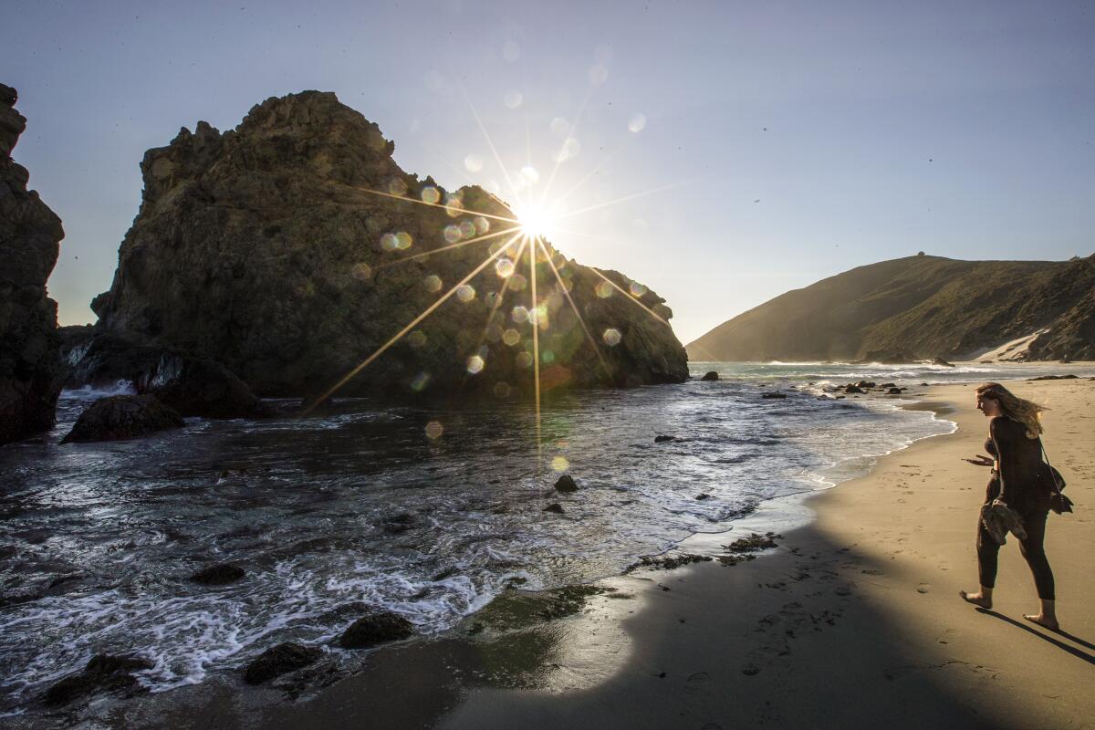
A woman walks along the shore near Keyhole Arch at Pfeiffer Beach.
(Brian van der Brug / Los Angeles Times)

Nepenthe, Big Sur

Monterey County Attraction
In all the California coastline, there is no more dramatic meeting of land and water than Big Sur. One of the best vantage points is the patio at clifftop Nepenthe, where since 1949 diners have gaped at the surf and rocks 800 feet below. There’s plenty of hiking here in several state parks (though many trails are closed for repairs). If your pockets are deep, there’s pampering to be had at the Post Ranch Inn or Ventana Big Sur (where $1,000 a night is routine). In Julia Pfeiffer Burns State Park, you’ll find the half-mile trail overlooking McWay Falls. At Bixby Creek Bridge, you’ll find a familiar view and distracted drivers jockeying for parking spots. At Big Sur Campground and Cabins, campsites this summer start at $80, cabins at $270.

Pro tip: Be warned that mudslides (and sometimes fires) often force California 1 to close, so check its status on the Caltrans website.
Read All Read Less
Route Details
Advertisement
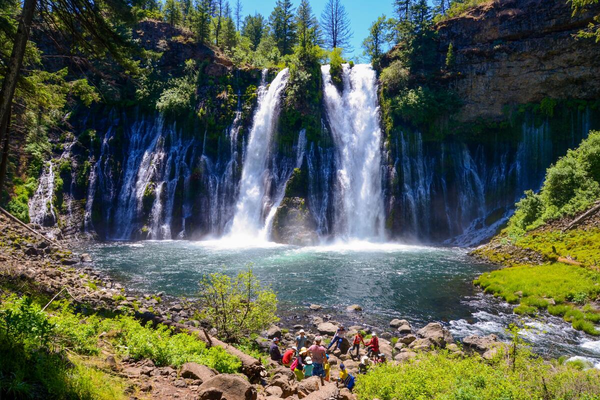
Burney Falls
(Christopher Reynolds / Los Angeles Times)

Burney Falls

Shasta County Attraction
Near the northern edge of California, you can easily see four or more waterfalls in a day in spring or summer. And you should. The big one is Burney Falls, 129 feet high, with a wide, thundering cascade. It’s the headliner at McArthur-Burney Falls Memorial State Park, about 65 miles northeast of Redding ($10 to enter). First you confront the water from across a gorge, then descend by trail to feel the roar and mist from below. Trying for four cascades in a day? Continue to McCloud Falls, a series of three cascades about 45 miles northwest of Burney Falls along California 89. It’s seven miles round trip to hike the trail connecting the three cascades; all are part of Shasta-Trinity National Forest, with campgrounds nearby.

Pro tip: Locals will tell you there’s a fifth waterfall within reach: Lion Slide Falls, also known as Hatchet Creek Falls, is closer to Redding than the others.
Read All Read Less
Route Details
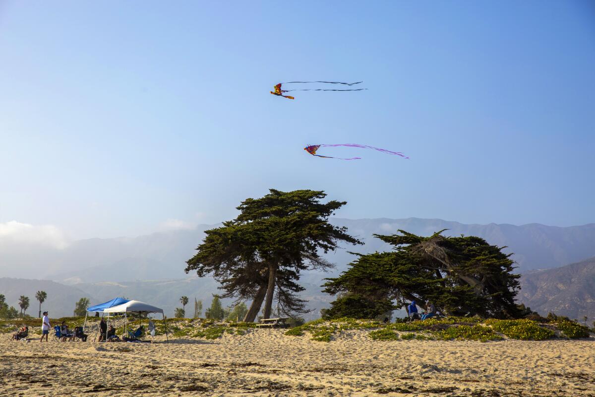
Kites fly along the shore at Carpenteria State Beach.
(Brian van der Brug / Los Angeles Times)

Carpinteria

Welcome to Carpinteria (population about 13,000), southernmost city in Santa Barbara County. It has less obvious money and attitude than you might find in some neighborhoods to the north, but plenty to keep a family happy, including a strip of sand that the town has promoted for decades as “the world’s safest beach.â€

That would be Carpinteria City Beach, which runs north from the foot of Linden Avenue, and Carpinteria State Beach, which runs south for a mile and features campgrounds that book up fast. Linden Avenue is lined with an unfussy collection of surf shops, antiques stores and eateries, including the Spot, a rustic burger stand, and Esau’s Cafe, which is all about breakfast, lunch and surfing. Rincon Beach Park, one of the state’s top surf spots, is three miles southeast of town.

Pro tip: If you take a long walk on the beach, you might find tar between your toes. That’s probably natural seepage from Santa Barbara’s offshore crude oil deposits. A little olive oil can help you clean up.
Read All Read Less
Route Details
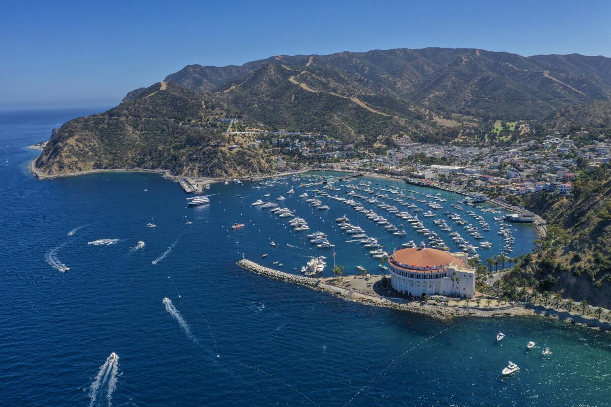
Aerial view of Catalina Island's Avalon harbor.
(Allen J. Schaben / Los Angeles Times)

Catalina Island

Los Angeles County Attraction
When you need an island escape with creature comforts and Hawaii is too far, here is your answer. The ferry ride is about an hour (about 22 miles) and you may encounter playful dolphins or a breaching whale on the way. In tiny downtown Avalon, traffic is a matter of bikes and golf carts. Back in the day, Zane Grey wrote westerns here and chewing gum potentate William Wrigley Jr. built a mansion (Mt. Ada, with room rates at potentate prices). Nowadays there are just enough options to fill a weekend: submarine tours, snorkeling, miniature golf, cycling, Descanso Beach Club and the Catalina Zipline Eco Tour, which will set you zinging above eucalyptus trees. Round-trip ferry rides with Catalina Express to Avalon from Long Beach, San Pedro or Dana Point cost about $75.

Pro tip: There are hiking and camping near Two Harbors and beyond, including a 38.5-mile, four-day adventure known as a Trans-Catalina Trail. Begin in Avalon, end at Two Harbors. And beware of bison.
Read All Read Less
Route Details
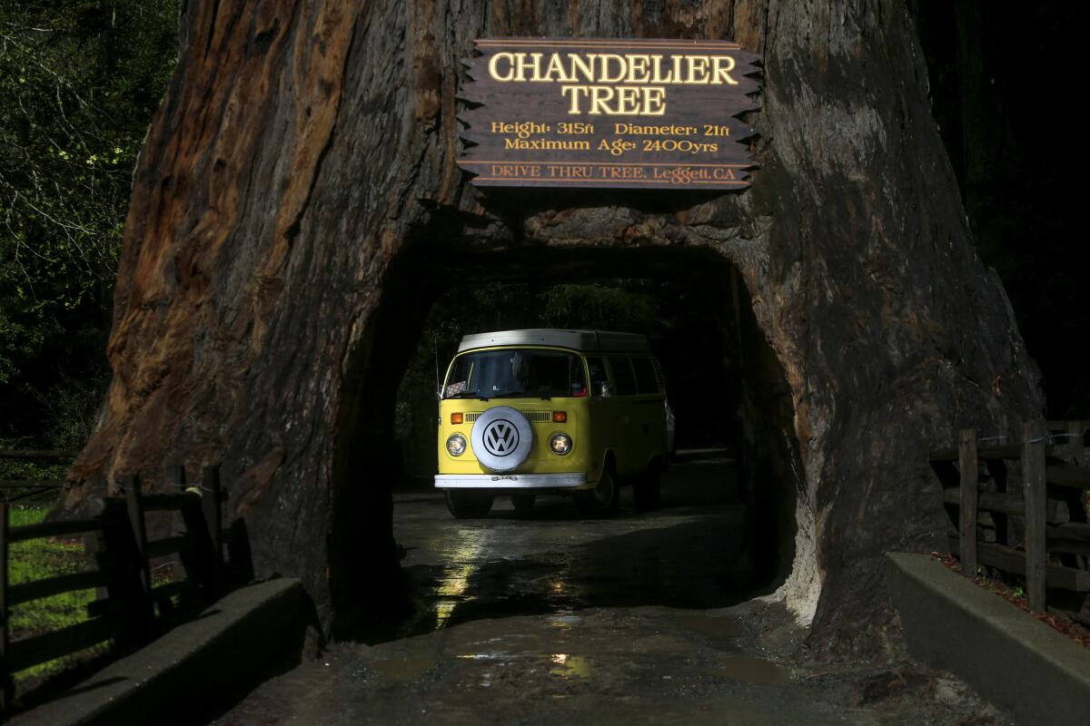
The tunnel cut through Chandelier Tree with a Volkswagen van about to nose through it.
(Mark Boster / Los Angeles Times)

Chandelier Tree

Mendocino County Attraction
Of course you’d like to drive through a tree. And of the three drive-through redwoods in California, this one is the handsomest. For more than 80 years, giddy Californians have been steering their vehicles through the Chandelier Drive-Thru Tree in sleepy little Leggett. The price is $10. It is owned by John Stephenson, the fourth in a long family line of tree-tenders. Browse in the big gift shop. Bask in the kitsch or the smell of the damp forest.

Then go deeper. About 75 miles farther north on U.S. 101, near Garberville, you’ll reach the 31-mile-long Avenue of the Giants. At Humboldt Redwoods State Park, stop to inspect the magnificent corpse of the Dyerville Giant, once thought to be the world’s tallest tree at 370 feet. Hooked on redwoods? Then press on, about 135 miles farther north, to Redwood National and State Parks, crowded with countless specimens.

Pro tip: Tuck in your mirrors.
Read All Read Less
Route Details
Advertisement
Artists unveil a new mural in Chicano Park
(Jarrod Valliere / San Diego Union-Tribune)

Chicano Park

San Diego County Park
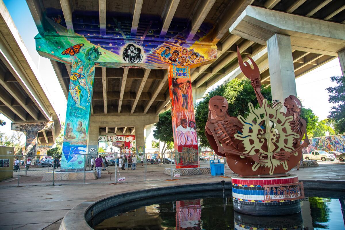
Even with no social context, this would be a striking set of murals, improbably arrayed beneath the Coronado Bridge. But this context matters. When state and local officials expanded Interstate 5 through San Diego and built the Coronado Bridge in the 1960s, they split the longstanding blue-collar neighborhood of Barrio Logan.

Then in 1970, when the California Highway Patrol started building an office where a park was expected, the largely Mexican American neighborhood rose up and at last got a 7-acre park built. Soon after came the first murals. Now there are 49 murals, some celebrating Mexican icons Pancho Villa and Frida Kahlo. Within two blocks, you can get flautas at Las 4 Milpas or tacos at Salud! In 2017, federal officials added the park to the National Register of Historic Places, crediting artists Salvador Torres, Mario Torero, Victor Ochoa and others.

Pro tip: If you’ve never driven across the bridge, do it. Then bear left on Orange Avenue and within a mile you’ll reach the Hotel del Coronado, a red-roofed, beachfront 1888 Victorian resort that served as a setting for the films “Some Like it Hot†(1959) and “The Stunt Man†(1980).
Read All Read Less
Route Details
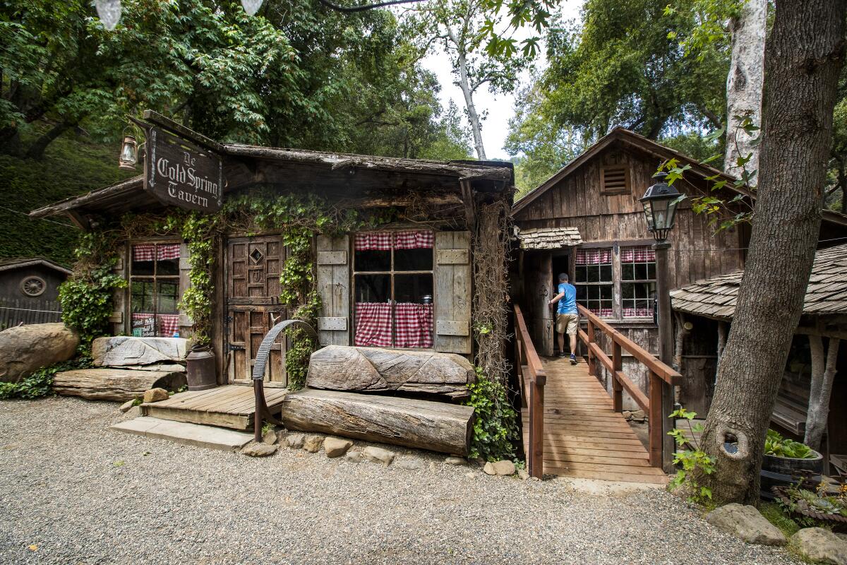
The weathered-wood exterior of Cold Spring Tavern.
(Mel Melcon / Los Angeles Times)

Cold Spring Tavern

Santa Barbara County Attraction
They’re not making stagecoach stops like this anymore.

Cold Spring Tavern is tucked along the roadside on San Marcos Pass above Santa Barbara, where it has been uniting bikers and dressed-down upper-crusters for decades.

A stage stop in the 1880s and owned by the same family since the 1940s, the Cold Spring and its four fireplaces are half an hour’s drive from Santa Barbara. The fanciest part of the property is its dimly lighted restaurant interior, where bison and venison are specialties. The rustic tavern serves indoors and out, and for generations has been known for its acoustic blues and tri-tip on weekends. (Also cheap chili during happy hour.)

Pro tip: Management says live music, outdoor barbecuing and full service will soon resume at the tavern’s Log Cabin Bar. For now, reservations are recommended, especially for Saturday or Sunday, but more than half of the tables are set aside for walk-up customers.
Read All Read Less
Route Details
Outside the office of the Columbia Gazette in Columbia State Historic Park.
(Christopher Reynolds / Los Angeles Times)

Columbia State Historic Park

Tuolumne County Park
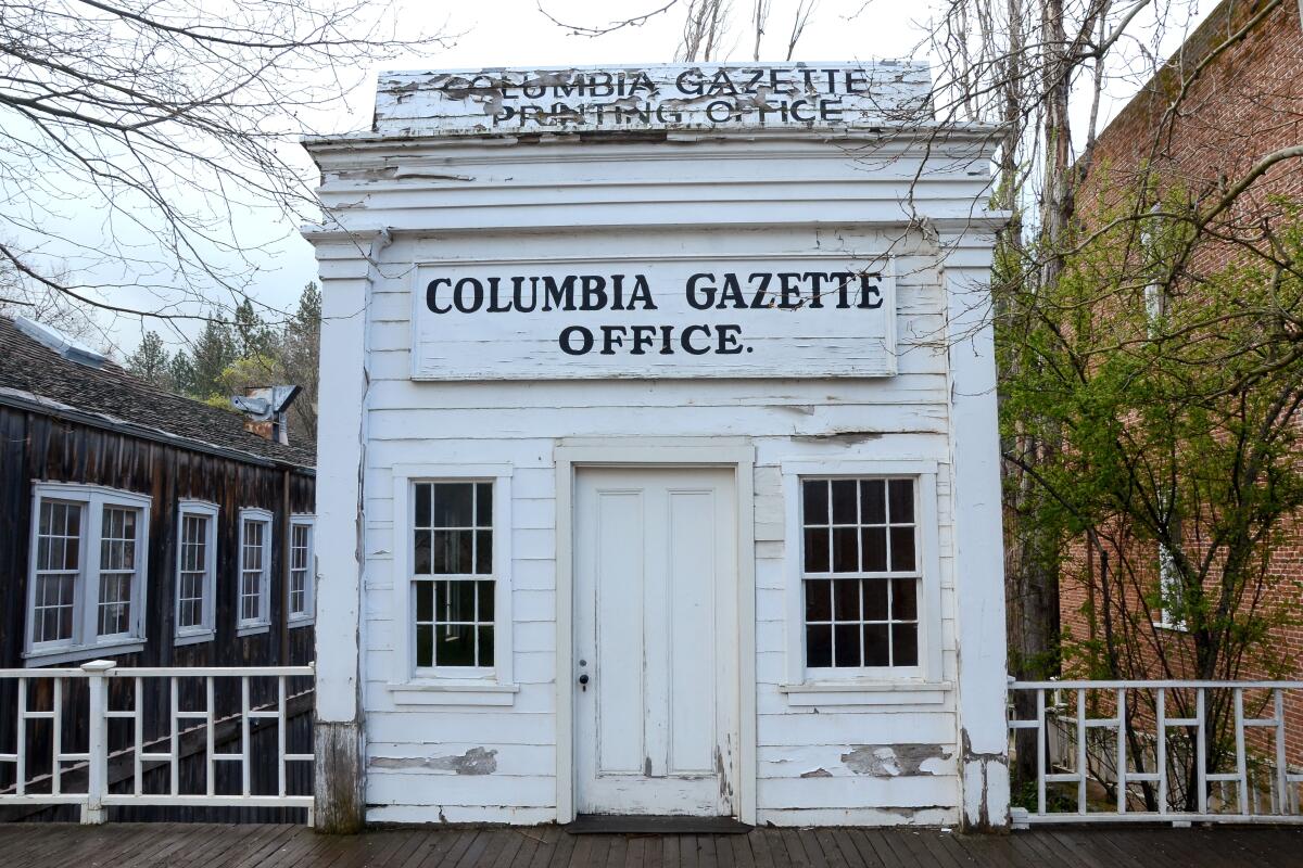
Once a booming Gold Rush town north of Sonora, Columbia is now a 272-acre state park, staffed by rangers and others in period attire. It’s the state park system’s largest collection of Gold Rush-era buildings, with restaurants, saloons (heavy on the sarsaparilla), retailers, museum, hotels and cottages, a gold-panning operation and stagecoach rides. The town was born in 1850 when prospectors found gold. Its best days were over by 1860 as discoveries dwindled. By the 1930s, it was on the brink of collapse. The state stepped in to acquire land and make Columbia a park in 1945. It’s off California 49, the main thoroughfare of Gold Country.

Pro tip: The Gold Rush began at Sutter’s Mill in Coloma, about 80 miles north of Columbia. Coloma has Marshall Gold Discovery State Park, but Columbia has more surviving buildings and more to see and do.
Read All Read Less
Route Details
A string of cabins along Crystal Pier.
(Christopher Reynolds / Los Angeles Times)

Crystal Pier

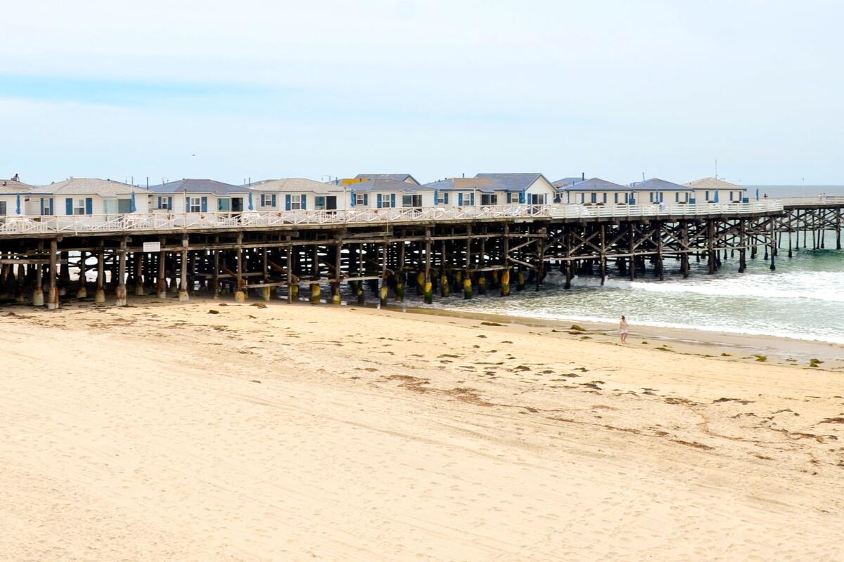
The Crystal Pier Hotel is a strange throwback, a pleasure pier from the 1920s with 30 cottages and hotel rooms perched above the sand and waves. There’s a website, but to make a reservation, you must call or show up in person — and do it up to 11 months in advance because most summer bookings are made by repeat customers. If you score a booking, you could celebrate by doing the Charleston.

The pier stands in San Diego’s Pacific Beach, where surfing, bar-crawling and restaurant-hopping happens, but you’ll find plenty of happy families at play too. The Cape Cod-style units have white walls, wood floors, ceiling fans and often kitchenettes. Summer rates are $225 to $600 a night, with a three-night minimum.

But you don’t have to spend the night. The pier is open to the public for strolling and fishing (no permit needed), and there’s a bait and tackle shop.

Pro tip: The pier juts out from the Mission Beach-Pacific Beach Boardwalk, a three-mile promenade (concrete, not wood) that’s edgier than Manhattan Beach’s Strand, milder than Venice’s Ocean Front Walk.
Read All Read Less
Route Details
Advertisement

Downtown SLO Farmers Market

San Luis Obispo County Farmers' market
The Downtown San Luis Obispo Farmers Market dates to the early ’80s. On Thursday nights at 6, the main drag is closed so people can browse from stall to stall. The market begins the summer of 2021 filling two and half blocks, selling fruit and vegetables only, with less restrictive rules expected soon. At full strength, the market fills five blocks with more than 120 vendors, assorted artisans and live music. Eating and drinking are everywhere. There are farm-fresh chicken, ribs, pulled pork, corn on the cob and that particular crescent-shaped bit of beef, best when grilled over red oak, known as tri-tip.

Pro tip: Admire downtown’s Bubblegum Alley (it’s just what it sounds like) or take a hike among the experimental architecture projects in Poly Canyon, just north of the Cal Poly campus.
Read All Read Less
Route Details
Ocean-worn debris known as sea glass sparkles in the sun.
(David Pu’u / Getty Images)

Glass Beach

Mendocino County Beach
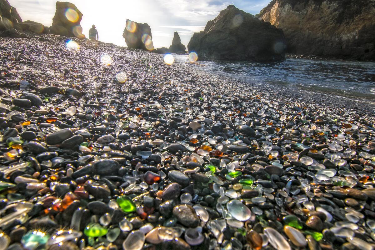
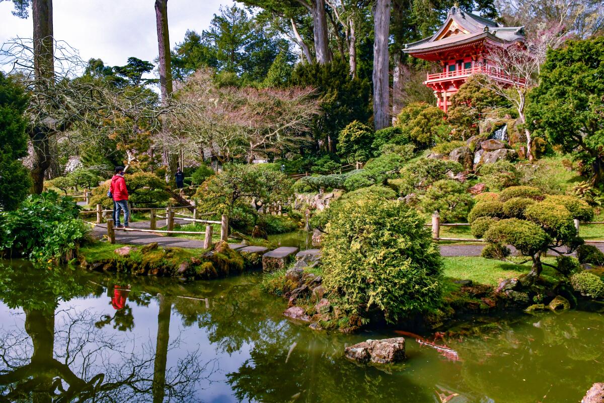
Here’s proof that with time, the churning Pacific can turn our broken bottles and car parts into something like nature. Fort Bragg, the workaday city 11 miles north of quaint Mendocino, used three of its beaches as dumps for decades, then in the 1960s decided that was unwise. Workers removed the big castoff junk, and the sea has been grinding away. The result is a shoreline that sparkles with pebbles of frosty white, green, blue and occasionally ruby red (said to come from pre-1967 automobile taillights). Families comb the shore and snap photos. It’s a lesson in planetary healing. And it’s a catch-and-release situation: Parks officials forbid visitors from carrying away a natural resource, which they say sea glass is, even if it came from a ’65 Mustang. The best-known Glass Beach is in town at the west end of West Elm Street. Others are slightly north in MacKerricher State Park.

Pro tip: The International Sea Glass Museum is a stone’s skip away from Glass Beach at 303 N. Main St., Suite F, Fort Bragg.
Read All Read Less
Route Details
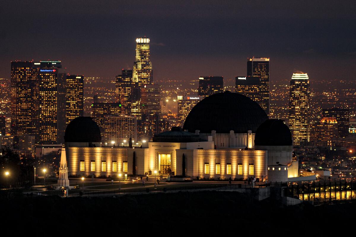
A pond lined with artfully shaped trees in the Japanese Tea Garden at Golden Gate Park.
(Christopher Reynolds / Los Angeles Times)

Golden Gate Park

San Francisco Park
Golden Gate Park has all sorts of cultural, natural and not-so-natural wonders, including the waters of Stow Lake, the heights of Strawberry Hill, the Conservatory of Flowers, Japanese Tea Garden and San Francisco Botanical Garden. On the museum front it offers the California Academy of Sciences (the building with the undulating green roof) and the De Young Museum (with an art collection that includes a bit of everything). Explore the park and you’ll find a bison paddock, golf course and a network of paths and car-free roads that attracts walkers, runners, skaters, cyclists and Segway riders.

It’s hard to imagine this green expanse as sand dunes, but so it was when park construction began in the 1870s. Look closely at many rocks and you’ll realize they’re colored concrete, placed at the direction of pioneering park superintendent John McLaren, who also devised fake lakes and fake waterfalls.

Pro tip: Atop the De Young Museum‘s bold, angular building, you’ll find a 140-foot-high observation tower with glass walls and staggering wraparound views. It’s free.
Read All Read Less
Route Details
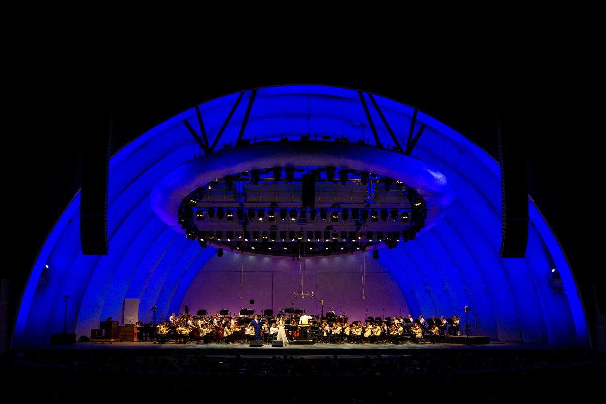
Griffith Observatory, lighted at night, with the downtown Los Angeles skyline beyond.
(Wally Skalij / Los Angeles Times)

Griffith Observatory

Los Angeles County Attraction
Without ever stepping inside the observatory on its perch in the Hollywood Hills, you can see Los Angeles as a tidy, twinkling grid of city lights, an epic view at dawn or sunset. And once we’re allowed inside, you can scan distant stars and check your weight on Mars.

Since 1935, Angelenos have embraced Griffith Observatory as “the hood ornament of Los Angeles,†in the words of observatory director E.C. Krupp. It’s the architectural star of 4,210-acre Griffith Park, with three green copper domes, prime views of the Hollywood sign and a bust of James Dean, who sulked here in the 1955 film “Rebel Without a Cause.†Parking is tough, so you might want to hike up from the Greek Theatre or Fern Dell or see about Dash shuttle bus service.

If the state sticks with plans to ease restrictions June 15, Krupp said the observatory should be able to reopen “well before the end of summer.â€

Pro tip: Hike from the observatory to the Tom LaBonge Panorama atop Mt. Hollywood, a roughly 2.6-mile journey with big views of the Hollywood Hills and San Fernando Valley. And be sure to read up on the felon and philanthropist — felon-thropist? — who made this all possible, Griffith J. Griffith.
Read All Read Less
Route Details
Advertisement
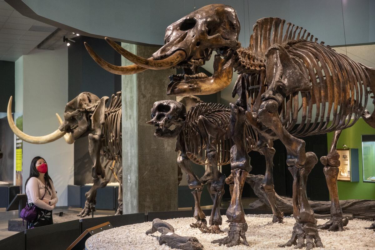
Hollywood Bowl at night
(Kent Nishimura / Los Angeles Times)

Hollywood Bowl

Los Angeles County Venue
The Hollywood Bowl, summer home of the Los Angeles Philharmonic, has been hosting performances since the early 1920s — before the Hollywood sign went up. Picnicking before and during shows there has become a treasured civic tradition in a city that could use more. For its return after a dark summer of 2020, the Phil has five free Bowl concerts for first responders and healthcare and other essential workers in May and June. After that: a July 3-Sept. 28 season, beginning with a fireworks show featuring Kool & the Gang and the Hollywood Bowl Orchestra. The “Sound of Music†sing-along? Aug. 21. In plans announced in May, 85% of seats will be designated for vaccinated guests, with capacity generally limited to 67% of the usual 17,500 people.

Pro tip: Yes, you’re allowed to bring your own food and drink for many shows, but alcohol is forbidden at some. Read up in advance.
Read All Read Less
Route Details
A woman looks at American mastodon skeletons on exhibit at the La Brea Tar Pits museum.
(Mel Melcon / Los Angeles Times)

La Brea Tar Pits

Mid-Wilshire
Where else are you going to see wolf jaws, a snarling saber-toothed cat and the skeleton of a mastodon all on land where they were found? The modern era of the La Brea Tar Pits & Museum begins in 1875, when the Hancock family presented an old cat’s tooth, found on their property, to visiting academic William Denton. In the years since, scientists have found the remains of 600-plus animal species, dating back perhaps 50,000 years. Bison, camels, sloths, smilodons. Some seem so lifelike, it’s scary. The tar pits and museum (officially the George C. Page Museum) are part of 30-acre Hancock Park, which includes grass for picnics and the Los Angeles County Museum of Art, partially open as major reconstruction goes on through 2024, and the long-awaited Academy Museum of Motion Pictures, whose signature dome is to open Sept. 30. Admission to the Page museum (part of the Natural History Museums of Los Angeles County) is $14 for adults.

Pro tip: As long as you’re thinking about where fossil fuels come from, consider a trip down the street to the Petersen Automotive Museum, whose vast collection extravagantly documents the role of cars in local and global history.
Read All Read Less
Route Details
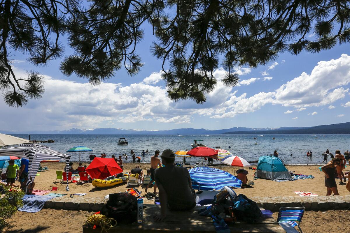
Beachgoers at Kings Beach in Lake Tahoe
(Mark Boster / Los Angeles Times)

Lake Tahoe

This big, blue lake at the California-Nevada border is a seven-hour drive from Los Angeles, but you can also fly into Reno-Tahoe International Airport. In summer, mountain hikes and water sports dominate and the area’s ski resorts retool for the warmer weather. You’ll find picnic tables at Donner Memorial State Park (yes, really). And there’s plenty of gambling in Stateline, just across the Nevada border at the lake’s south end. For great hiking, a classic lake view and a quirky mansion in the same area, try Emerald Bay State Park. For a bite or drink (or an overnight), try Sunnyside Lodge on the western shore. It’s a 72-mile drive around the lake — highly recommended.

Pro tip: The paddle-wheeler the M.S. Dixie II, which offers daily scenic cruises including Emerald Bay, is based in Zephyr Bay on the lake’s Nevada side.
Read All Read Less
Route Details
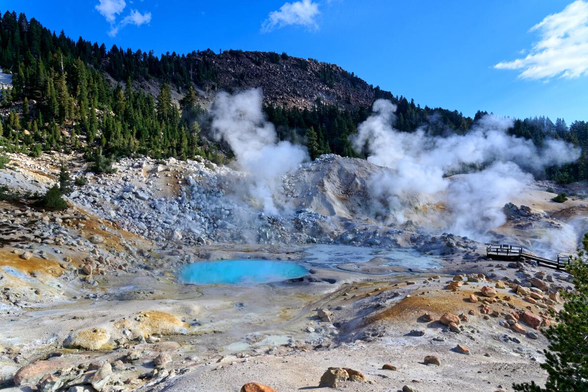
Steam rises from pools in Lassen Volcanic National Park.
(tristanbnz/Getty Images/iStockphoto)

Lassen Volcanic National Park

California’s own Yellowstone is dotted with boiling creeks, steaming lakes and bubbling mud pots. Its most dramatic element is Bumpass Hell, a three-mile round-trip trail full of steam-belching scenery that usually opens in June or July. Snow typically closes the 30-mile main road from November through May. (This year it opened May 17.) Near the park’s northern entrance, there’s an easy, 1.6-mile trail around Manzanita Lake (where people swim and kayak) with a campground, cabins and Lassen Peak rising close at hand. Kings Creek Falls is the highlight of a 2.3-mile round-trip hike, moderate difficulty.

Pro tip: Drakesbad Guest Ranch, open June 11 through Oct. 11, 2021, in the southeast corner of the park, is an endearing throwback with 19 units in a century-old lodge and surrounding cabins. Rooms for two start at $394, meals included.
Read All Read Less
Route Details
Advertisement
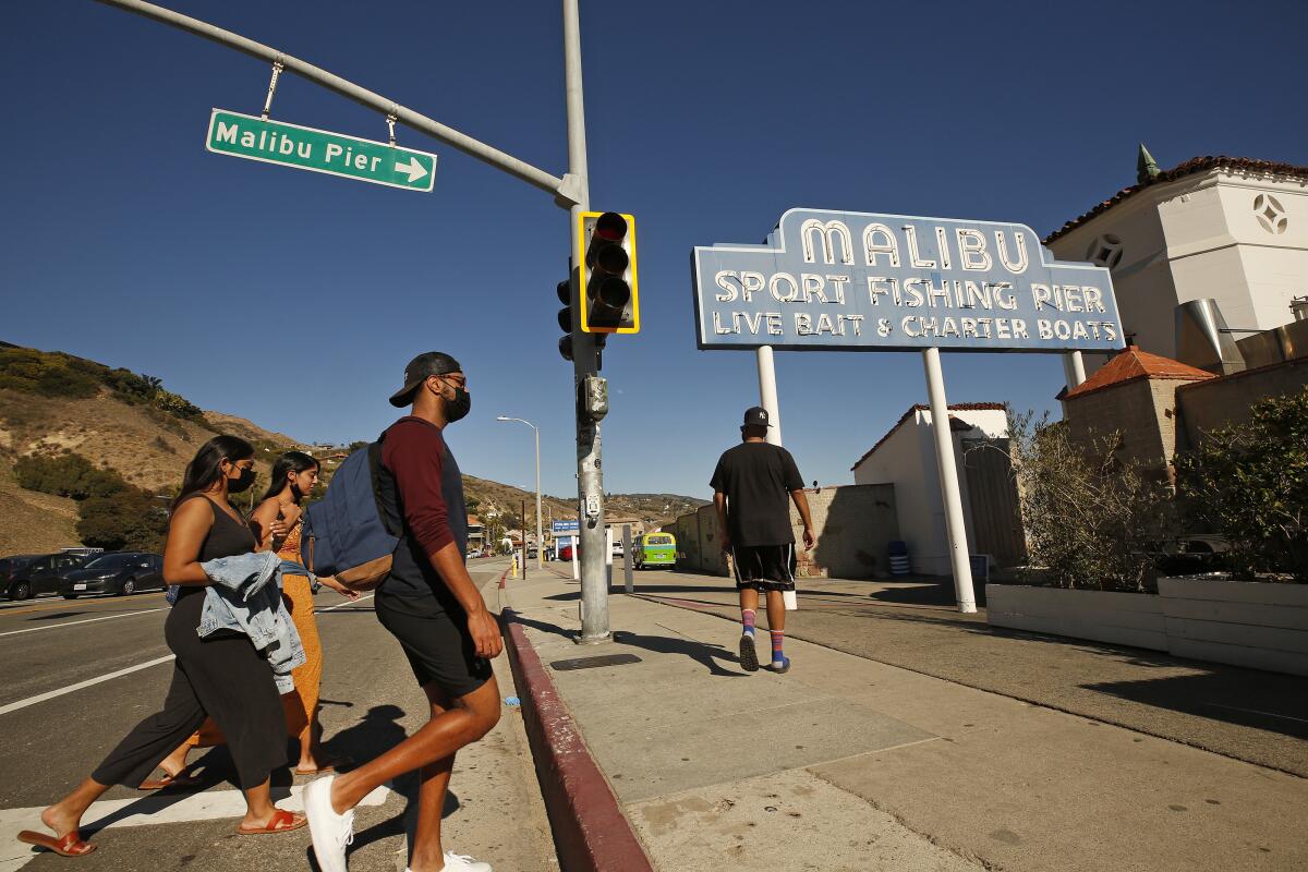
Pedestrians head toward the entrance to Malibu Pier.
(Al Seib / Los Angeles Times)

Stroll, dine or fish on the Malibu Pier

Los Angeles County Attraction
This is about as genteel as a pier can get while still selling bait.

With no Ferris wheel or thrill rides and a 9 p.m. closing time, Malibu Pier, built in 1905, offers sea views, skatewear, souvenirs, rental fishing rods and upscale dining.

Malibu Farm Restaurant sits at the base of the pier with a dining room, patio and table service ( 11 a.m. to 8 p.m. weekdays, 9 a.m. to 8 p.m. weekends). At the ocean end of the pier, the more casual Malibu Farm Cafe (order at the counter) opens at 9 a.m. weekdays, 8 a.m. on weekends, serving breakfast and lunch most days, staying open until 6 p.m. on Fridays, Saturdays and Sundays.

BTW: You can fish here without a permit. In summer, in theory, you might catch halibut, thresher shark, bat rays, corbina or mackerel.
Read All Read Less
Route Details
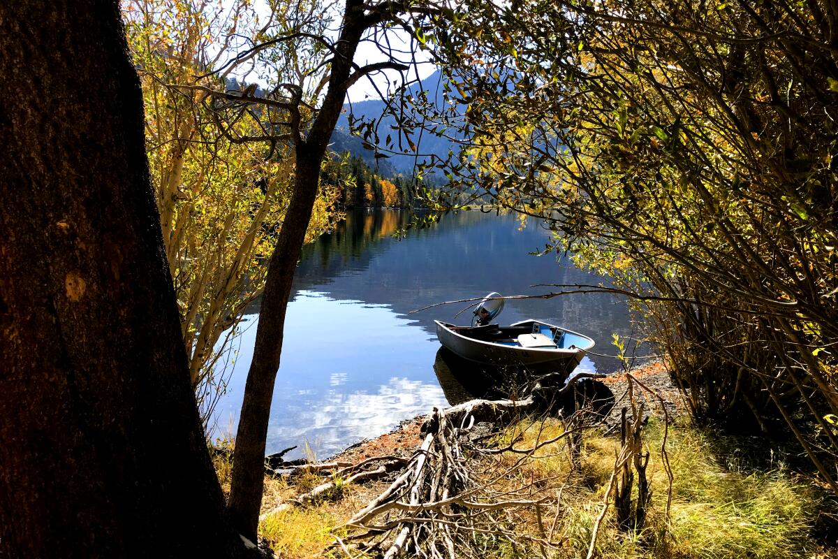
An idle row boats floats in Silver Lake near Mammoth Lakes.
(Chris Erskine / Los Angeles Times)

Mammoth Mountain

Mono County Mountain Resort
Legions zoom up from Southern California for winter sports at Mammoth Mountain (and this year the skiing and boarding will last through Memorial Day). But these slopes are worthy of attention in summers too, whether for hiking, fishing or mountain-biking. The mountain ski operation was founded in 1953 by a moonlighting hydrologist named Dave McCoy, who died in 2020 at age 104. The mountain’s summer offerings include more than 80 miles of single-track trails, a via ferrata for climbers and gondola rides to the summit. There’s golf, of course. And outside town there’s also Camp High Sierra. For a quiet dinner, head for the Lakefront in Tamarack Lodge, a 1924 log cabin.

Pro tip: To break up the 300-mile L.A.-Mammoth drive, detour into the rugged Alabama Hills near Lone Pine, where dozens of movies and TV shows have been filmed, including the first “Lone Ranger†film in 1938. Check out Lone Pine’s Museum of Western Film History. Farther up the road you’ll hit Bishop, the best place for a bite or overnight on the way to Mammoth.
Read All Read Less
Route Details
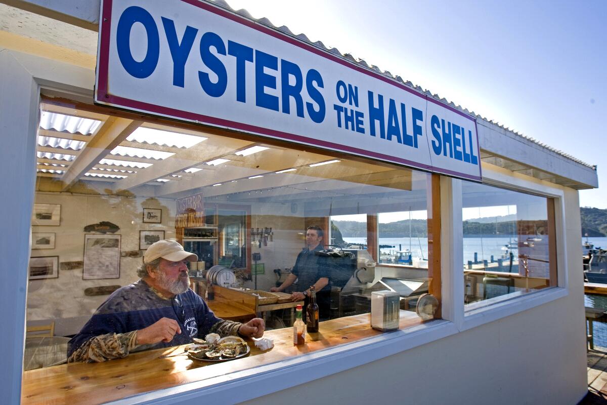
A man sits at a window counter eating from a platter of oysters at the Marshall Store.
(Peter DaSilva / For The Times)

Marshall Store

Marin County Restaurant
The fresh oysters here are so good. And the views of Tomales Bay aren’t bad either. The Marshall Store is a casual Marin County joint with more tables outside than inside, open Fridays-Mondays, first come, first served. It’s renowned for its Pacific oysters, fresh from the Tomales Bay Oyster Co. Show up before noon (to beat the crowds) and get six tangy breakfast oysters on ice with lemon and mignonette sauce (about $25). The store also sells crab, shrimp, salmon and more from the smoker.

Pro tip: Beneath long, narrow Tomales Bay lies a bit of the 800-mile-long San Andreas Fault, the great quake risk that runs from the Salton Sea to Mendocino County. Walk the nearby Point Reyes National Seashore‘s 0.6-mile Earthquake Trail, which starts near the Bear Valley Visitor Center.
Read All Read Less
Route Details
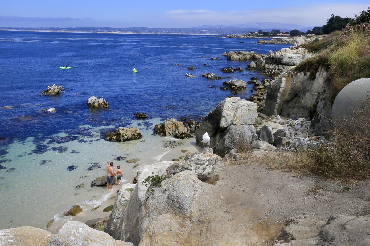
A man and child explore the rocky Monterey Bay shoreline.
(Allen J. Schaben / Los Angeles Times)

Monterey Bay

This is the California of gnarled cypress trees, jutting rocks, hanging fog and irresistible otters. The 17-Mile Drive at Pebble Beach has been this area’s most heavily promoted attraction since the 1880s, but Lovers Point Park in Pacific Grove will win you over just as quickly.

You can glide along 17-Mile Drive and past the park in a car or astride a rental bike from Adventures by the Sea on Cannery Row in Monterey (which also rents kayaks). Begin at the recently reopened Monterey Bay Aquarium, then proceed along Ocean View Boulevard and Sunset Drive from Cannery Row to Pebble Beach.

The 17-Mile Drive includes the Lone Cypress (the symbol of the Pebble Beach resort area for decades) and brilliant scenery. The drawback? It’s a private road, so you must pay to drive it ($10.75 as of April 2021). But wait. Pebble Beach management allows bicyclists at no cost. So if you’ve got a bike, it’s yours to conquer.

Pro tip: Hungry? The Pebble Beach Market has sandwiches for a fraction of what the resort restaurants charge.
Read All Read Less
Details
Advertisement
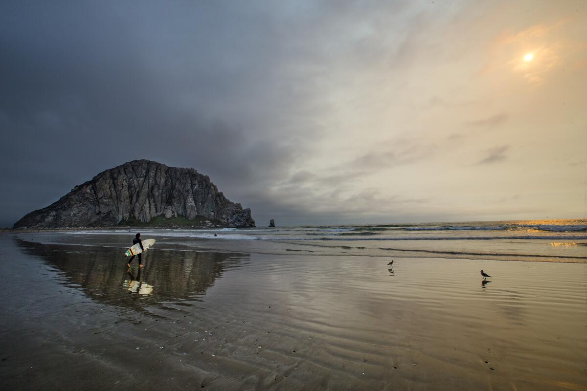
A surfer and Morro Rock are reflected in the water at low tide.
(Allen J. Schaben / Los Angeles Times)

Morro Rock

San Luis Obispo County Beach
Morro Rock looms lovably over Morro Bay. The rock, more than 570 feet tall and 23 million years old, is one of the Nine Sisters — nine volcanic peaks in San Luis Obispo County. Some can be climbed for nice views (including Black Hill and Cerro Cabrillo in Morro Bay State Park), but not this sister. Admire this great, rounded rock, preferably at dawn, from the Morro Bay embarcadero. Or the beach. Or the dunes. Or a kayak. Morro Bay’s waterfront galleries and shops are nice for a few hours’ browsing, and there are watercraft rentals.

Pro tip: Morro Rock usually is a dark landmark in a sunny landscape. But not at sunrise. Get to the water’s edge early and you’ll see it handsomely lighted from the east, the surrounding waters shaded.
Read All Read Less
Route Details
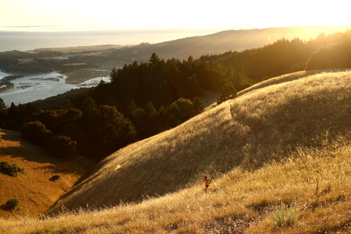
Ultramarathon runner Dean Karnazes does a training run in Mount Tamalpais State Park
(Ezra Shaw / Getty Images)

Mt. Tamalpais State Park

Marin County Park
Whether you’re on foot or knobby tires, Mt. Tamalpais State Park, cradle of mountain-biking innovation in the 1970s, is full of options, including fire roads and multi-use trails. The Verna Dunshee Trail (0.75 mile) at East Peak, known for big views and wheelchair-accessibility, is a good spot for a first-timer. The Dipsea Trail, a 7.4-mile route between Mill Valley and Stinson Beach, is demanding (and hosts the nation’s oldest trail race). Bikers, hikers and equestrians alike use the Coast View and Dias Ridge trails. (The park’s visitor center at East Peak remained closed as of early May.)

Pro tip: If you hike or ride Dias Ridge, you’ll end at Muir Beach by the Pelican Inn, a facsimile of a 16th century English pub with seven guest rooms and a menu full of beers, ales and hearty British dishes.
Read All Read Less
Route Details
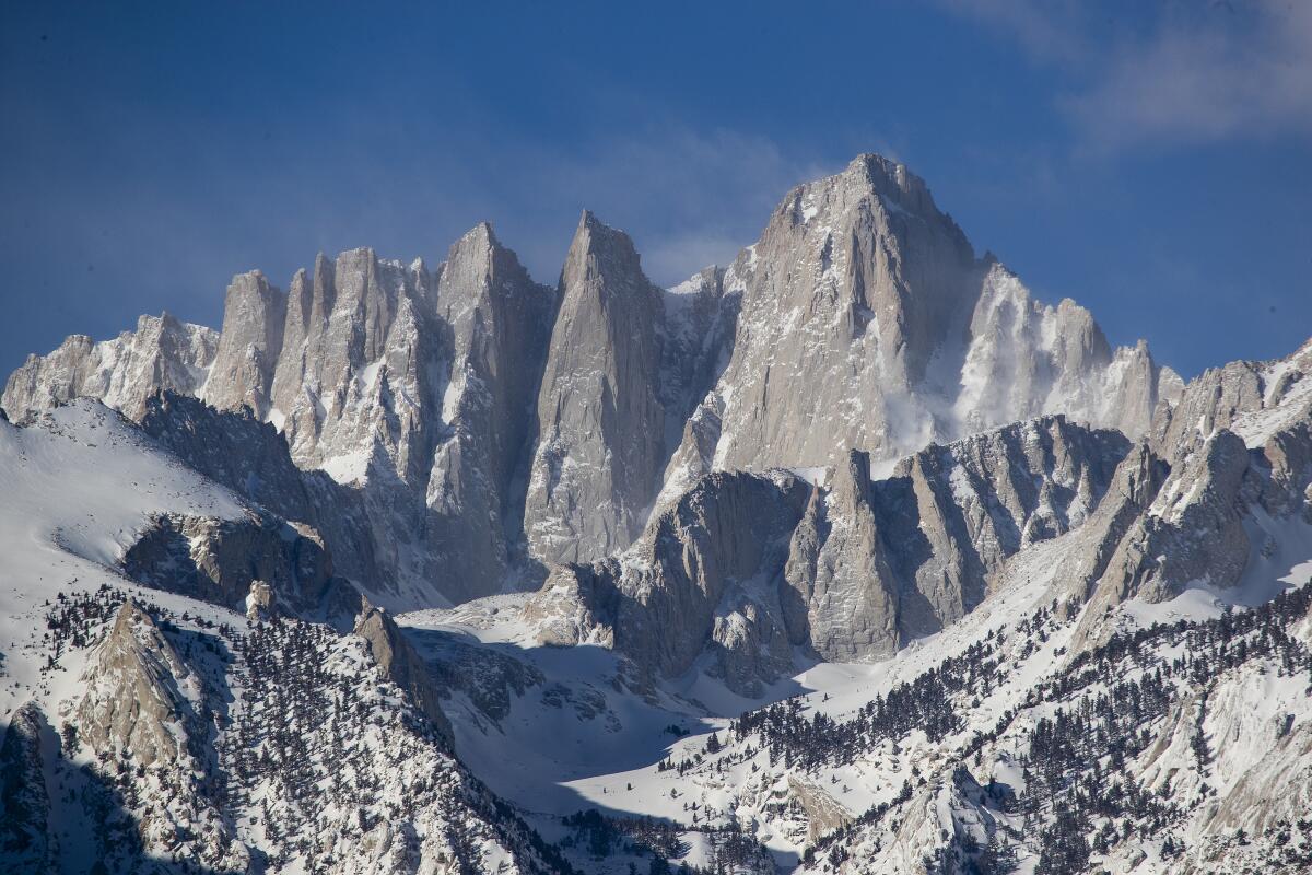
Mt. Whitney blanketed in snow.
(Allen J. Schaben / Los Angeles Times)

Mt. Whitney

Inyo and Tulare counties Hike
Mt. Whitney is the highest point in the contiguous U.S. at 14,505 feet (give or take), which makes it challenge No. 1 for many summer Sierra hikers. But it is dangerous. The most popular route to the summit, an 11-mile climb, begins at Whitney Portal, about 13 miles west of Lone Pine in the Eastern Sierra. It’s either a 22-mile round-trip day hike or a two- or three-day backpack journey, staying overnight at camps along the way. A wilderness permit ($20) is required, and demand is so great that there’s a lottery every year. The trail to the top includes about 6,600 feet of altitude gain as meadows give way to switchbacks — 99 of them — and then two more miles of climbing above the tree line. At the top, hikers sign a register and pose before a stone shelter built in 1909. The Whitney Portal Store sells supplies as well as burgers and pancakes for returning hungry hikers.

Pro tip: You don’t have to go all the way. Instead, do a day hike (no permit required) from Whitney Portal to Lone Pine Lake and back, a 6½-mile round trip that includes about 1,900 feet of elevation gain and often stiff winds.
Read All Read Less
Route Details
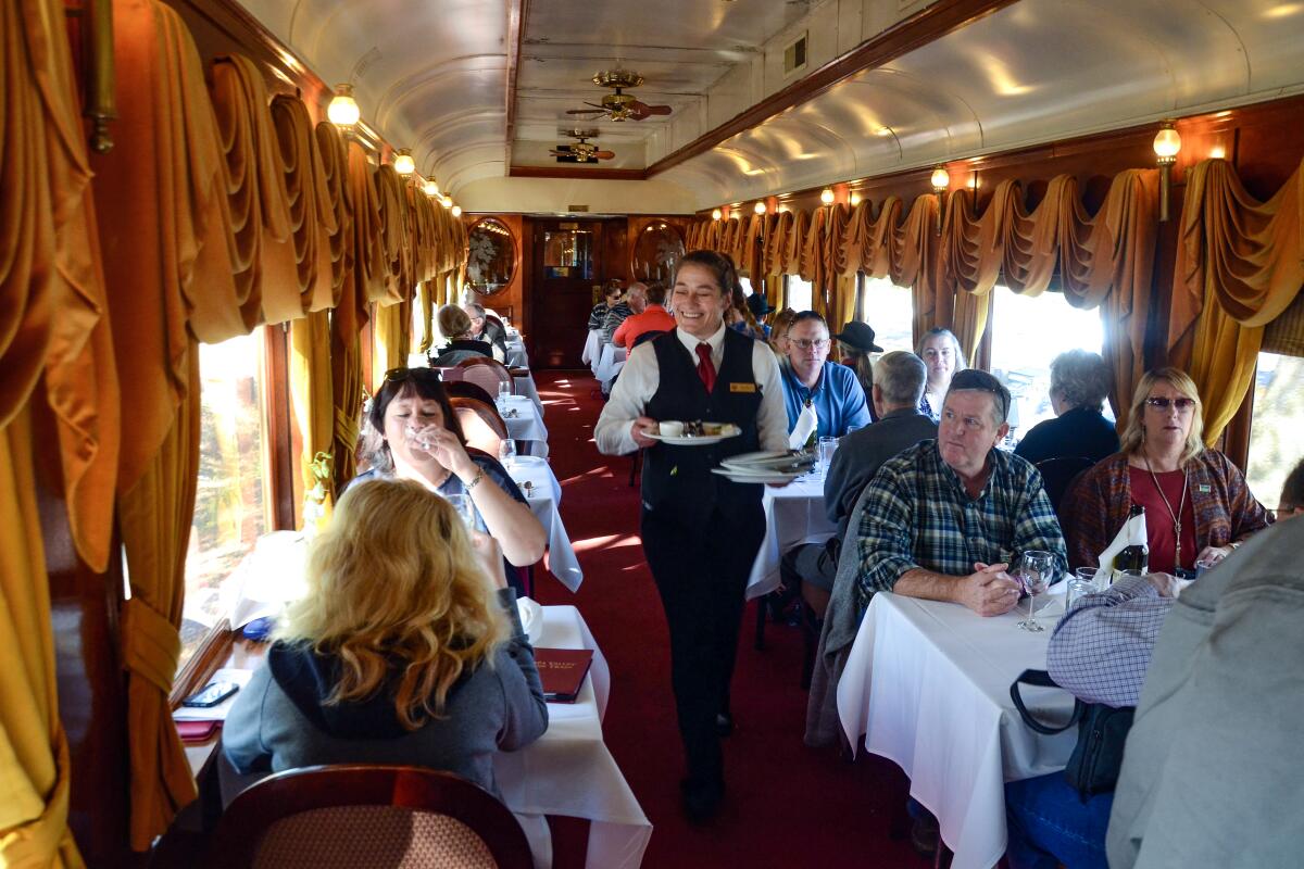
Food is delivered to tables in the gold-curtained Napa Valley Wine Train.
(Christopher Reynolds / Los Angeles Times )

Napa Valley Wine Train

Napa County Attraction
If you’re going to fully appreciate Napa Valley and its globally admired vineyards, it’s better to skip the driving. On the Napa Valley Wine Train, you can dine in style while the miles and wineries roll past. The train covers about 18 miles, running north alongside California 29 from the city of Napa through Yountville and Oakville to St. Helena. Depending on what tour you sign up for, you may stop to taste at one to three wineries and eat a three-course meal on board. It’s expensive — about $160 to $450 per person — but very comfortable.

Pro tip: For a good taste of what people grow in the Napa Valley besides grapes, stop by the Oxbow Public Market. If history rings your bell, the oldest winery in the valley is Charles Krug in St. Helena, founded in 1861 and owned by the Mondavi family since the 1940s. For the summer of ’21, most tastings are being done outdoors, beginning at $45.
Read All Read Less
Route Details
Advertisement

Pageant of the Masters, Laguna Beach

Orange County Performance
The good people of Laguna Beach don’t do artsy lunacy often, but when they do … it’s this. On an outdoor stage with orchestral accompaniment, live models pose amid immaculate sets to mimic famous artworks new and old. Sometimes there are singers, dancers, horses, balloons — and it might cost you anywhere from $25 to $110 for a seat.

The Pageant of the Masters has its roots in 1932, when area artists were looking for a spectacle to lure Olympics visitors from Los Angeles. It has evolved into a strangely potent, family-friendly night of entertainment in a 2,600-seat amphitheater. (The ritual has been lampooned on “Gilmore Girls†and “Arrested Development.â€)

Because the area’s living painters need to eat too, there’s a juried Festival of Arts Fine Art Show. The 2021 pageant, which runs July 7-Sept. 3, has a “Made in America†theme.

Pro tip: Parking in Laguna Beach is difficult, and the pageant has no dedicated adjacent lot, but there is an app. Expect to do some walking or waiting for a shuttle.
Read All Read Less
Route Details
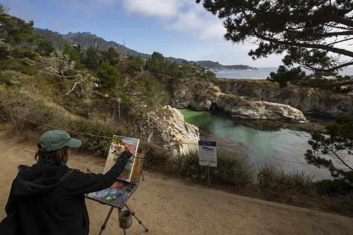
A plein-air painter at her canvas above China Cove at Point Lobos State Natural Reserve.
(Brian van der Brug / Los Angeles Times)

Point Lobos State Natural Reserve

Monterey County Park
Point Lobos State Natural Reserve, three miles south of oh, so civilized Carmel, covers just under 400 acres. But its waves, fog, strange sea creatures, trees and photographic history make it all seem bigger.

It used to be a working shoreline. Soon after the Gold Rush, Chinese immigrants arrived to fish. Later came whalers, Japanese, and Portuguese fishermen, and an abalone cannery. Since 1933, the state has owned it. Take the 1.4-mile North Shore Trail between Whalers Cove and Sea Lion Point and keep an eye out for Old Veteran, a grizzled Monterey cypress that clings to a cliff top. At Weston Beach, remember acclaimed photographer Edward Weston, who made images here from the late 1920s to the late 1940s and whose ashes were scattered here in 1958. Admission is $10 per car; the 150 parking spaces often fill up, inspiring the frugal and the tardy to park along the shoulder of the highway.

Pro tip: “Come in the winter when it’s stormy and no one’s out here,†Edward Weston’s grandson, photographer Kim Weston, told me a few years ago. “It’s an amazing piece of land.â€
Read All Read Less
Route Details
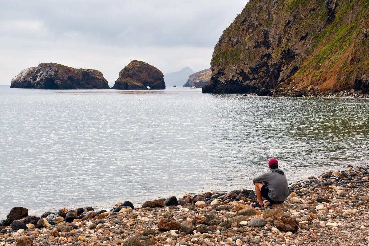
A man sits on a rocky shore on Santa Cruz Island.
(Christopher Reynolds / Los Angeles Times)

Santa Cruz Island

Santa Barbara County National Park

What if a chunk of California broke off the coast of Santa Barbara and floated off before anyone had time to erect a Taco Bell on it? You’d get something like Santa Cruz Island, the largest, most popular chunk of Channel Islands National Park, which is mostly empty.

It’s an hour’s boat ride from Ventura Harbor. You can hike and camp (one campground, 31 sites), kayak in sea caves or imagine when the island was a working ranch. Nowadays, the park service controls about a quarter of it, including Scorpion Anchorage, where concessionaire Island Packers drops most visitors. The other three-quarters of Santa Cruz are owned by the Nature Conservancy, which scorns visitors. If you camp, keep an eye out for island foxes: The once-embattled population is now so numerous and bold that one or more are likely to take a run at your picnic table. Lock up your food.

Pro tip: If tiny islands, shrieking seabirds or far-flung lighthouses quicken your pulse, you might need a day trip to Anacapa, about five miles west of Santa Cruz. Island Packers boats go there too.
Read All Read Less
Route Details
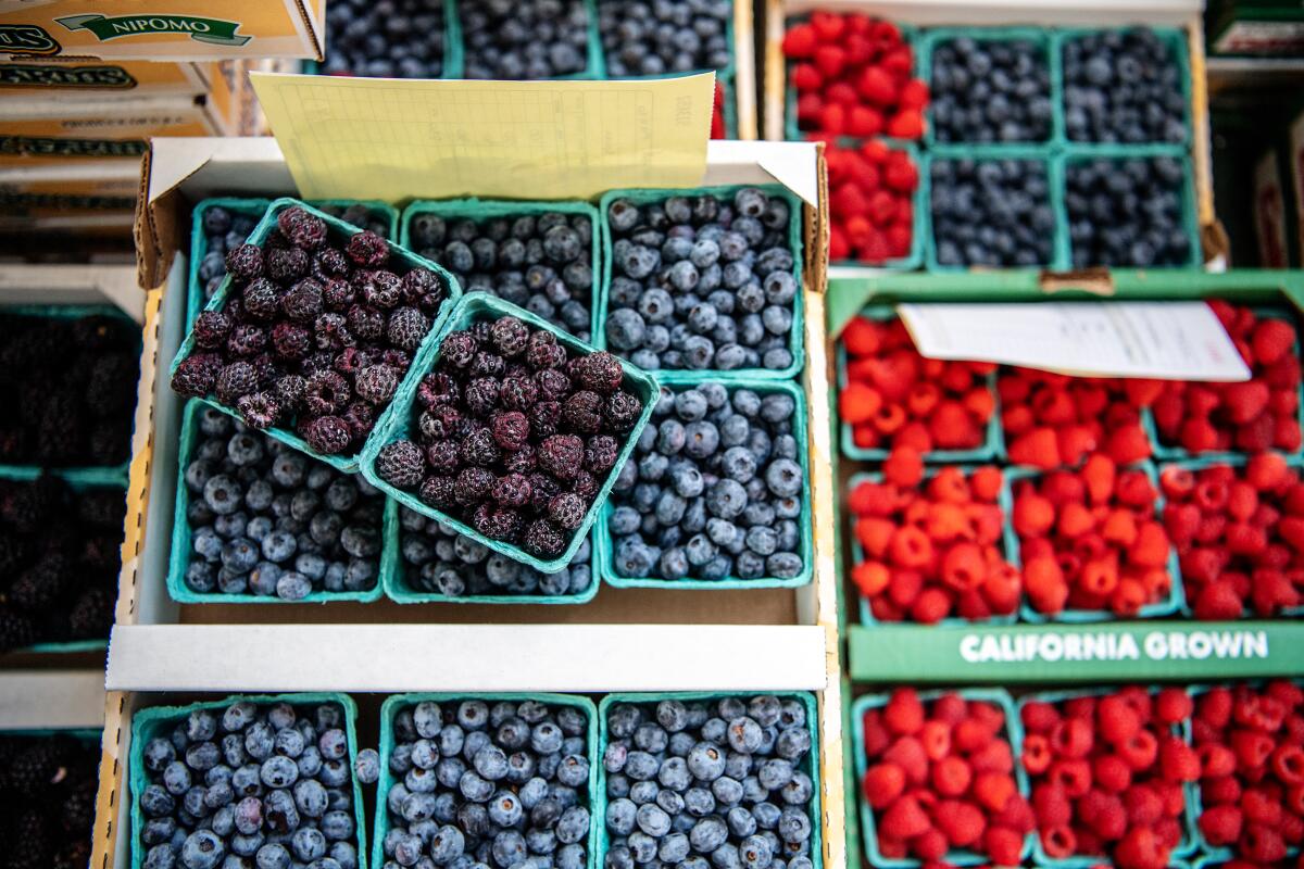
Blackberries, blueberries and raspberries at a stand at the Santa Monica Farmers Market.
(Mariah Tauger / Los Angeles Times)

Santa Monica Farmers Market

Santa Monica
Some of the state’s most accomplished farmers rise before dawn on Wednesdays and drive up to 200 miles to be part of this market. One reason: The Santa Monica Farmers Market, born in 1981, draws some of Southern California’s most acclaimed chefs. The market venue is a tomato toss from the beach, a cucumber roll from the shops and restaurants on the Third Street Promenade.

As many as 75 farmers set up stalls along Arizona Avenue between 4th Street and Ocean Avenue (until pandemic restrictions are lifted, capacity is reduced). If you’re arriving by car, you’ll have to cope with nasty traffic and parking. But once you’re afoot, life is good. Peaches from Hanford. Olives from Tulare. Leeks from San Luis Obispo. Here and there, banjo players and guitarists.

Pro tip: Can’t do Wednesday? The same organizers do Saturday markets on Arizona Street and Virginia Avenue Park and a Sunday market on Main Street.
Read All Read Less
Route Details
Advertisement
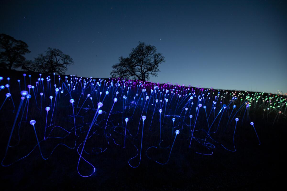
Sunrise begins to light the sky beyond the glowing, multicolored "Field of Light."
(Francine Orr / Los Angeles Times)

Sensorio, Paso Robles

San Luis Obispo County Attraction
The rolling, oak-studded hills around Paso Robles get good and hot in summer, which is why those hills are covered with vineyards. It has become a premier winery region, and the solar-powered super bloom known as Sensorio has become its luminous emblem.

The glow-in-the dark artwork by Bruce Munro began in May 2019 with “Field of Light,†a 15-acre walk-through installation illuminated by 58,000 stemmed spheres with optic fibers inside. Munro has added “Light Towers,†69 colored towers made of more than 17,000 wine bottles. Their colors change to music. It will be open Thursdays-Saturdays through May 31, then Thursdays-Sundays through Sept. 30. Tickets from $30.

Dinner? Sensorio has a kitchen, and Ricky’s Tacos food truck is usually handy.

Pro tip: Between forays to the scores of tasting rooms of greater Paso Robles, take a walk around grassy Downtown City Park, a green space surrounded by many restaurants and a pleasant small-town atmosphere.
Read All Read Less
Route Details
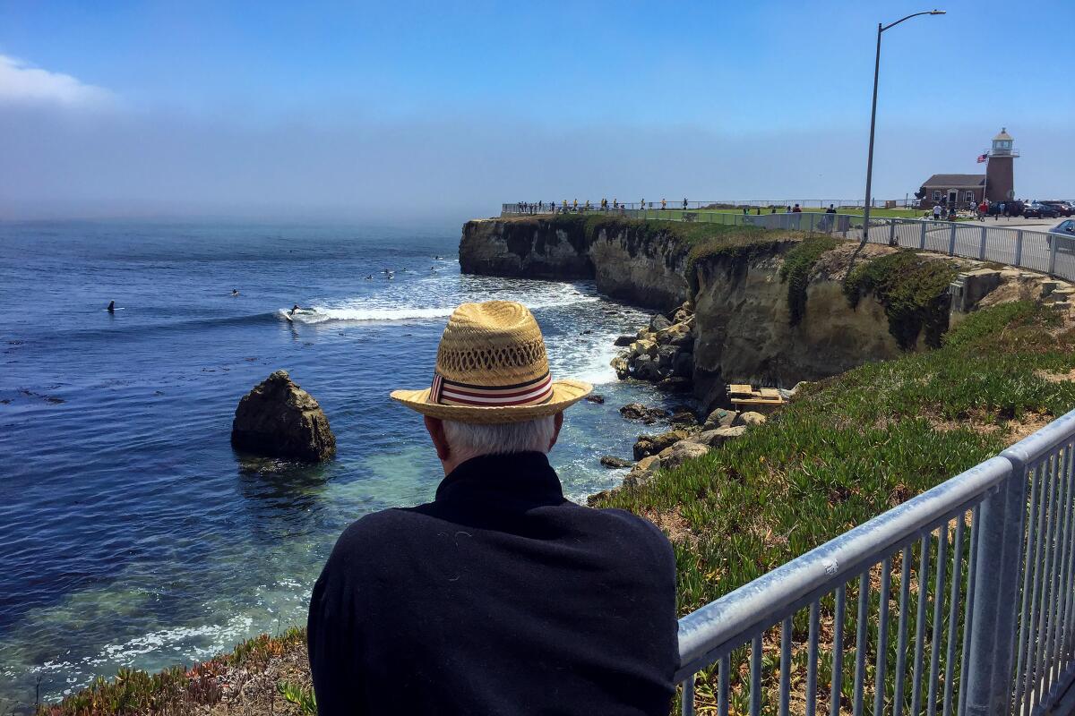
A man in a straw hat watches surfers ride waves at Steamer Lane.
(Allen J. Schaben / Los Angeles Times)

Steamer Lane, Santa Cruz

To appreciate the Steamer Lane surf break, you don’t need to get wet. You don’t even have to duck into the little red-brick lighthouse that was converted into the Santa Cruz Surfing Museum in 1986. (But it would be silly not to.)

Just looking down at one of the state’s best-loved surf spots is enough to bring you closer to the cool, damp soul of Santa Cruz, which glistens with the tracks of innumerable banana slugs. The elevation gives you a great angle for photography, and Lighthouse Field State Beach is next door.

Pro tip: You’re already on West Cliff Drive, which is great for a coastal meander. Less than a mile northeast on that route, you’ll find the Santa Cruz Wharf, a landmark full of eateries and frequented by sea lions and pelicans. A few hundred yards beyond the wharf is the Santa Cruz Beach Boardwalk amusement park.
Read All Read Less
Route Details
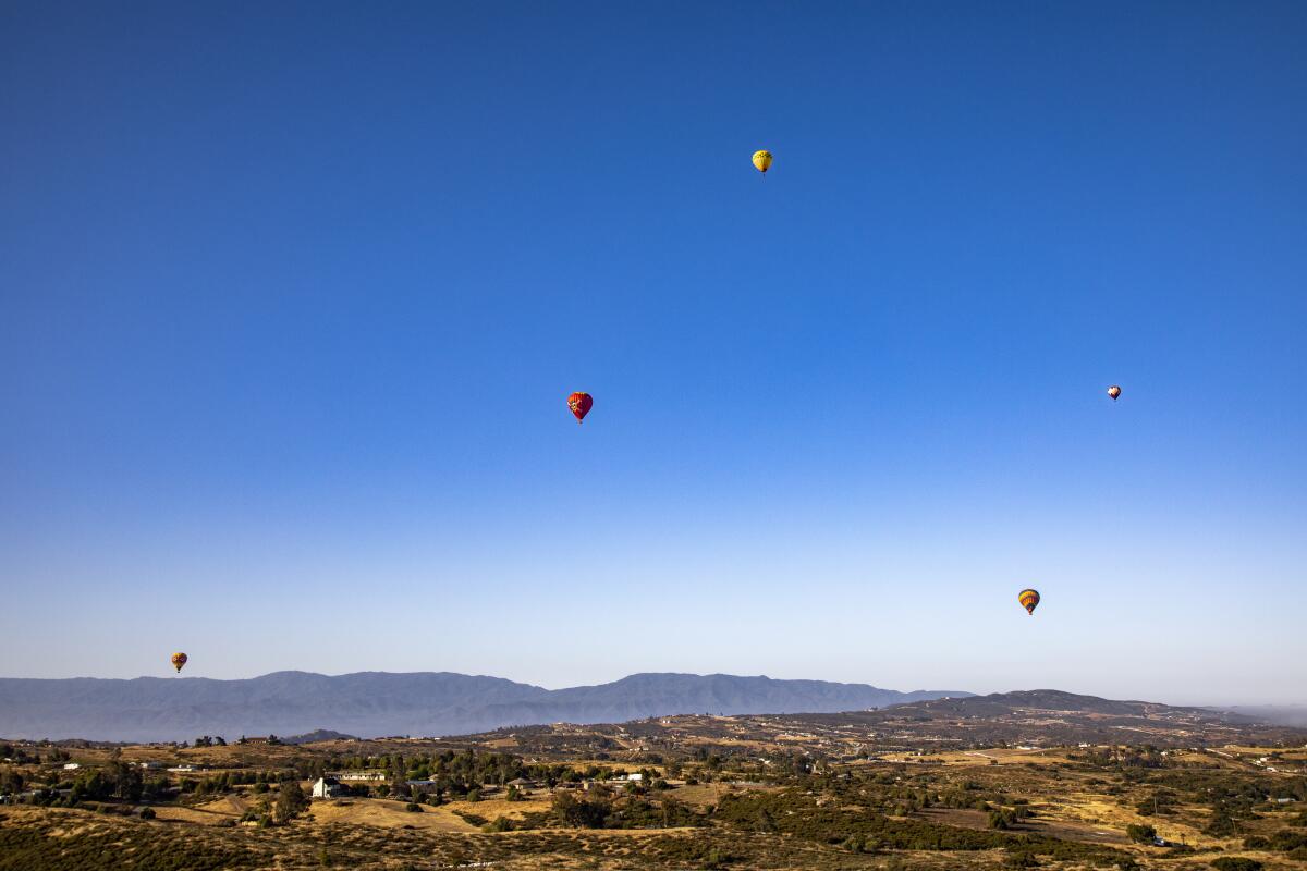
Hot air balloons above Temecula Valley
(Ricardo DeAratanha / Los Angeles Times)

Temecula Valley by balloon

Riverside County Attraction
Sure, you could stay on the ground and enjoy the restaurants and tasting rooms of the Temecula Valley’s wine-country scene. But you could also rise before dawn, climb into a basket under a big balloon, then drift skyward and float over the hills and vineyards. Flights usually last 60 to 75 minutes. And, yes, you have to get up early, because the wind dies down in early morning. Good time for photos too.

Several balloon companies operate in the area, including: California Dreamin’ and A Grape Escape. Weekend shared group flights start at about $200 per person. On a typical flight, you’ll get up to 2,000 feet high and feel the heat (and hear the roar) of the overhead burners that control the balloon’s altitude.


Pro tip: One ballooning company, Magical Adventure, offers a “mile-high flight†for about $1,250 that is “exactly what you are thinking, naughty one.â€
Read All Read Less
Route Details
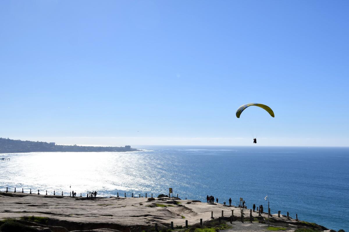
A glider hovers above Torrey Pines Gliderport, with the ocean beyond.
(Christopher Reynolds / Los Angeles Times)

Torrey Pines Gliderport

San Diego County Attraction
This is the place to see men and women jump off a cliff, then rise on the updraft. The gliderport sits between the UC San Diego campus and the Pacific, sending skyward a steady stream of paraglider pilots and the occasional model airplane. Grab breakfast or lunch at the Cliffhanger Cafe (nothing more than $9.49), settle in at a picnic table and watch the action in the air.

Sail planes were taking off here as early as the 1920s. In 1930, Charles Lindbergh glided on these winds. Hang gliders joined in the 1970s, then paragliders, then tandem paraglider flights ($175-$255). See the shoreline about 200 feet below? That’s Black’s Beach, accessible by a steep, half-mile trail. (It has a nude zone.)

Pro tip: For more visual stimulation, cross North Torrey Pines Road to explore the outdoor artworks of UCSD’s Stuart Collection and the brutally top-heavy geometry of its Geisel Library.
Read All Read Less
Route Details
Advertisement
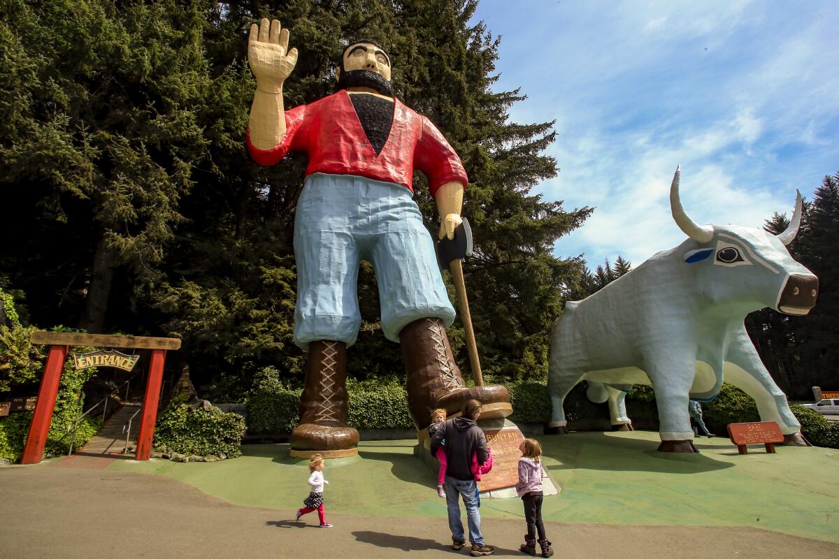
Towering Paul Bunyan, beside his blue ox, Babe, waves at a family below.
(Mark Boster / Los Angeles Times)

Trees of Mystery

The 49-foot-tall Paul Bunyan here has a wisecrack ready for your kid. Call him the kitsch king of Klamath or maybe, given his girth and ax, you should just call him Mr. Bunyan. About 36 miles shy of the Oregon border, this big lumberjack stands beside U.S. 101, flanked by his faithful blue ox, Babe, beckoning visitors into Trees of Mystery, which has been celebrating the area’s tall trees since 1946. Holler a question during open hours and Mr. Bunyan will give you a live answer and maybe a wink and a wave. (Ask about his Friday night poker game with Bigfoot.)

Inside, you’ll find the Redwood Canopy Trail, a network of eight suspension bridges with stairs and platforms 50 to 100 feet above the forest floor. There’s also a SkyTrail gondola, Forest Experience Trail, Wilderness Trail, the Trail of Tall Trees — all manner of taller and strangely shaped trees, epic wood carvings and good, clean timberland hucksterism. Admission, $20 for adults; $11 for children age 6-12.

Pro tip: If you want to keep the talking-giant illusion intact, don’t look too closely at the back of Paul Bunyan’s right boot.
Read All Read Less
Route Details

Venice Beach

Los Angeles County Beach
If you’re new in these parts, you’ll find Venice and its famed Ocean Front Walk just south of Santa Monica and left of the American mainstream. It is youthful, bohemian, occasionally dangerous and reliably squalid around the edges. Try the walk on a weekend morning with a concealed fistful of dollar bills for tip-seeking street performers. And don’t miss Rip Cronk’s mural of Venus on roller skates (near Speedway and Windward Avenue) or the dangling VENICE letters at Pacific and Windward. Take in the careening teens at the Venice Skate Park, the cyclists, the busy basketball courts, fishing pier, Muscle Beach bodybuilders and the quirky little bookstore. Save time (or another day) for the canals just south of South Venice Boulevard and the upscale restaurants, galleries and shops along Abbot Kinney Boulevard. Parking can be tough, but there are three nearby county lots.

Pro tip: The Sidewalk Cafe (at Horizon Avenue) is a prime place along Ocean Front Walk to sit and watch people. The Venice Ale House (at Rose Avenue) is another.
Read All Read Less
Route Details
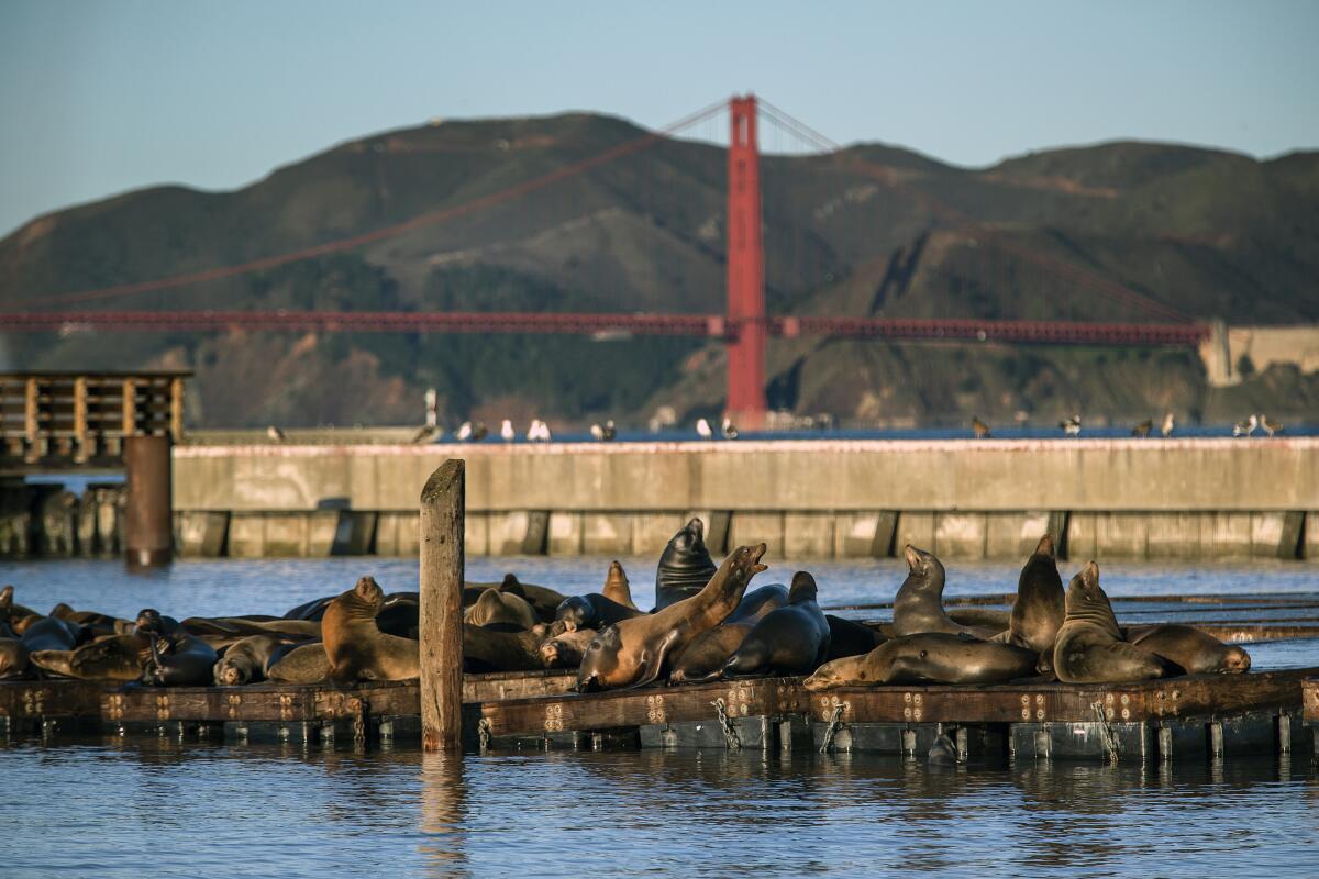
Sea lions sunbathe on a dock at Pier 39.
(Mel Melcon / Los Angeles Times)

Ferry Building and waterfront

San Francisco Attraction
In a food-and-view-obsessed city, no venue is foodier than San Francisco’s Ferry Building and no view beats the Golden Gate Bridge. The real estate that connects them — and Fisherman’s Wharf and the Embarcadero — is the waterfront, a stretch of more than five miles that will feed you, teach you, entertain you and muss your hair (stiff breezes).

Start at the foot of Market Street in the the Ferry Building. From 1898 until the Bay Bridge and Golden Gate Bridge went up in the 1930s, ferries from Alameda and Marin counties were the heart of Bay Area commuter life. Then cars and BART took over. Now the Ferry Building is crowded with artisan shops and restaurants and a farmers market. Working your you way north and west on the waterfront (by foot, bike or streetcar), you’ll find food and booze at the snug, old Pier 23 Cafe; a tourist-driven shopping scene at Pier 39; and the spectacle that is Fisherman’s Wharf. If you rent a bike at Blazing Saddles, Sports Basement or San Francisco Bike Rentals ($25-$75 daily), you can pedal to Golden Gate views at Crissy Field, the Warming Hut and Fort Point. Or ride across the bridge to Sausalito (1.7 miles) and catch a ferry back.

Pro tip: Dress in many layers (for the wind). Also, keep an eye out for the Bay Bridge light show after dark.
Read All Read Less
Route Details
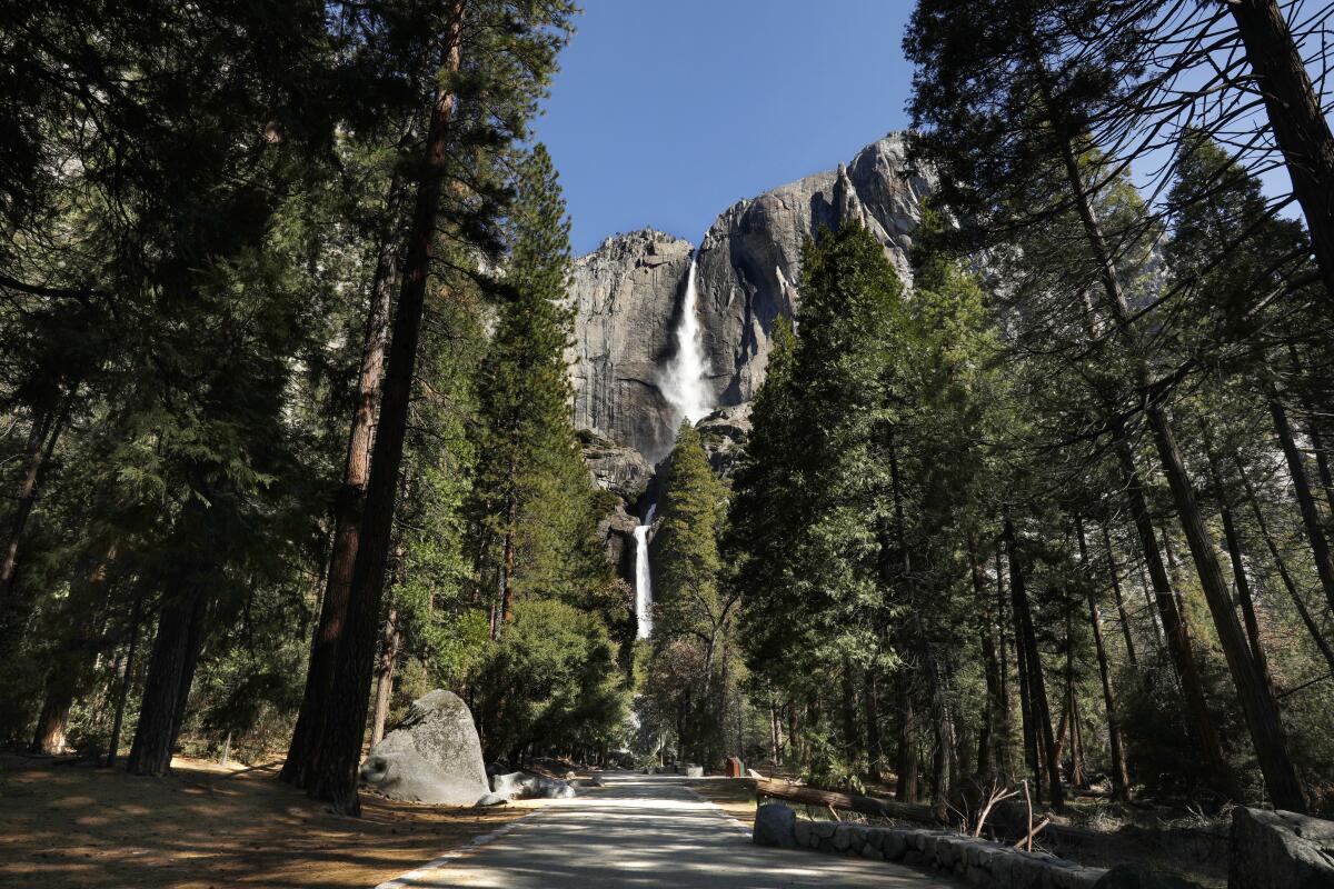
Yosemite Falls seen in the distance through an avenue of pine trees.
(Carolyn Cole / Los Angeles Times)

Yosemite National Park

Mariposa County National Park
Yosemite National Park is vast, gorgeous and off-limits to impulse visitors this summer. Rangers require that all day-trippers who drive in between May 21 and Sept. 30 have advance reservations. (If you have overnight reservations, you’re covered.)

Yosemite Falls, the great spigot of Yosemite Valley, is North America’s tallest waterfall, a 2,425-foot medley of cascades down granite walls. Stand in the mist and be humbled. Or climb the Yosemite Falls Trail to Columbia Rock (two miles round trip). Or try the Mist Trail to the top of Vernal Falls. There won’t be shuttle buses this summer, so explore the valley by bicycle.

But remember, the valley is six square miles in a 1,187-square-mile park. Drive into the high country and catch the panorama from Glacier Point. Take Tioga Road (which usually opens in late May or June) to Olmsted Point, Tuolumne Meadows and Tenaya Lake.

Pro tip: Cars and buses can’t enter Mariposa Grove right now because access was closed after a January wind storm. But you can hike or bike in (four miles, round trip from Mariposa Grove Welcome Plaza). Then you can explore a forest with 15 fallen sequoias.
Read All Read Less
Route Details
Advertisement