San Diego County piers

Imperial Beach PierOverview: Californiaâs southernmost recreational pier is within walking distance of the Mexican border. At its end is the Tin Fish, a small eatery with seafood, burgers and sandwiches. At its foot are Cow-a-Bunga, a coffee store, and Sound of Beach, which sells sundries. A colorful visual touch nearby is âSurfhenge,â four acrylic arches representing the areaâs surfing heritage.
Background: This pier was dedicated Nov. 23, 1962, the day afterPresident John F. Kennedy was killed.
Views: The Coronado Islands are visible to the southwest; to the north is the town of Imperial Beach.
Parking: A lot at the foot of the pier charges $2 for all-day parking; some free parking is available on adjacent streets.
Directions: The 5 Freeway to the Palm Avenue/Highway 75 exit. Follow Palm Avenue to Seacoast Drive, turn left and take it to the pier.
Bayside Park Pier
Overview: This 675-foot pier in Chula Vista provides nice if un-exotic views across San Diego Bay to Coronado Cays Park.
Parking: Free in a sizable lot near the pier.
Directions: The 5 Freeway to the Marina Parkway exit. Turn right on West J street, continue onto Marina Parkway, turn left onto Sandpiper Way and into the park.
Pepper Park Pier
Overview: This is a Southern California rarity, a pier extending into wetlands. The small, bare-bones wood pier is along Sweetwater Channel, an indentation in San Diego Bay near the border of Chula Vista and National City. Across from the pier are marshy wetlands and a fair amount of bird life in the spring.
Parking: Free, in a large nearby lot.
Directions: From the 5 Freeway, take Exit 10 to merge onto Bay Marina Drive. After half a mile or so, turn left onto Tidelands Avenue and take it until it you reach the parking lot of Pepper Park.
Coronado Ferry Landing
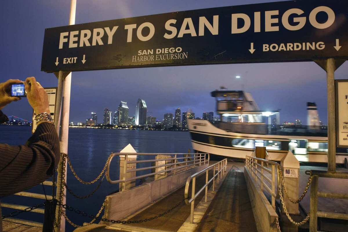
Overview: Arguably the best half-day destination of any pier in Southern California, though not so much for the pier itself, which is a small fishing and ferry-landing spur poking out 300 feet into San Diego Bay. The lures are its views (below), a small âbaby beach,â a scenic walking path along the shoreline and lunch opportunities.
View: Great views of San Diego Bay at its best, with sweeping displays of the cityâs skyline, the naval yards, ships at berth and the Coronado Bay Bridge. They come close to rivaling views of San Francisco Bay.
Parking: The Coronado Ferry Landing parking lot is free but usually crowded.
Directions: The 5 Freeway to the Highway 75 exit. Take 75 over the Coronado Bay Bridge, continue on 4th Street, which becomes Pomona Avenue. Turn right on C Avenue, then right on 1st Street. The pier is not visible from the street, but is behind the Coronado Ferry Landing shopping complex.
Embarcadero Marina Park Pier
Overview: Only 95 feet long, this T-shaped plank pier extends parallel to the shore for 300 feet. The lure here is the pleasant small park rather than the pier itself. In front of the pier is J.J.âs Sunset Deli, with sandwiches, dinner plates and burgers.
Views: The pier is a good location to see ferries, cargo ships and sailboats entering or leaving the San Diego harbor under the Coronado Bay Bridge.
Parking: Two-hour parking in a metered lot next to the pier.
Directions: The 5 Freeway to the Market Street exit. Take Market west to Harbor Drive. Turn left on Harbor Drive and take it to 8th Avenue. Turn right onto Convention Way, follow it a short distance to Marina Park Way, which leads to the parking lot at the base of the pier.
Shelter Island Pier
Overview: This short T-shaped concrete pier is more appealing to fishermen than tourists A gift shop called Sharkeyâs is at its foot.
Views: Land and water views in all directions, but by San Diego Bay standards, the views are nondescript.
Parking: Free lot next to pier.
Directions: The 5 Freeway or 8 Freeway to Rosecrans, turn west, then turn left at Shelter Island Drive and follow the road. After you pass the roundabout, the road curves right; look for the long, narrow parking lot on the left, fronting the bay, and about halfway down is the pier.
Ocean Beach Fishing Pier
Overview: Stretching almost a third of a mile, this is said to be the longest concrete pier in the state. With its T-shaped arms providing a few hundred more feet of walkable surface, the pier makes for a good aerobic destination. Halfway along, you can take a break at the Wow (âWalking on Waterâ) Café with outdoor and indoor tables. Mexican, American and seafood meals. At low tide, the tide pools underneath are fun to explore.
Views: From the 193-foot north-facing spar of the T-shape pier, panoramic vistas of Mission Bay and the La Jolla promontory; to the south, planes departing Lindbergh Field are visible.
Parking: Free lot at the nearby corner of Abbott and Newport.
Directions: From the 5 Freeway, take the Seaworld Drive exit and follow it until it runs into Sunset Cliffs Boulevard. Take Sunset Cliffs Boulevard to Newport Avenue, turn right and stay on the road to the pier parking lot.
More: https://www.oceanbeachsandiego.com/ocean-beach-pier
Crystal Pier
Overview: The only public pier in the state with a hotel. The 21 trim cottages of the Crystal Pier Hotel & Cottages have views of the sand and surf below. Room rates vary based on the time of the year; for information, call (800) 748-5894 or go to https://www.crystalpier.com
Background: The Crystal Pleasure Pier Ballroom & Joy Zone opened on Fourth of July weekend, 1927. The pierâs constant swaying proved to be a turnoff for ballroom dancers, and the venture went broke during the Depression. After extensive remodeling, the pier re-opened in 1936 with cottages and a soda fountain. The pier was sold several times over the years, but the lodgings stuck, and a public/private partnership between the hotel ownership and San Diego County has kept the wooden pier and its dwellings intact.
Views: To the west are excellent sunsets. To the north, the La Jolla promontory makes for an interesting view.
Parking: Street parking is free, but it can be a chore to find.
Directions: From the 5 Freeway, exit at Balboa Boulevard/Garnet Avenue. Take Garnet west to the foot of the pier.
Oceanside Pier
Overview: The Oceanside Pier demands to be walked. Its elevated position above the comparatively narrow beach accentuates itself over an otherwise flat coastline. Halfway down is a lifeguard station and bait shop selling sundries; at the end is one of the four Rubyâs on Southern California piers. (The others are in Newport Beach, Huntington Beach and Seal Beach.)
Background: A peculiar facet of the Oceanside Pier is the periodic public debate over its length â various city records list it as 1,900, 1,942 or 1,954 feet long â and whether it is the longest pier in the state. (It appears to be not even the longest in San Diego County, with the Ocean Beach Pier checking in at 1,971 feet.)
Views: When itâs clear, beachfront views stretch for miles in either direction. To the north, the harbor jetty is visible, as are helicopters from the Camp Pendleton. To the south, the shoreline down to Del Mar and La Jolla can be seen in good weather.
Parking: Pay parking is available in the lot at the foot of the pier; metered parking is on nearby streets.
Directions: From the 5 Freeway, take Mission Boulevard toward the coastline, turn left on Pacific Coast Highway, take the third right onto Surf Rider Way, turn left on the Strand and follow it to the pier.
More: https://www.ci.oceanside.ca.us/gov/pw/harbor/things/pier.asp
Oceanside Small Craft Harbor Pier
Overview: This L-shaped plank pier is 7 feet wide, about 50 feet long and has a Remember Pearl Harbor plaque at its base. The small pier is generally overlooked by visitors except for fishermen interested in placid waters and freeway proximity.
Views: Restricted to the placid harbor, breakwater and small craft moored nearby.
Parking: Free next to the pier.
Directions: From either the southbound or northbound 5 Freeway, exit at Harbor Drive and follow it for a third of a mile down to the harbor. Stay right where the road splits; the pier is about 200 yards down the road.
¿-- Christopher Smith
More to Read
Sign up for The Wild
Weâll help you find the best places to hike, bike and run, as well as the perfect silent spots for meditation and yoga.
You may occasionally receive promotional content from the Los Angeles Times.


