Wild or mild, these bike rides are among the best in the West (and Iowa)
- Share via
You don't have to embark on a bike ride from L.A. to Long Island to enjoy the benefits, psychic and physical, of a ride. We asked biking enthusiasts, some casual, others just this side of obsessive, to tell us where they like to point their wheels.
Santa Cruz
Just Wild Enough in Wilder Ranch
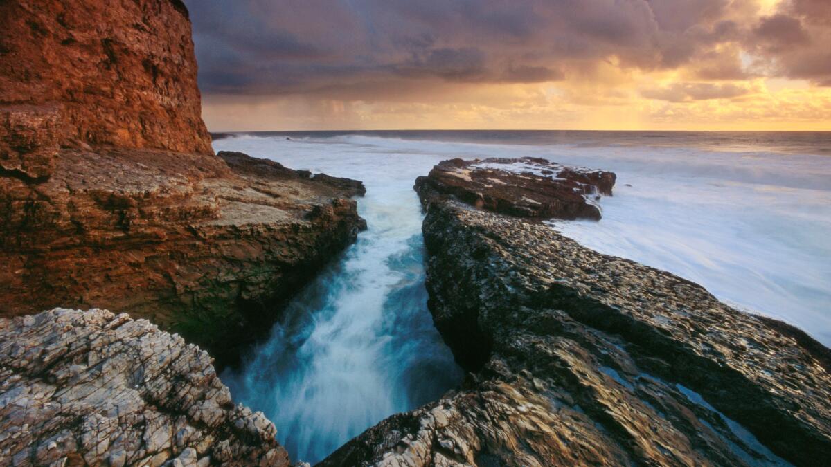
The ride: Along the ragged bluffs of Wilder Ranch State Park in Santa Cruz. You can ride three to seven miles, depending on your access point and how loopy you get.
The why: Great views of eroded coves and coastal benches with dramatically exposed sedimentary cliff layers and crashing waves.
The setting: Wilder Ranch State Park is a historic site housing an 1800s dairy ranch, farm animals and an interpretive center. There are more than 35 miles of trails, many of the most rugged ones are on the eastern side of Highway 1.
This ride is on the western bluffs, chopped by relentless waves into a succession of picturesque vistas. The Old Cove and Ohlone Bluff trails are easily accessed from the main parking lot.
You’ll ride aside farm fields, past grassy headlands and, this time of year, plenty of wildflowers.
There are benches where you can pause and take in the stirring panoramas; pack a backpack lunch and park on a cliff for a wave-waving view. When there are horses present, dismount from your bike and walk; you’ll also want to keep an eye out (and ready brakes) for children darting on the trail.
Fitness/skill level: The trail is basically flat, though it can be rutted at points. Some biking nimbleness required for dodging trail walkers and the occasional horse.
Inside knowledge: You’ll want a mountain bike, not a road bike, on these trails. The bluffs can be sharply windy, so check ahead on predicted winds. Pick up a trail map at the entrance kiosk or nearby ranger station, accessed from the Highway 1 marked entrance just north of Santa Cruz. Visiting the old ranch buildings can be fun too, so bring a bike lock.
My favorite way to begin the ride is just outside the park. You can park on Shaffer Road at the northern end of Santa Cruz off Highway 1. There’s a marked, paved trail head near the junction that’s a nice ride past the old ranch buildings and into the park grounds, where you can start the bluff ride.
Cost: $10 parking fee
Info: Wilder Ranch State Park
—Tom Bentley
Chehalis Western Trail, Wash.
Forests, farmlands and great views
The ride: The Chehalis Western Trail, also known as the Woodard Bay Trail, runs from the Woodard Bay Conservation Area on Puget Sound’s Henderson Inlet to the small town of Rainier, population 1,800. The ride is 24 miles one way.
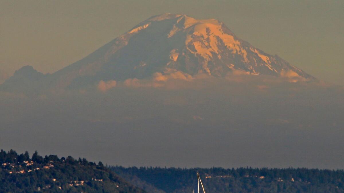
The why: This is the top bike trail in Thurston County with lots of wildlife, including a large heron rookery at Woodard Bay, as well as forests, prairie, farmlands and great views of the Olympic Mountains to the west and Mt. Rainier to the east.
Fitness/skill level: Beginner. The trail is relatively flat, with gentle hills and plenty of benches where you can stop and rest.
The setting: Ride south along the former route of the historic Chehalis Western Railroad, which Weyerhaeuser Co. used for 60 years to transport logs north to Puget Sound. You then roll through farmland on the way to Olympia and the bicycle roundabout at the junction with the Woodland Trail. Farther south, you’ll pedal along the Deschutes River. Stop for a picnic and cool your heels at the river’s edge.
Inside knowledge: Indulge your sweet tooth with some of the best cookies in the county at the Main Street Cookie Co. in Rainier (mainstreetcookies.com). Take a rain slicker too because you never know when it’s going to sprinkle.
Cost: Free.
Info: Thurston County Bicycle Map; Thurston Here to There. Bike rentals, Deschutes River Cyclery, Olympia, Wash.
—Brian E. Clark
Los Angeles
Channel your energies on Ballona Creek
------------
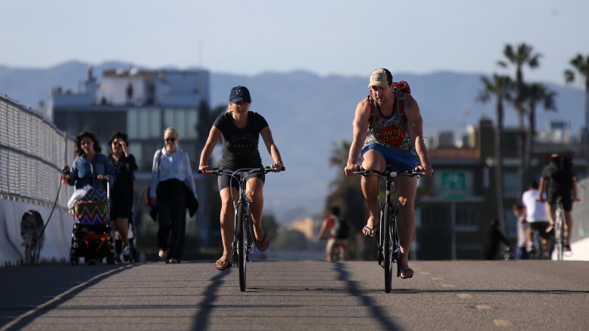
For the Record, April 11, 1:05 p.m.: The caption above misidentifies the bridge’s location. It is at Pacific Avenue, not Ocean Drive.
------------
The ride: Along Ballona Creek, from the Del Rey area of Los Angeles to Marina del Rey. About six miles round trip.
The why: Wetlands teeming with water birds, plus stunning marina and ocean views.
Fitness/skill level: Easy. The pathway is paved and mostly flat.
The setting: Ballona Creek does double duty as a concrete-lined storm channel for the Los Angeles Basin and a way station for countless birds that migrate from as far away as Alaska.
Riding west from the Centinela Avenue entrance to the Ballona Creek Bike Path, you'll follow the wide, placid creek as you zoom under highway overpasses and past the Ballona Wetlands Ecological Reserve.
Depending on the season, you may spot American coots, mallards, teals and other birds paddling in the creek near Centinela, while black-necked stilts forage along the banks.
Along the way is small, charming Milton Street Park, landscaped with coast sunflowers, sticky monkey-flower and other native meadow plants. Farther down the creek, stately blue herons and white egrets often stand still as statues.
After about two miles, the path merges with the Marvin Braude Bike Trail, with the creek on one side and sparkling Marina del Rey, home to million-dollar yachts, on the other.
End the ride at the Pacific Avenue Bridge, about a mile away, or for a longer tour, continue down the Braude trail to South Bay beaches.
Inside knowledge: Entrances to the bike path may be closed during periods of heavy rain. Mornings are best for solitude and bird watching. Watch out for wicked onshore winds that can kick up in the afternoons. There’s no food along this stretch of the bike path, but you’ll find eateries in Playa del Rey and Fisherman’s Village in Marina del Rey.
Cost: None, except for parking at Fisherman’s Village (two hours free with validation; $1 each 20 minutes thereafter). Street parking is available near several entrances to the bike path.
Info: Ballona Creek Bike Path
—Jane Engle
San Francisco
From San Francisco to Sausalito: It’s golden
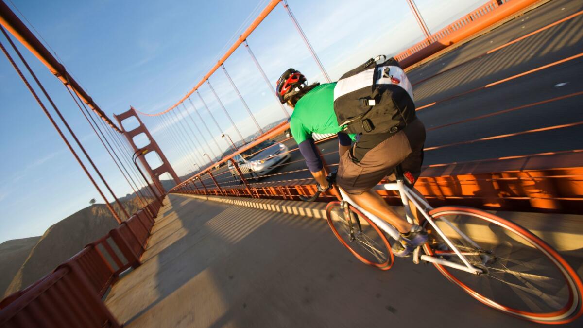
The ride: Across the Golden Gate Bridge between San Francisco and Sausalito.
The why: Seeing the Pacific far below. Watching San Francisco get smaller as you go. Seeing the green slopes of Marin County get bigger.
Fitness/skill level: Easy to moderate. The bridge is flat, but the waterfront route to the bridge from Fisherman’s Wharf (where most people begin) leads to a 0.7-mile climb between the Warming Hut and the start of the bridge. The bridge itself isn’t my favorite part — zooming cars, sometimes headwinds— but landscapes at either end are tremendous, as is Sausalito’s seaside small-town atmosphere. In all it’s an eight-mile ride from Fisherman’s Wharf to the Sausalito ferry landing.
The setting: You climb and sweep through Ft. Mason, then glide through the Presidio as you pedal toward the bridge. You’re fenced off from car traffic on the bridge. Once across, you swoop into Sausalito. Plan on about 90 minutes one way, plus whatever stops you make, plus 30 to 45 minutes for the ferry ride back. (In the Presidio, right along the bike path, I like the Warming Hut’s selection of books and snacks.) The Blue & Gold Fleet ferries from Sausalito will drop you at Pier 41; the Golden Gate ferries will drop you at the Ferry Building.
Inside knowledge: If you’d like a little help on the hills, there are electric bike tours. (Guided tours with electric bikes are $85 at Blazing Saddles.) Conversely, if you want to sweat more and do it all yourself, keep going past Sausalito and ride on to Tiburon. It has ferry service back to the city too. That route covers 22 miles.
Cost: Blazing Saddles, with six locations along Fisherman’s Wharf and another in Union Square, rents bikes for $8 or $9 an hour.San Francisco Bicycle Rentals, which has locations at Fisherman’s Wharf, Golden Gate Park and the Ferry Building, starts at $8 per hour or $30 per day. The Blue and Gold Fleet ferries cost $11.50 per adult from Sausalito; the Golden Gate Ferry costs $11.75.
Info: Blazing Saddles; San Francisco Bicycle Rentals; Blue & Gold Fleet; Golden Gate Ferry
—Christopher Reynolds
Marin County
Long and flat ride
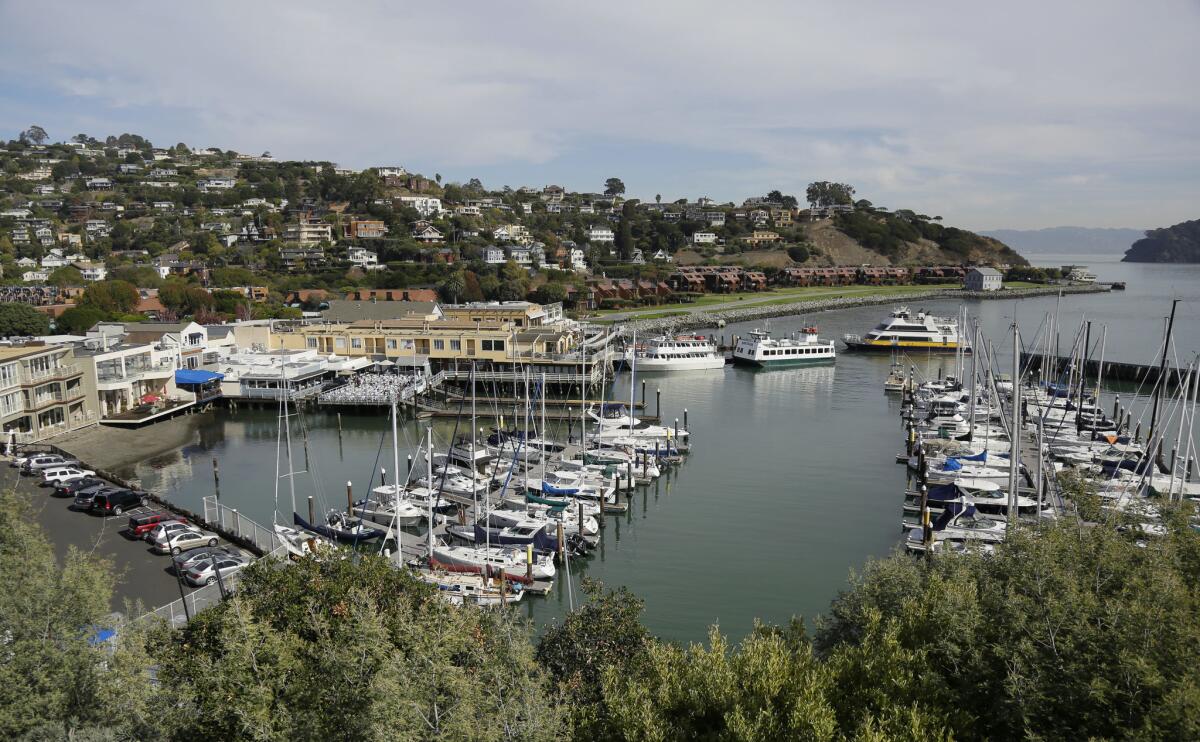
If you’re hankering for a longer or flatter ride to the bridge and Marin County, try this route instead:
The ride: From San Francisco’s Mission District over Golden Gate Bridge to Sausalito, about 11 miles. For a longer tour, keep going to Tiburon.
The why: This relatively flat way to see the City by the Bay goes through Golden Gate Park and the Presidio before crossing the bridge and then plunging down the long, steep hill to Sausalito.
Fitness/skill level: Moderate. Most people think of San Francisco as the hilliest city in the world, but in many cases you can ride around those steep hills. Still, it’s nice to have a bike with gears for some small hills that are unavoidable on the way north. Be sure to skip Bradford, Prentiss and Nevada streets in Bernal Heights, all of which have maximum grades of 35% or more.
The setting: This ride starts at Mission Bicycle Co. (776 Valencia St.), where you can rent a bike or even have them build you a custom model. You’ll go from urban San Francisco, snake through an area called the “Wiggle” and traverse several of the city’s most well-known green spaces, before crossing the Golden Gate Bridge and dropping into Marin County.
Inside knowledge: Stop at Bi-Rite Market (3639 18th St.) and grab food for a picnic in Mission Dolores Park, where the vistas are stunning. In Golden Gate Park, pause at the deYoung Museum and take the elevator to the observation deck for panoramic views. When you get to Sausalito or Tiburon, your first stop should be the ferry terminal. Buy your tickets early because the ferries can often be crowded.
Info: Mission Bicycle Co.
—Brian E. Clark
Sonoma County
Wineries on West Dry Creek Road
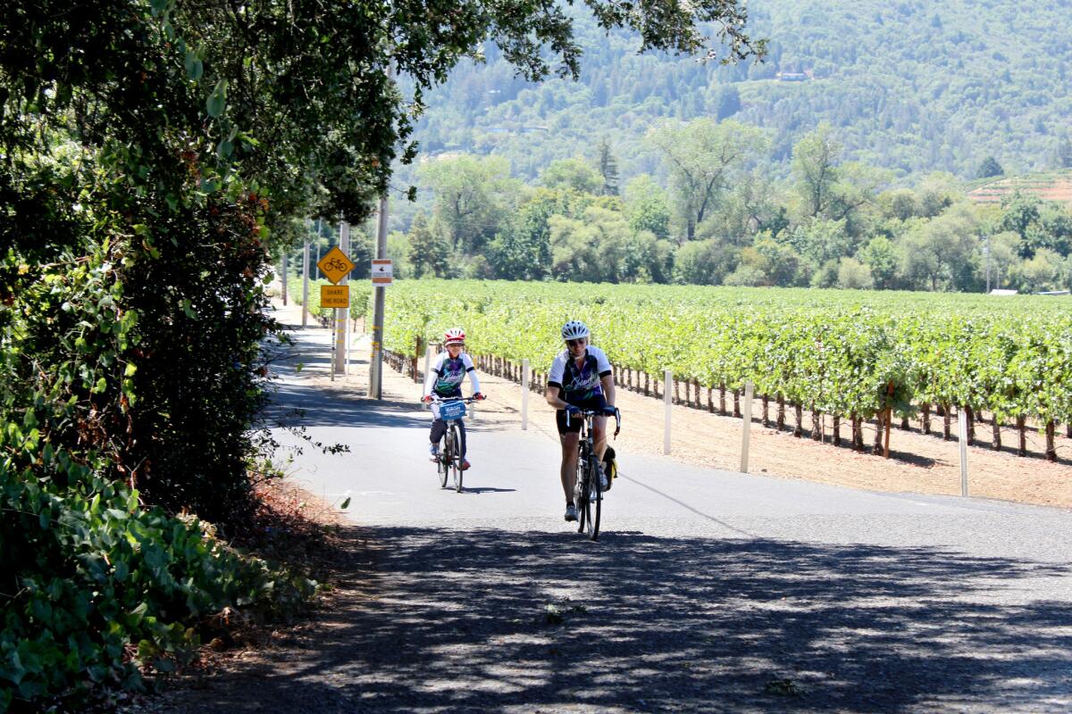
The ride: West Dry Creek Road is just a short distance from the bucolic Sonoma County town of Healdsburg. This 25-mile round trip to the Bella Vineyards and Wine Caves at the north end of Dry Creek Valley, can be extended for those who want to climb a mild grade to the Lake Sonoma Recreation Area, for a total of 35 miles.
The why: Bicycling Magazine calls this route one of the globe’s seven great rides.
Fitness/skill level: Low intermediate. Almost anyone can do this ride. If you want to make the climb up to the Lake Sonoma recreation area, you might need to dismount and push your bike because the road climbs several hundred feet. To get to West Dry Creek Road, take Mill Street out of Healdsburg about a quarter mile and turn right.
The setting: West Dry Creek Road flows over gently rolling terrain on the west side of valley, with vineyards to the east and the intercoastal range of hills to the west. If you get hungry on the way north or south, take Lambert Bridge Road to the Dry Creek General Store (3495 Dry Creek Road, Healdsburg) for a sandwich, cookie or something to drink. I recommend the toasted house-made bagel with smoked salmon, $9.95. This grocery has been around since 1881 and looks it. Dry Creek Road can have a lot of traffic, so it’s best to head back to lightly traveled West Dry Creek Road for the return to Healdsburg.
Inside knowledge: It can be foggy until 10 a.m., so you might want to delay your ride until then. Layer your clothes and wear a windbreaker that you can tie around your waist as the day warms. Plan on about two hours of riding and give yourself plenty of time to stop for a picnic and to visit Lambert Bridge, Quivira and Dry Creek wineries.
Cost: Free
Info: Wine Country Bikes, 61 Front St., Healdsburg; Spoke Folk Cyclery, 201 Center St., Healdsburg
—Brian E. Clark
Park City, Utah
Thrills and chills at a mountain bike park
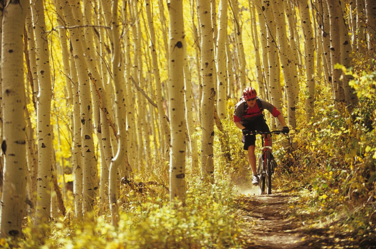
The ride: Up, down and around the Park City Bike Park, the purpose-built mountain bike park at Canyons Village at Park City Mountain.
The why: A thrillingly engineered park, with chairlifts to the top and all the amenities of the ski resort nearby.
Fitness/skill level: Intermediate to expert. Confident beginners can ride the easier, flatter loops.
The setting: You have your pick of terrain as the glorious ski areas defrost to become flow, jump and downhill mountain bike trails in the summer. The resort has 20 miles of cross-country trails as well as a bike park serviced by three bike lifts. You can focus on sharpening your downhill and free-ride technical skills, such as catching air off of a ramp, harnessing centrifugal force to ride sideways along a wooden berm or banging gracefully down a twisty ski run/bike trail.
Inside knowledge: You can bring your own bikes, but rent if you want to test some top-of-the-line downhill and free-ride mountain bikes. I rode a nearly $5,000 Cannondale Claymore with full suspension and a geometry that gave me bump-eating superpowers. You should also rent the body armor and the full-face helmet to test your limits with no, OK, with less, fear.
Cost: Bike rentals begin at $50 for a half day and up to $120 with protective gear for a full day.
Info: Park City Bike Park opens June 16. For hours, rates and more, go to parkcitymountain.com.
—Valli Herman
IOWA
Mardi Gras on two wheels
------------
For the Record
April 13, 11:50 a.m.: An earlier headline on this item said the event is in Missouri. It is in Iowa.
------------
No one would ever confuse rural Iowa with the south of France, but this ride is something of a trip back in time as well as a Mardi Gras on two wheels.
The ride: This seven-day, 411-mile spin starts with a tire dip in the Missouri River, crosses Iowa’s mostly flat or gently rolling terrain and ends with a tire dip in the Mississippi.
The why: Some pundits call RAGBRAI, a.k.a. the Register’s Annual Great Bicycle Ride Across Iowa, a “rolling Woodstock.” The ride, now in its 45th year, was started by a pair of newspaper columnists. Thousands of riders will gain a total of 13,078 vertical feet along this year’s route, which runs through Iowa’s northern counties.
Fitness/skill level: You’ll be pedaling 60-plus miles every day, so you need to be in relatively good shape. Be sure to drink lots of water because RAGBRAI takes place July 23-29, which means high heat and humidity.
The setting: This is Iowa, so you’ll see plenty of corn and soybean fields. The tour rolls through numerous small towns in the Hawkeye State — some with populations of fewer than 1,000 — where church ladies sell pork chops, corn on the cob and delicious homemade pies. Because these burgs are about 10 miles apart, it’s easy to pace yourself during the day and take in the Camp Algona Prisoner of War Museum, where Germans were held during World War II, and the famous Surf Ballroom in Clear Lake where Buddy Holly, Ritchie Valens and the Big Bopper played their final show in 1959. Riders come from all over the United States, and from far-flung corners of the globe, and camp in parks, schoolyards or even football fields.
Inside knowledge: Start riding early in the morning when temperatures are cool. And moderate your partying the night before. Pedaling with a hangover on a hot day is no fun. And be ready for the final day. Though it only covers 45 miles, it gains 3,200 feet.
Cost: $175 for a week-long rider; or $30 a day for shorter sections.
Info: RAGBRAI
—Brian E. Clark
Sign up for The Wild
We’ll help you find the best places to hike, bike and run, as well as the perfect silent spots for meditation and yoga.
You may occasionally receive promotional content from the Los Angeles Times.

