Traveling to California wine country? What you need to know about the Wragg fire

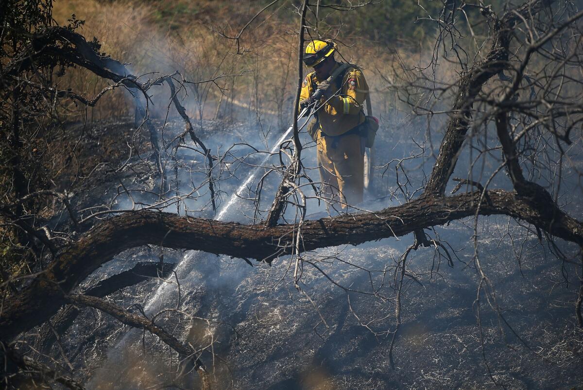
A firefighter sprays water on a hot spot while battling the Wragg fire Thursday near Winters in Yolo County.
- Share via
The fast-moving Wragg fire burning in Northern California in a brushy area near Lake Berryessa swelled to 6,000 acres on Thursday morning. But for those heading out for a wine country weekend in the Napa-Sonoma area, no need to upend your plans.
Napa and Sonoma
The Wragg fire has spread to 6,000 acres since it began Wednesday afternoon near the eastern side of Lake Berryessa and the town of Winters. It's 30 miles to 40 miles from wineries and tourist attractions in Napa and Sonoma.
"It's nowhere near us, and all the wine is safe," says concierge Gloria Noel at Calistoga Ranch in Calistoga.
Kim Powers at the Napa Valley Wine Train's station in downtown Napa says there was blue sky and few clouds Thursday morning. "It's a bit hazy to the east, but I don't believe I can see a distinct column of smoke as I did last night," she said in an email.
Lake Berryessa
Places that are affected are those closest to the blaze. The California Department of Forestry and Fire Protection reported Thursday morning on its website that 200 structures were threatened, and that some communities in the area were under mandatory evacuations.
Closures in the area include the Canyon Creek and Lake Solano campgrounds near the lake and part of California Highway 128, the main access road on the lake's eastern side from Winters.
However the lake's Pleasure Cove Marina in Napa and other lake resorts remain open. Just remember, you won't be able to enter from the eastern side because of the road closure.
If you're planning to go boating on Lake Berryessa or stay in the area, best to call ahead to check on conditions.
Smoke and air quality
If you are traveling north and concerned about air quality because of the fire, check on current conditions before you go. Air quality information for Sacramento and other districts is posted online.
Also, the Yolo-Solano Air Quality Management District has been tweeting real-time updates for people concerned about exposure to smoke.
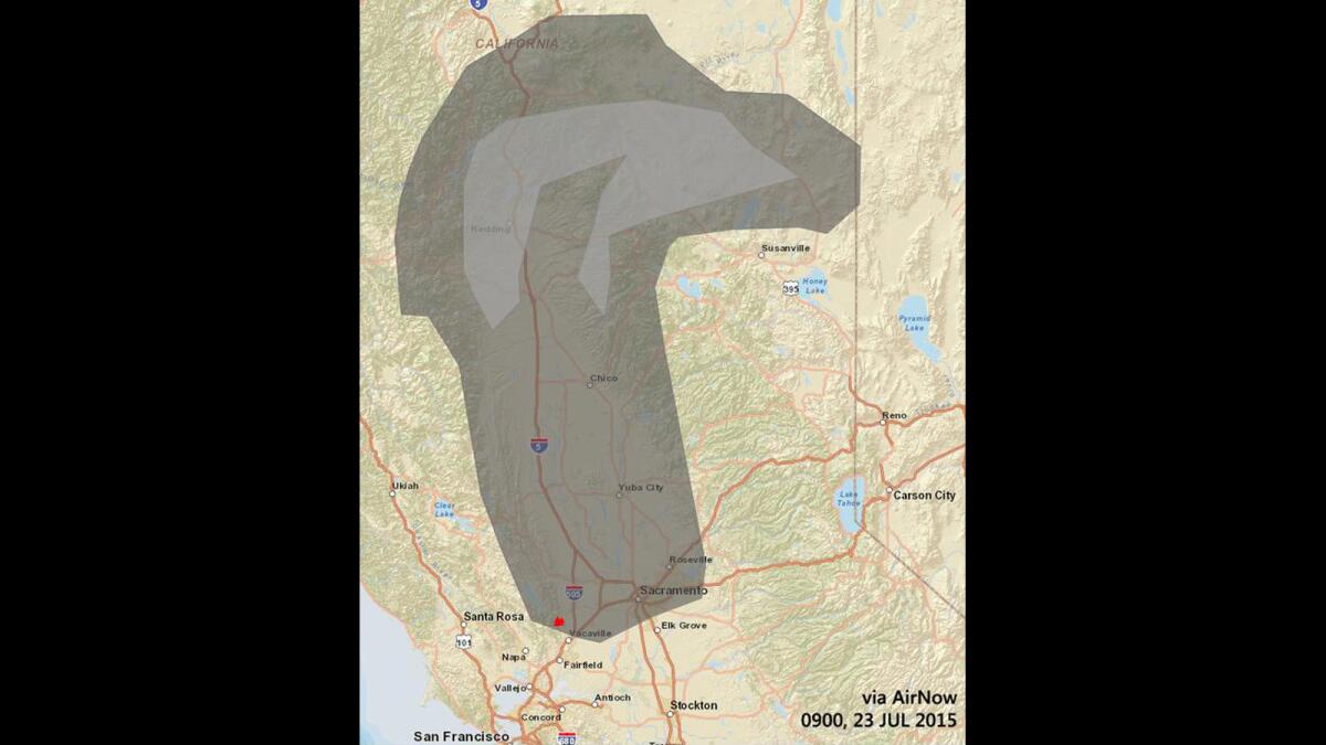
Here's a map showing how the plume of smoke from the fire was forecast to spread over the area.

The smoke plume from the Wragg fire as mapped by AirNow.
(AirNow)
And here's a photo posted by the National Weather Service of the skies over Sacramento.
Sign up for The Wild
We’ll help you find the best places to hike, bike and run, as well as the perfect silent spots for meditation and yoga.
You may occasionally receive promotional content from the Los Angeles Times.


