Is a strong El Niño on the horizon? Forecasters say count on it

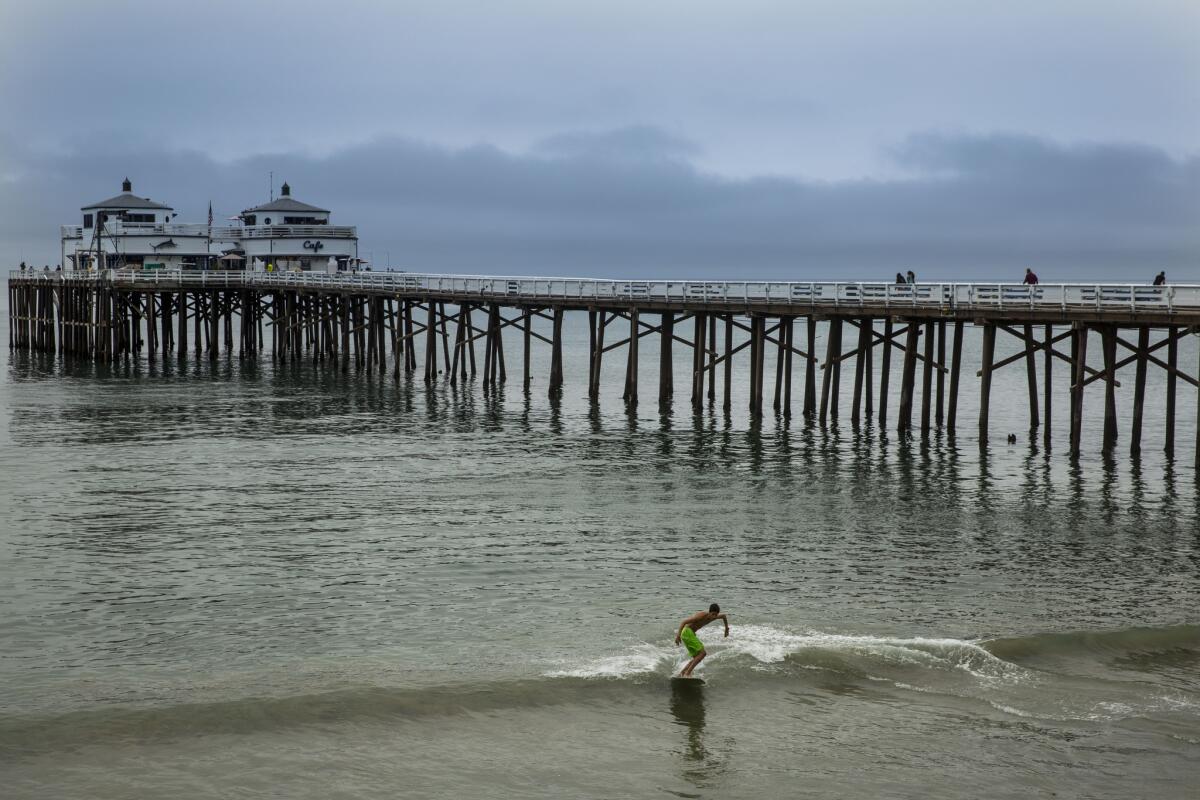
Christian Rodriguez, 19, of Santa Barbara skimboards at the Malibu Pier with low clouds in the background on Thursday, June 11, 2015 in Malibu, California. Forecasters say chance for strong El Nino increased to more than 90%.
- Share via
Californians should brace themselves for one of the strongest El Niño events to hit the Pacific Ocean in years.
Unusually warmer temperatures of equatorial water in the Pacific and shifting winds continued through July, indicating that El Niño will be strong through the fall and into next spring, according to the National Oceanic Atmospheric Administration’s Climate Prediction Center.
In fact, scientists say the likelihood that a significant El Niño will happen is more than 90%, and some models suggest there is a nearly 100% chance it will be strong this fall. Scientists previously said they expected a weak El Niño.
The weather phenomenon will probably contribute to an above-normal hurricane season in the central and eastern Pacific.
So what does this mean for Southern California?
Meteorologist Scott Sukup of the National Weather Service in Oxnard says the region could see above-normal rainfall with more strong storms like those of past El Niños.
He said it is too early to tell what the strong El Niño will actually bring, but the odds for a wet winter are looking good.
Past El Niños have brought in excess of a dozen inches of rain to downtown L.A.: more than 20 inches in 1957-58 and 1972-73, more than 15 inches in 1965-66, and more than 25 inches in 1997-98.
But in California, he said, any rain is welcomed.
“It could bring quite a bit to help the drought,” Sukup said.
El Niño, however, could present problems for areas recently scorched by wildfire.
The Lake fire consumed 31,359 acres of trees, grass and brush, leaving portions of the San Bernardino National Forest vulnerable to mudslides.
Fearing that communities could be affected by flooding and debris flows, forest officials have been asking communities in the area to start preparing for rainstorms.
Forest officials saw their first glimpse this week of what heavy rain could bring to the area, forest hydrologist Robert Taylor said.
Thunderstorms on Monday sent mud flowing onto county roads, limiting access the area, he said.
For breaking news in California, follow @VeronicaRochaLA
More to Read
Sign up for Essential California
The most important California stories and recommendations in your inbox every morning.
You may occasionally receive promotional content from the Los Angeles Times.


