Extreme drought in Northern California just got 10% better

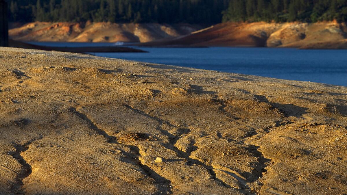
Dry ruts in a island reveal where the water level used to be at Lake Shasta due to serious drought conditions. Lake Shasta is at 31% of capacity due to the ongoing drought and is likely to get worse.
In rare good news on the California drought, extremely dry conditions in northern parts of the state improved by 10% after a series of strong storms.
This weekŌĆÖs U.S. Drought Monitor reports extreme conditions throughout the state dropped from 77% last week to 67%. The positive change occurred mostly in northwestern California and the Santa Cruz Mountains between San Francisco and Santa Cruz. The northern half of the Santa Lucia Range, which is along the Central Coast, also saw drought conditions improve.
Meanwhile, exceptional drought in California -- the most severe classification -- remained unchanged at nearly 40%.
A series of strong Pacific storms brought much-needed rainfall to Northern California, according to David Simeral, a research scientist with the Western Regional Climate Center.
Portions of Northern California were battered by widespread heavy downpours last weekend, bringing the ŌĆ£first significant precipitationŌĆØ since December, he said.
MORE: Chronicling CaliforniaŌĆÖs drought
The storms were subtropical, so most of the moisture was rain and had little effect on snowpack levels in the Sierra Nevada mountains.
The storm system dumped 3 to 15 inches of rain across the Northern California region. Three to 10 inches fell in the Sierra Nevada mountains.
Runoff from the storm, however, added 500,000 acre-feet of water to CaliforniaŌĆÖs four major reservoirs ŌĆō Folsom, Oroville, Shasta and Trinty, he said.
But even with all the rain, some reservoir storage is still low, Simeral said.
The last week was also unseasonably warm for the entire western U.S. Temperatures were 3 to 15 degrees above normal in California, Colorado, Idaho, Nevada, Utah, Washington and Wyoming.
For breaking news in California, follow @VeronicaRochaLA
More to Read
Sign up for Essential California
The most important California stories and recommendations in your inbox every morning.
You may occasionally receive promotional content from the Los Angeles Times.


