Must Reads: Southern California’s coastal communities could lose 130 feet of cliffs this century as sea levels rise

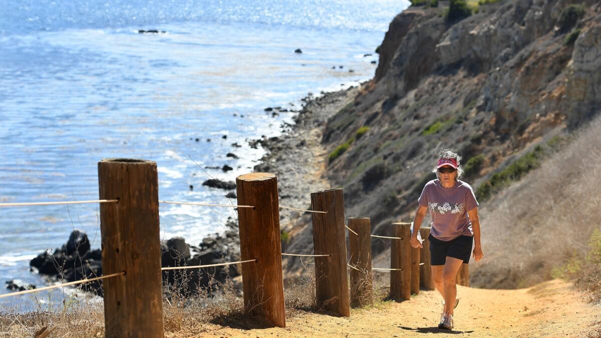
It’s not just beaches and sand that are disappearing as the ocean pushes inland. Sea level rise is also eating away at California’s coastal cliffs.
The question is by how much, as Californians have heavily developed and continue to build along the edge of the Pacific.
Scientists are now one step closer to projecting how these bluffs will fare this century ‚ÄĒ and the outlook is sobering. In Southern California, cliffs could recede more than 130 feet by the year 2100 if the sea keeps rising, according to a new study led by the U.S. Geological Survey.
‚ÄĚIt‚Äôs a pretty big number,‚ÄĚ said Pat Limber, a coastal geomorphologist and lead author of the study. ‚ÄúHopefully this model will give coastal managers a broad-scale picture of how the cliffs might respond to sea level rise, so that they can start planning for the future.‚ÄĚ
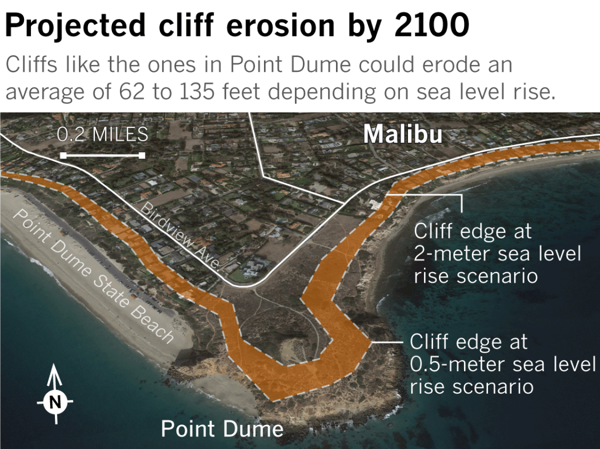
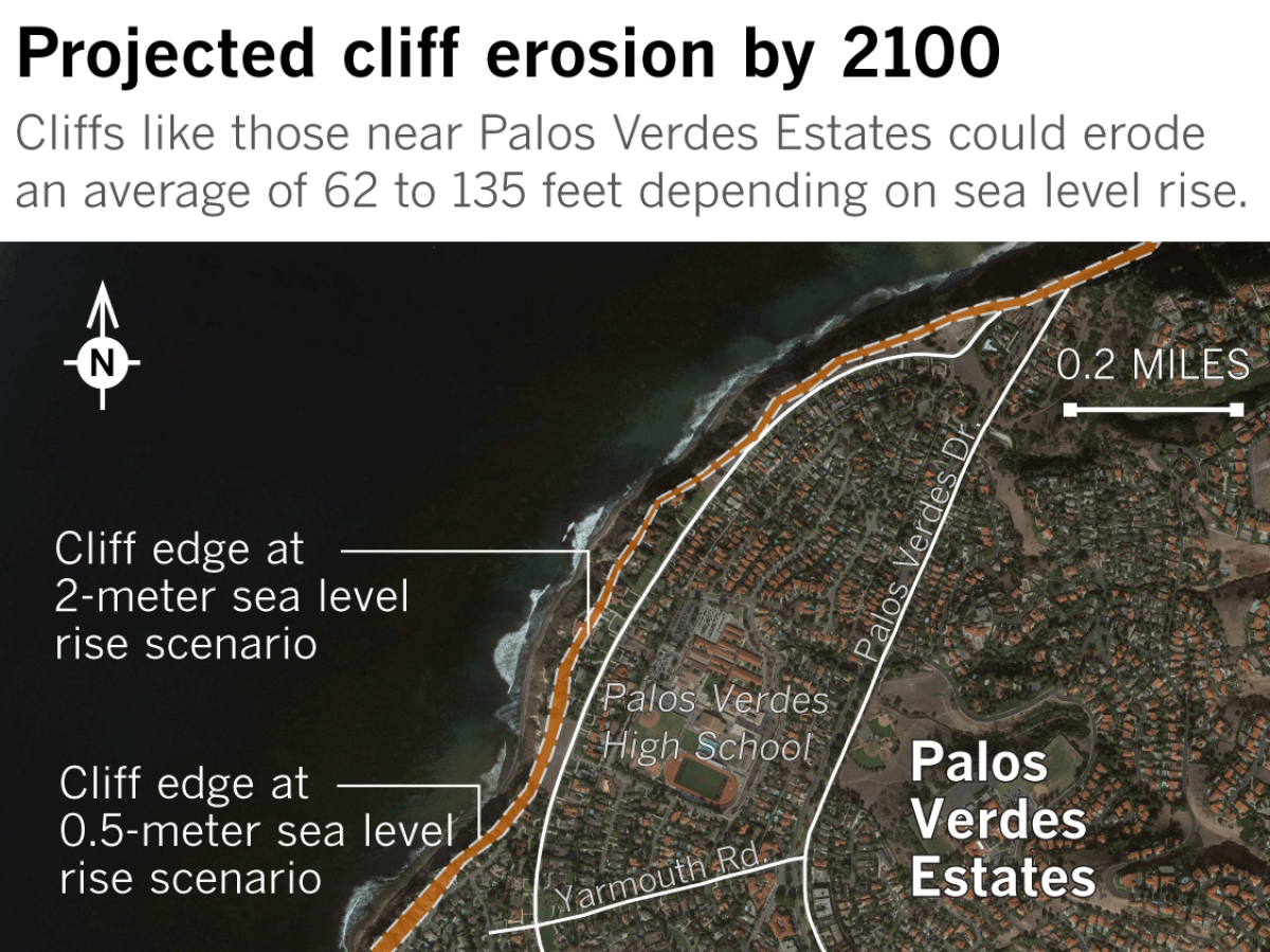
The consequences of this erosion could be severe on major roads along the Palos Verdes Peninsula. In Malibu and other coastal cities, blocks of homes, parks and public facilities could be lost to the sea under such projections.

These forecasts could help provide a roadmap for the daunting decisions that coastal communities must confront sooner rather than later.
Evacuating ‚ÄĒ and then coming back to ‚ÄĒ clifftops hammered by the ocean have become par for the course in towns such as Pacifica and along Highway 1, which was buried last year in a landslide south of Big Sur and then rebuilt atop the debris.
From San Diego County to Santa Cruz, local disputes have intensified over how many more seawalls to build to fend off rising waters ‚ÄĒ and who will pay to maintain them each year. Others have debated whether to let go, move farther inland and allow Mother Ocean to have her way.
The study uses a sophisticated model that synthesizes existing data and conclusions on how sea level rise could impact these defining features of California’s coast. Its findings establish a more concrete time frame for communities in the southern part of the state as they grapple with what to prioritize.
‚ÄúThis is a significant amount of erosion, and it‚Äôs something that we need to be preparing for now, not later,‚ÄĚ said Heather Cooley of the Pacific Institute, an Oakland-based think tank that has studied the socioeconomic effects of sea level rise in California. ‚ÄúWe‚Äôre talking about very high-value real estate ‚ÄĒ there‚Äôs private properties, there‚Äôs public infrastructure, we have roads, we have treatment plants, there‚Äôs even consideration of building desalination plants in some of these areas. All of those facilities would be at risk from this erosion.‚ÄĚ
The USGS study, published this month in the Journal of Geophysical Research: Earth Surface, examined cliffs from San Diego to Point Conception. Using sea level rise scenarios ranging from 0.5 to 2 meters (1.6 to 6.6 feet), researchers stitched together five previous models ‚ÄĒ incorporating their varying uncertainties and assumptions, as well as historical erosion rates ‚ÄĒ and ultimately reached a consensus that the cliffs will erode on average between 19 to 41 meters (62 to 135 feet) by the end of the century.
‚ÄúWe tried to tie in the uncertainties as plainly as possible,‚ÄĚ Limber said, ‚Äúso that we can better communicate it to the people who are using this information.‚ÄĚ
He noted these projections might even be on the conservative end, given that California policymakers are now considering 3 meters as the higher end of expected sea level rise.
Oceanfront property owners often react to the threat of erosion by armoring the coast with seawalls or temporary rock walls ‚ÄĒ about one-fifth of Southern California‚Äôs coastline is already armored and that proportion is likely to grow, the study noted. But increased protection prevents the cliffs from eroding and providing the natural supply of sand to beaches. It also enables more development in already vulnerable locations, which, in turn, further increases the risk.
Reinforcement also fixes the cliff in place, so as the sea level rises, the beach in front gets submerged because it cannot migrate inland. This coastal squeeze is already happening ‚ÄĒ a study last year by the same USGS team projected that up to two-thirds of Southern California‚Äôs beaches could disappear by 2100 because of similar pressures from rising water and human interruptions to sediment flow.
Coastal managers thus face the difficult decision of either prioritizing private property or public beaches by permitting or prohibiting cliff armoring. Further research on how beach-cliff systems respond to climate change, Limber said, would help improve the forecasting tools needed to make these kinds of choices.

Like hurricane and climate forecasting, projecting how much erosion will accelerate due to sea level rise, while inherently difficult, is in increasing demand. Better data to feed into these models will also lead to forecasts with greater certainty.
‚ÄúThis particular method, the idea of using multiple models, is a really nice step forward,‚ÄĚ said Adam Young, a project scientist at UC San Diego‚Äôs Scripps Institution of Oceanography who has spent years collecting data on cliff erosion in California. ‚ÄúThere are a lot of different models out there and it‚Äôs hard to say which one is best. By looking at all of them, it really gives you a sense of where the future may be.‚ÄĚ
Cliffs are particularly difficult to study because they tend to erode slowly over time, punctuated with sudden losses from landslides or collapse during a storm. The strength of the rock, cliff height, sediment composition, the slope of the beach, the slope of the seafloor, wave action, human intervention and other variables come with their own uncertainties.
And scientists often think in averages, experts note, which has been a challenge when talking about cliff erosion and other climate change issues. Stretched over a long period of time, an average ‚ÄĒ however extreme the changes may be ‚ÄĒ might not sound like much. But the overall change can be vast.
Losing an average of 1.7 feet of cliff per year over 80 years, for example, might not sound as urgent as losing 135 feet by the end of the century.
Patrick Barnard, research director of the USGS Climate Impacts and Coastal Processes Team and a co-author of the study, said forecasts can help communities better understand their risks and the consequences of their decisions.
‚ÄúHowever you manage the coast, there‚Äôs going to be ramifications,‚ÄĚ said Barnard, whose team is now wrapping up projections for the Central Coast and will work on Northern California next.
Environmental decisions, of course, aren‚Äôt just made at the local level. As the Earth continues to get warmer and land-ice continues to melt into the ocean ‚ÄĒ in large part fueled by human-produced greenhouse gases ‚ÄĒ efforts to rein in these emissions could play a role in how fast the sea will rise. The model itself shows a range of erosion anywhere from 62 to 135 feet, illustrating the impacts of choices to be made this century.
‚ÄúThere‚Äôs a range here, where it‚Äôs not as bad under lower sea level rise projections,‚ÄĚ said Cooley of the Pacific Institute. ‚ÄúWe have to get serious about reducing greenhouse gas emissions.‚ÄĚ
Interested in coastal issues? Follow @RosannaXia on Twitter.
More to Read
Sign up for Essential California
The most important California stories and recommendations in your inbox every morning.
You may occasionally receive promotional content from the Los Angeles Times.


