California risk shifts from drought to floods after record rain, snow
- Share via
Though California may be ending its winter with quenched reservoirs and near record snowpack, meteorologists are warning that the state will face increased flooding risk in the coming months as Sierra Nevada snowmelt fills rivers and streams.
On Thursday, the National Oceanic and Atmospheric Administration’s spring flood outlook reported that drought conditions will continue to improve in much of the state, but the potential for flooding will worsen in the face of heavy snowpack and elevated soil moisture.
“Approximately 44% of the U.S. is at risk for flooding this spring,” said Ed Clark, director of NOAA’s National Water Center. “California’s historic snowpack, coupled with spring rain, is heightening the potential for spring floods.”
As record snows saddle the eastern Sierra Nevada, snowmelt threatens to inundate Los Angeles Department of Water and Power infrastructure.
The severity of that flooding remains to be seen, however, and depends on a variety of weather factors, experts say.
“It’s going to happen, and the question is whether it happens quickly versus slowly,” UCLA climate scientist Daniel Swain said. “Is it gradual snowmelt — in which case the flood concerns would be mostly minor — or is it more rapid … in which case we could be talking about something in the major flood territory.”
Potential triggers for rapid snowmelt could be an early season heat wave or another series of warm storms, Swain said, both of which could lead to “significant snowmelt flooding, particularly in the San Joaquin Valley and on some of the Sierra east-slope watersheds that drain in the Great Basin and into Nevada.”
The NOAA report forecast moderate flooding in the Central Valley and Sierra, and minor flooding in nearly all of Northern California and along the coast.
For a state that has endured three years of drought, only to be hammered by 11 atmospheric rivers since the start of the year, the prospect of clear sky flooding comes as a mixed blessing as some of that water is bound to soak into badly depleted aquifers.
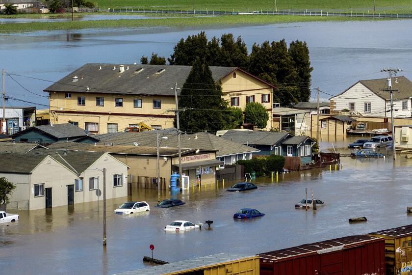
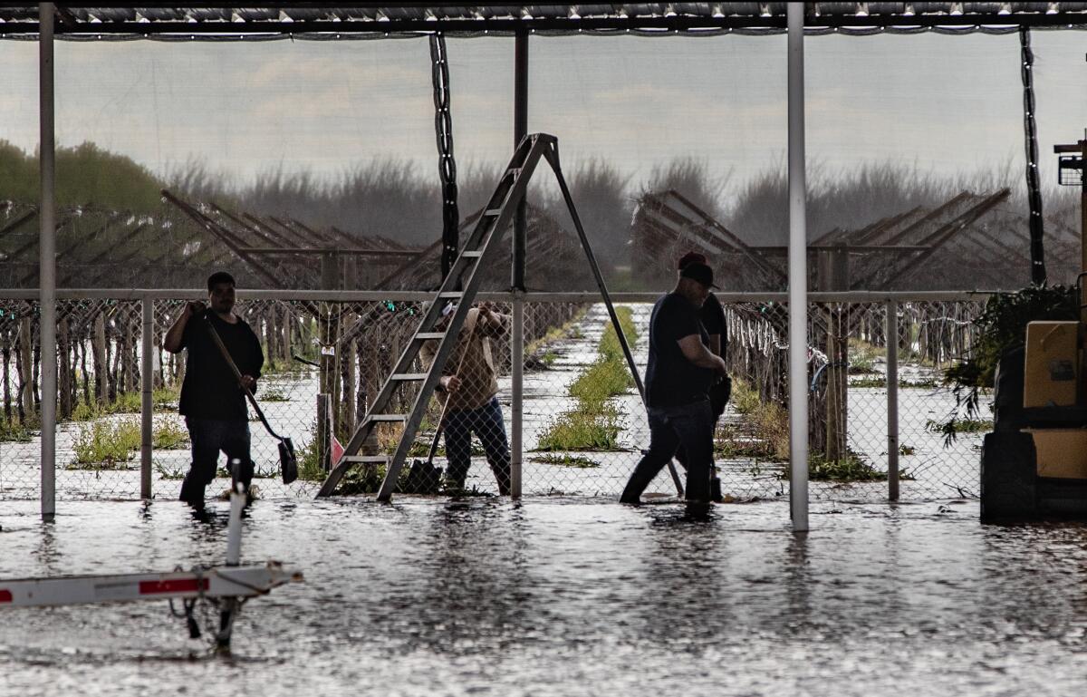
But for communities that have suffered deaths and displacement as a result of being inundated, the forecast is alarming. Such communities include Pajaro, in Monterey County, which was flooded after a levee breached late Friday night.
The flooding displaced hundreds of people in the primarily migrant town, with no clear timeline for returning. It also raised significant concerns about crop yields in the heavily agricultural region this year.
A similar series of storms in January breached levees along the Cosumnes River near Sacramento, flooding low-lying fields and roadways and contributing to the deaths of at least three people.
The town has power and gas but no potable water. Gov. Gavin Newsom said farmworkers affected by the floods would receive checks of $600, regardless of immigration status.
State and federal officials who were contending with dwindling reservoirs just months ago are now making strategic releases from dams to make room for incoming flows.
Water managers are “making sure that the reservoir releases are coordinated as best as they can be — given the amount of snowpack — to minimize to the extent possible downstream impacts,” Jeremy Arrich, manager of the Division of Flood Management with the California Department of Water Resources, said during a briefing Wednesday.
“However, there’s a ton of snow above these watersheds, and we do expect a significant amount of flows coming through through the snowmelt season.”
An incoming storm threatens to overflow the swollen Salinas River, imperiling the lives of farmworkers and crops and triggering evacuations.
Minor flooding is already occurring along the Sacramento, Salinas, Merced and San Joaquin rivers due to the recent storms, and “many rivers and streams along the Sierra Nevada foothills, especially in the San Joaquin Valley, will continue to run high through the next week from a combination of heavy rainfall and snowmelt,” the NOAA outlook said.
The latest round of storms saw a near-record crest on the San Joaquin River at Patterson, with water rising to less than a foot of its high-water mark from February 2017, according to the U.S. Drought Monitor.
The Pajaro River at Chittenden reached its highest crest since February 1998, while the nearby Salinas River at Spreckels rose 3.89 feet above flood stage, second only to the record set in 1995. The Nacimiento River edged out its 1969 high-water mark by 1.51 feet.
Such swells only add to the potential for flooding, as melting snow will arrive atop rivers, creeks and tributaries that could be running high.
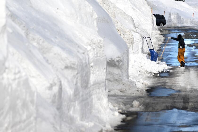
Snowfall at the U.C. Berkeley Central Sierra Snow Lab at Donner Pass has exceeded 650 inches this season, compared with a normal full-season total of around 360 inches.
“If we have average or below-average temperatures and no significant warm atmospheric rivers with rain, there will still be plenty of snowmelt, but it will be more gradual,” said Andrew Schwartz, lead scientist at the snow lab. “If we see long periods of uncharacteristically high temperatures, then flooding can become a significant risk from this large snowpack.”
The Metropolitan Water District has lifted mandatory water restrictions for nearly 7 million people, but is still urging conservation efforts.
Though the storms and associated floods have proved dangerous and deadly, they have also been a boon for water supplies and other conditions in the state. The latest drought monitor update shows nearly 64% of California is no longer classified in any category of drought, including 45% out of drought completely and 19% considered “abnormally dry.” That’s a remarkable turnaround from just three months ago, when nearly all of the state was deeply mired in record dryness.
The areas out of drought completely include the northwest coast, much of Central California and the Sierra, and portions of Southern California including swaths of Kern and Los Angeles counties.
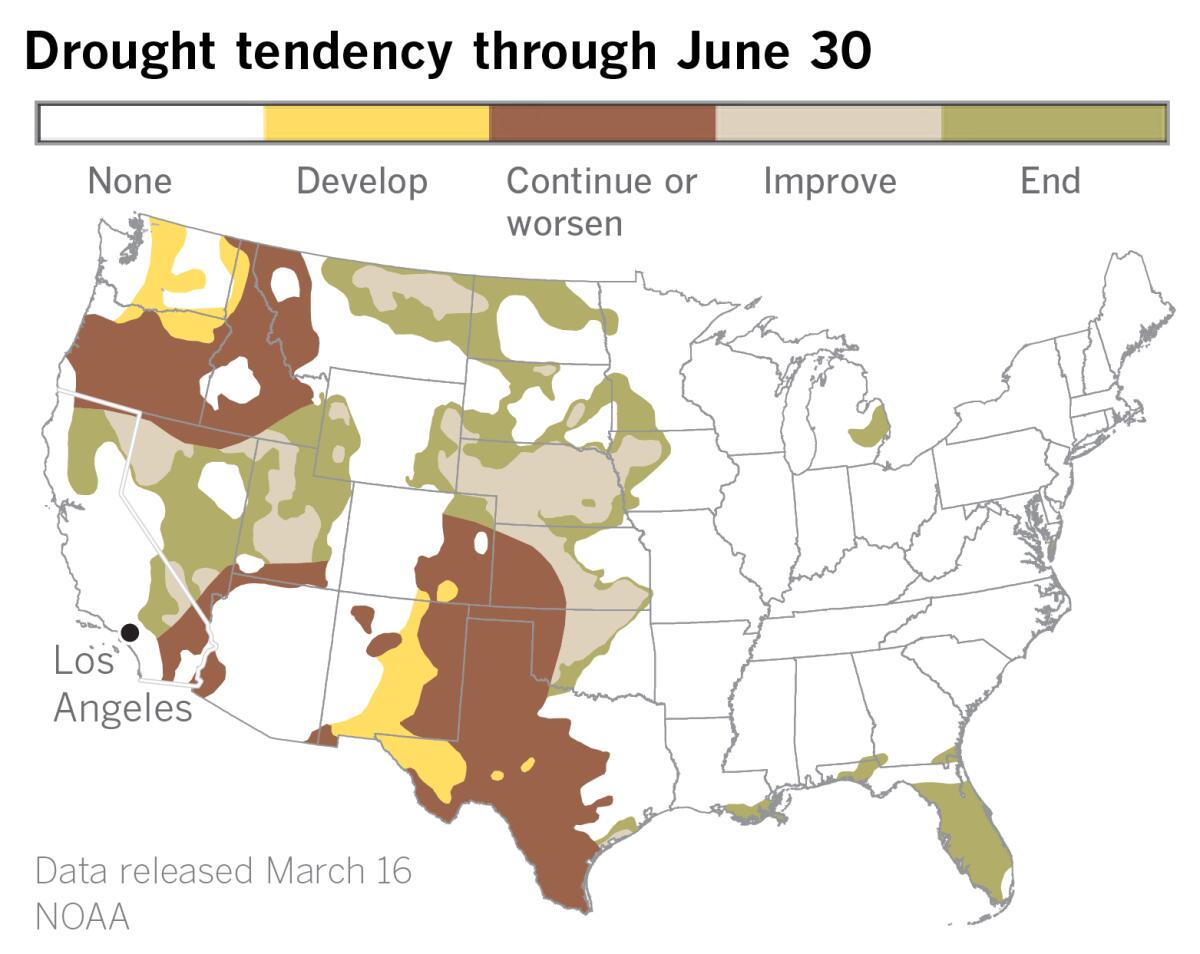
What’s more, no part of California remains in the two worst categories — extreme or exceptional drought — compared with 36% just three months ago.
The Department of Water Resources increased its allocation of supplies for state agencies to 35% last month, and officials this week said that number may grow.
The bounty has also enabled the state to divert more water to groundwater basins, including diverting more than 600,000 acre-feet from the San Joaquin River to areas where it can spread and percolate into the aquifer beneath the San Joaquin Valley.
On Wednesday, the Metropolitan Water District of Southern California — the wholesaler that supplies 26 agencies and 19 million people in the region — rescinded its unprecedented water conservation mandate. That mandate, which went into effect last June, saw nearly 7 million people under strict water use limitations, including one- and two-day-a-week outdoor watering limits.
However, officials warned that although the state has seen an improvement in drought and water conditions, Southern California’s other major source, the Colorado River, remains imperiled.
“One of the big challenges for California lies outside of California, in the Colorado River Basin,” said state climatologist Mike Anderson. “The basin has been in drought for 23 years and running, facing some pretty significant challenges.”
He added that spring will see a “very dynamic condition as we try and manage all of the water that has shown up, both in January and in March here, as well as in February, when a lot of it was snow.”
A 12th atmospheric river is possible early next week and could affect the California coast.
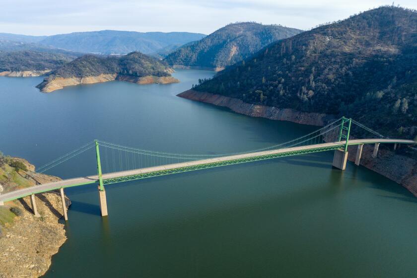
Indeed, California’s 154 primary intrastate reservoirs gained 9.9 million acre-feet of water between Nov. 30 and Feb. 28, according to the drought monitor, bringing their total storage — 23.2 million acre-feet — to 96% of the historical average for the time of year.
But in the Colorado River system, storage on Feb. 28 stood at 15.1 million acre-feet, just 46% of average and 29% of capacity.
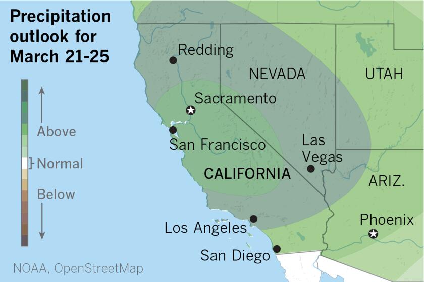
The rest of March looks to be potentially wetter, with yet another atmospheric river expected to hit California early next week and possibly another one after that. Both may be colder storms that will add to the state’s snowpack.
The forecast arrives only days after climatologists declared the end of La Niña, a climate pattern in the tropical Pacific associated with drier-than-normal conditions in the state, particularly Southern California.
The El Niño-La Niña Southern Oscillation, sometimes referred to as ENSO, has a major influence on temperature and rainfall patterns in different parts of the world. ENSO-neutral conditions are expected to continue into early summer, with increasing chances of a wetter El Niño pattern developing soon after.
Surveying the damage in Pajaro on Wednesday, Gov. Gavin Newsom said winter’s wild run was indicative of extreme weather swings driven by climate change.
“You look back at the last few years in this state — it’s been fire to ice, and no warm bath in between,” he said.
