As massive Park fire marches into history books, firefighters face hurdles to slowing it down

- Share via
As the Park fire marches into history books — becoming California’s sixth largest on record — experts say it still has much life left, with several challenges hindering efforts to combat the blaze as it continues to chew up remote wilderness at an astonishing clip.
Burning across mostly rural areas of Butte and Tehama counties, the Park fire surpassed 370,000 acres Monday, with a shift in weather forcing firefighters to react to new hot spots and unpredictable flare-ups.
“There’s more to be seen from this fire,” said Don Hankins, a Chico State University professor of geography with expertise in pyrogeography and fire management. “As soon as those conditions change, [fire growth is] back on again.”
Almost 5,000 personnel were responding to the wildfire, and they were able to secure 12% containment as of Monday evening. Much of the fire’s future, however, rests with factors beyond human control: weather and terrain.
“I definitely see the potential for it to be a much larger fire,” said Hankins, whose family has been evacuated from their home in Forest Ranch, northeast of Chico. Their house hasn’t been damaged, he said, but he worries about what this fire could do — and where it could reach — if it continues to burn into the autumn months, which he said could happen unless there is a dramatic change in conditions. He noted it wasn’t until rain hit the deadly Camp fire in 2018 that it fizzled out.
“The topography and the landscape there makes it difficult [for firefighters] to work in,” Hankins said of the Park fire, which is burning throughout the rugged Ishi Wilderness.
After a weekend of lower temperatures and higher humidity, which aided fire suppression, increased heat and winds were starting to again fuel fire activity, officials said. Last week, the explosive wildfire more than doubled in size several times in a matter of hours and produced fire whirls, or “firenados,” as it grew.
“This fire is extremely unstable and unpredictable,” Tehama County Sheriff Dave Kain said at a news conference Monday. “We’ve seen many places we thought were going to be safe to move back into erupt in flames again.”
Officials continued to ask those who were evacuated to remain patient as crews worked to secure fire lines that would allow people to return home — “but only when safe,” Kain said.
“As the week progresses, temperatures are expected to rise,” said Sergio Arellano, a Park fire spokesperson.
Temperatures are forecast to reach 100 in Chico by Wednesday, rising to 106 by Sunday.
“It will make fire behavior ... increase due to the high heat — it’s going to dry out the fuels more — plus we’re expecting some light winds,” Arellano said.
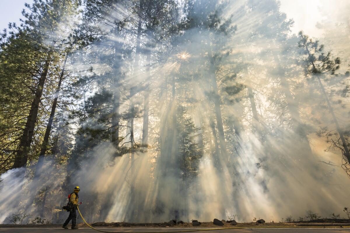
“Wind is always our enemy,” he added. Winds, as well as thick smoke, can ground helicopters, which have become key in battling the flames throughout the remote terrain.
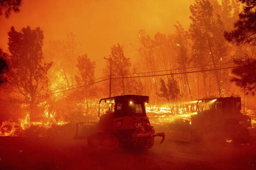
A perfect storm of hot, dry winds, untouched brush and remote topography has fueled explosive growth of the Park fire north of Chico, now over 350,000 acres.
The blaze ignited Wednesday afternoon in what authorities said was an act of arson when a man pushed a burning car into a gully near Chico. The fire quickly ballooned into the state’s largest of the year.
The rate of growth slowed in recent days, declining to about 20,000 additional acres over 24 hours from Sunday to Monday, but many sections were still a major threat.
More than 26,000 people were ordered to evacuate across Butte, Tehama and Shasta counties, Arellano said Monday, and many more were under evacuation warnings, including in western Plumas County.
At least 109 structures have been destroyed and 4,200 are threatened, according to the California Department of Forestry and Fire Protection. The fire’s northern and eastern boundaries remain major concerns, with flames jumping across Highways 32 and 36.
As the weather started to clear Sunday afternoon, it became hotter and drier, pushing the smoke and cloud cover away, Mark Bunton, the operations section chief for the Park fire’s unified command, said at a morning update.
“So it now allowed the fire to breathe,” Bunton said. “With that, we ended up with ... a number of areas that gave us challenges.”
He said some areas saw spot fires — blazes set off by sparks jumping beyond the fire’s perimeter — spread more than 100 acres, but crews were working to establish and hold containment lines, despite the challenging conditions. He said much of the fire’s western edge was almost impossible to reach with ground equipment, requiring “very laborious work and time-consuming” hand crews to lead the firefight.
Lassen Volcanic National Park, in southern Shasta County, was closed and evacuated, with park officials concerned the fire would reach its historic district and headquarters in Mineral, which escaped the wrath of the Dixie fire in 2021, the national park said in a statement. Its staff was assisting with evacuations and “scrambling to save historic artifacts stored in the 1927 Loomis Museum.”
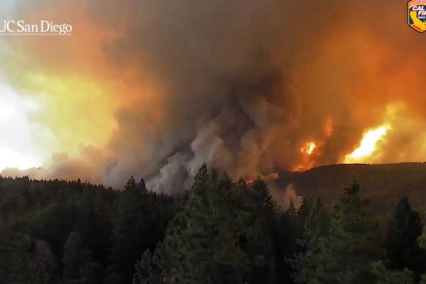
The explosive Park fire north of Chico created massive smoke plumes that whirled up into the atmosphere, swirling in a tornado-like way, a phenomenon known as a “firenado.”
The Park fire was far from the only concern across California, with crews responding to more than 22 wildfires statewide.
The Nixon fire in Riverside County started Monday afternoon and was described as a fast-moving brush fire. By 10 p.m., the fire had exceeded 3,700 acres and was 0% contained. Mandatory evacuation orders were triggered.
The Borel fire in Kern County continued to burn in and around Sequoia National Forest, growing to 53,010 acres Monday morning, according to federal officials.
Already the blaze has left a path of destruction, with significant structure loss in the historic mining town of Havilah and concern about more damage, given the area’s red flag warning — an alert for dangerous fire weather — through Monday night. Several nearby communities were under evacuation orders and warnings, and much of the national forest and federal lands were closed.
“Moderate to rapid fire spread will continue to move to the east and north, potentially impacting structures and infrastructure in Bodfish, Moreland Mill, and French Meadow areas,” federal officials said in a Monday update. “Fire may exhibit very high rates of spread, high intensity and difficulty of control.”
The Borel fire is now being managed with two other fires in Kern and Tulare counties, previously referred to as the SQF Lightning incident. The others are the Trout fire, which has burned 23,369 acres and is 33% contained, and the Long fire, which has burned 9,204 acres and is 95% contained, according to federal officials.
“The summer is far from over, so staying prepared is crucial,” Cal Fire wrote on social media. The historic nature of the Park fire “underscores the urgent need for wildfire preparedness. ... Have your go bag packed and know two evacuation routes. Stay informed by signing up for emergency alerts, stay prepared, and help protect our communities.”
Times staff writer Susanne Rust contributed to this report.
More to Read
Sign up for Essential California
The most important California stories and recommendations in your inbox every morning.
You may occasionally receive promotional content from the Los Angeles Times.


