The worst of Hilary is about to slam L.A. How to stay safe during onslaught

- Share via
The worst of Tropical Storm Hilary is set to hit the Los Angeles area Sunday afternoon and evening, bringing intense rain and the potential for widespread flooding.
Here is what officials say you need to do to stay safe, and a breakdown of where the storms will hit hardest.
1. Avoid unnecessary travel
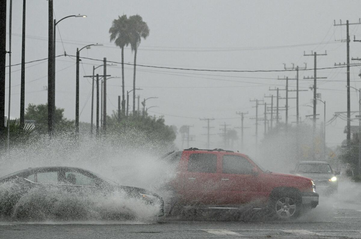
Roads across Southern California are already beginning to flood after a morning of steady rain. A few places have also reported small mudslides. Conditions will worsen considerably as more intense rain hits. The National Weather Service issued a flash flood warning for large swath of Los Angeles County.
As Hurricane Hilary weakens into a tropical storm, deserts and mountains will be at highest risk for floods. Here’s the crucial Sunday forecast.
“This is an unprecedented weather event,” warned Los Angeles Mayor Karen Bass. “Right now again, it is critical that Angelenos stay safe and stay home unless otherwise directed by safety officials. Avoid unnecessary travel. If you do not need to be on the road, please don’t get in your car. Make sure your emergency kit and essential devices are on hand and ensure that all of your devices are charged in the event of life-threatening emergency.”
2. Dangerous conditions
When the main part of Hilary move through the region, rains will pick up — and be more intense than what Southern California experienced in the A.M. hours. Officials said a half-inch of rain per hour will be common, with some areas seeing as much as 3 inches in an hour. Flash flooding would quickly follow.
Los Angeles Fire Chief Kristin M. Crowley, speaking at a press conference at 4 p.m., said the next 5-6 hours could well be the worst of the storm.
3. Areas of concern
- The warnings cover a large swath of the county. But in the L.A. basin, the National Weather Service cited several areas of particular concern for flooding including Long Beach, Thousand Oaks, Simi Valley, Malibu, Hollywood, Beverly Hills, Universal City, Downtown Los Angeles, Griffith Park, Culver City, Inglewood, Burbank, North Hollywood, Venice, Santa Monica, Van Nuys, Encino, Manhattan Beach, Alhambra and Hermosa Beach.
- As for inland valley, desert and mountain regions, the NWS listed these communities to be on heightened watch: Lake Los Angeles, Acton, Wrightwood, Palmdale, Lancaster, Mt. Wilson, Santa Clarita, Pasadena, Glendora, San Dimas, Altadena Quartz Hill, Pearblossom, Llano, Littlerock, Lake Palmdale, Elizabeth Lake, Lake Hughes, La Cañada Flintridge and Sylmar.
- Zooming further out, forecasters warn there could be historic flood impacts, especially for San Bernardino and Inyo counties, with Death Valley and Morongo Basin expected to see the most major flooding.
Tropical Storm Hilary rolled into Southern California, bringing steady, often heavy rain and ‘life-threatening’ flooding.
4. Staying safe
The Times has compiled a detailed guide for how to handle Hilary:
- The complete guide to storm safety preparedness
- How to track Hilary and get emergency alerts in Southern California
- What you can do to prepare now
- Must drive? How to do it as safely as possible
- Checking your own flood risk
What weather experts are saying
Hilary‘s eye is expected to pass over San Diego by 3 to 5 p.m. and move northeast, reaching the borders of Los Angeles and San Bernardino counties by evening, said Joe Sirard, meteorologist at the National Weather Service in Oxnard.
“It’s the high-intensity rainfall in a short period of time that causes the flooding and flash flooding,” he said. “That’s the danger. .... Flooding can happen very quickly with with this kind of system.”
Dan Berc, a meteorologist with the National Weather Service Las Vegas, warned of “major to historic” flood impacts in many areas including in parts of San Bernardino and Inyo counties.
“Even with the small amount of rain we’ve had over the period of time, we’re raining over such a large area that it’s all draining into the same basin,” he said. “Half an inch over the entire area is just as much water as 2 inches over a very small area.”
A high wind warning has also been issued for much of the area, which will continue into Monday.
There’s also a small chance of tornado, and a chance of strong wind speed exceeding 58 miles per hour, in much of San Bernardino County from Sunday afternoon through early Monday morning, Berc said.
“We’re not going to see an EF5 tornado running down the street,” he said. “But we can get these little spin-up tornadoes and they can do some damage locally.”
More to Read
Sign up for Essential California
The most important California stories and recommendations in your inbox every morning.
You may occasionally receive promotional content from the Los Angeles Times.


