These parts of California could get a year’s rain in a few days thanks to Hurricane Hilary
- Share via
Some areas of Southern California and southern Nevada could see a year’s worth of rain in the coming days as Hurricane Hilary arrives.
Historic flooding could hit a wide swath of Southern California and the Las Vegas area, especially in San Bernardino and Inyo counties, with Death Valley and the Morongo Basin expected to see the most major flooding.
Hilary is likely to have weakened to a tropical storm by the time it leaves Mexico and enters California. But officials are sounding the alarm for potential flooding.
Everyone “should prepare for the potential for significant flash flooding. This is not the time to wait to prepare; this forecast is unlikely to improve,” said the National Weather Service in Las Vegas, which also issues forecasts for Death Valley and Morongo Valley.
Some areas could even see as much as a year’s worth of rain in a 24-hour period Sunday — and if not then, over the next few days. “This will not be a constant rainfall, but rather several rounds of moderate/heavy rainfall,” from Friday through Monday, the weather service said.
“Once impacts begin in your areas, they will likely worsen as we head into next week,” forecasters said. Sometimes the rain “could be slowly compounding. Other times, it could be flash flooding. Not much time between rounds of rain for conditions to improve.”
Other desert areas are also expected to receive at least a year’s worth of rain during the storm, officials with the National Weather Service said.
Palm Springs and Yucca Valley both average 4 to 5 inches of rainfall per year, but the forecast shows a deluge of 4 to 7 inches falling between Saturday and Monday, according to Elizabeth Adams, a meteorologist with the weather service in San Diego.
“The amount of moisture we’re getting is just unbelievable,” Adams said. “The rain rates could potentially be really extreme as well — over an inch or 2 inches of rain in an hour will be possible.”
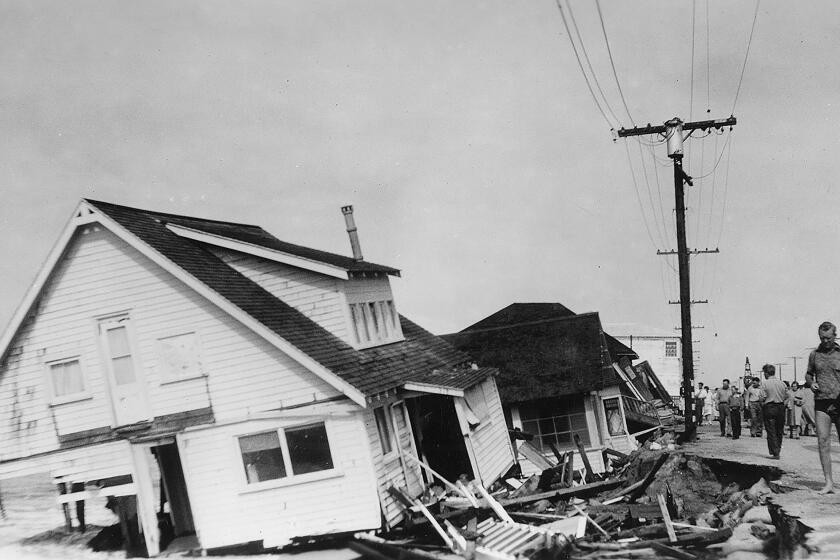
Long before Hurricane Hilary, ‘El Cordonazo’ or ‘the Lash of St. Francis’ devastated Long Beach and San Pedro in September 1939.
Even higher rainfall totals of 6 to 10 inches are possible along the east-facing desert slopes of the Riverside, San Bernardino and San Diego County mountains, Adams said.
She advised residents in the storm’s path to monitor forecast updates and ensure they have multiple methods of receiving warnings, including wireless emergency alerts, weather apps and local TV, radio and news stations.
In Yucca Valley, officials are warning residents to take precautions and avoid unnecessary travel, as access to some local roads may be limited.
“As the ability to travel may be reduced over the next two days, residents are reminded to keep a supply of necessary provisions and medications on hand,” Yucca Valley officials said on X, formerly known as Twitter. “Be sure to bring pets inside. Never use generators, outdoor heating or cooking equipment indoors.”
The National Weather Service office in Phoenix, which issues forecasts for portions of southeastern California, said it’s likely the storm will bring “significant and rare (and potentially destructive) impacts.”
Current models show moisture anomalies that are “off the charts,” the agency wrote in its latest forecast — “and almost unbelievably more extreme than previous iterations. Essentially every standardized field measure is pegged at a climatological extreme for this time of year at multiple time scales.”
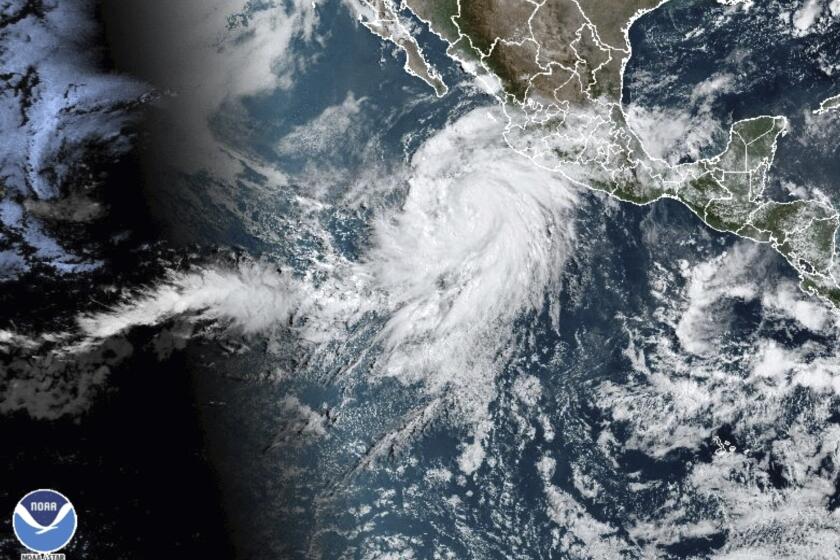
Hurricane Hilary is likely to make landfall in Los Angeles as a tropical storm, bringing heavy rains and potential flooding. Here’s what you can do now to prepare, and how to stay safe when the storm arrives.
The rains expected with Hilary are rare and bring a “life-threatening” risk of flash floods from Baja California to southern Nevada.
A tropical storm watch is in effect across much of southwestern California, from the California-Mexico border into parts of Los Angeles County, something the National Hurricane Center said is a first for this area.
A watch indicates that tropical storm conditions — meaning sustained winds of more than 39 mph — are possible within 48 hours, according to the hurricane center.
‘Life-threatening flash flooding’
While high winds are creating the unusual tropical storm conditions, officials continue to emphasize that rain remains the greatest concern.
“This could [bring] rare and life-threatening flash flooding in the heaviest areas of rainfall. That is especially going to be prevalent Sunday evening through Monday morning,” said Elizabeth Adams, a meteorologist with the National Weather Service in San Diego.
An unprecedented tropical storm warning is in effect from the California-Mexico border to Point Mugu and for Catalina Island.
A high-risk warning for excessive rainfall was issued for much of inland Southern California — from the San Bernardino Mountains through the Coachella Valley and down into the Anza Borrego Desert — indicating the high probability for flash flooding Sunday and Monday.
The warning was issued for the first time in more than a decade for the low deserts east of the Southern California mountains, which are typically the drier-facing slopes, Adams said.
Rainfall is expected as early as Saturday morning for the Southland’s mountains and deserts, continuing through Monday — with eastern-facing mountains likely to see the most extreme amounts of rain, from 6 to 10 inches, and up to a foot in some isolated areas. Three to 6 inches of rain will be expected across the deserts.
An unprecedented tropical storm watch has been issued for Southern California as Hilary barrels north toward the United States.
Precipitation will move into the coasts and valleys, including the Inland Empire, likely by late Saturday, Adams said, where 2 to 4 inches will be expected through Monday.
According to the National Weather Service, Big Bear Lake, Julian, Idyllwild, and Mt. Laguna could get up to 7 inches of rain between Saturday and Monday. The Coachella Valley, including Palm Springs, could see up to 5 inches. Hemet, San Bernardino, Hesperia and Victorville could see up to 4 inches.
Coastal areas
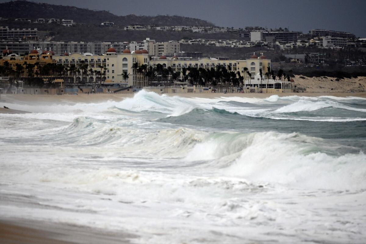
- High surf (5-9 feet)
- Strong winds
- Dangerous rip currents
- Coastal flooding/beach erosion
- Dangerous conditions for south- and southeast-facing harbors
- Catalina Island could see hazardous winds and reduced visibility
Deserts and mountains
- Intense rainfall in mountains, more than 10 inches in isolated areas
- Coachella Valley could see up to 5 inches of rain
- Flash flooding possible in some areas
- Five to 7 inches of rain possible in Wrightwood, Big Bear and parts of Imperial County
More to Read
Sign up for Essential California
The most important California stories and recommendations in your inbox every morning.
You may occasionally receive promotional content from the Los Angeles Times.
