New storms move into Southern California, bringing wet, hazardous holiday weekend
- Share via
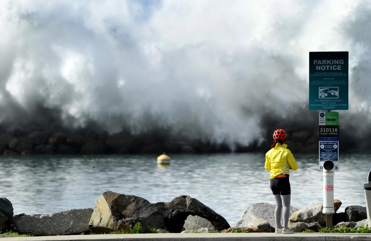
The first of two holiday weekend storms delivered a solid punch Saturday to an already beaten and soggy Southland, battering the coast with high surf, threatening more flooding and stretching emergency services.
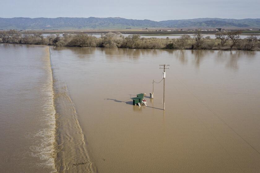
To the north, flood waters continued to rise with evacuation orders issued in communities from Monterey to Mendocino counties and east to Sacramento. High winds, white-out conditions and spinouts led to the closure of Interstate 80 over the Donner Summit, leaving many drivers stranded in their cars.
Unlike the stream of atmospheric rivers – the so-called Pineapple Express – that brought record rainfall to the region from the western Pacific, this was a more traditional winter storm coming down the coast from the north, said Mike Wofford, a meteorologist with the National Weather Service in Oxnard.
And another is on its way.
While clearing skies and patchy sunshine are expected for most of Sunday, a second storm arrives in Southern California tomorrow night and will linger through most of Monday. A weaker system will pass through on Wednesday, mostly to the north, and then as a ridge of high pressure builds along the West Coast, the state will finally have a chance to dry out.
“It’s been a wild couple of weeks,” said Bill Rasch, a meteorologist with the National Weather Service in Sacramento, referring to the succession of storms that started pummeling the state since Dec. 26.
The heaviest rainfall in Southern California is expected Saturday between 7 and 10 p.m., with up to an inch of rain along the coast and in the valleys and with 2 to 3 inches falling in the mountains, Wofford said.
Snow levels will drop to about 6,000 feet, bringing a dusting of snow to Interstate 5 through the Tejon Pass. Winds will be light, ranging from 15 to 25 mph.
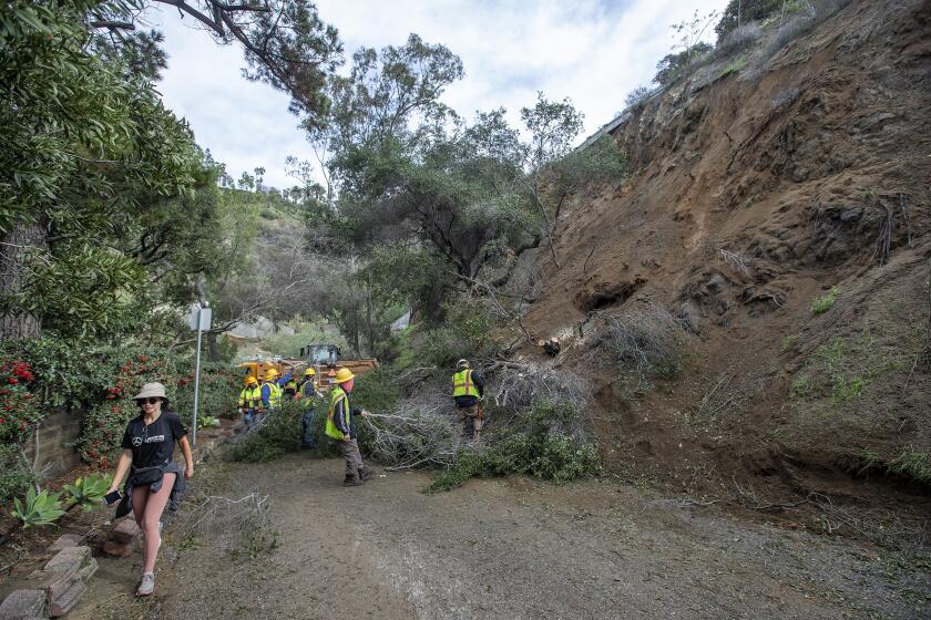
Angelenos can expect “minor roadway ponding” and “moderate to brief heavy rain, leading to minor urban and small creek flooding,” according to the weather service. Rockslides are possible in canyons and steep hillsides, but flooding will be minimal.
The two right lanes of northbound Interstate 5 in Castaic remained closed Saturday after a landslide earlier this week left debris scattered on the roadway three miles south of Templin Highway. The lanes will remain closed for “an unknown duration,” Caltrans said.
Los Angeles Mayor Karen Bass on Friday declared a local state of emergency in response to mudslides, flooding and road closures. The declaration, which asks the governor’s office to waive regulations that would slow recovery efforts, directs city departments to continue assessing storm damage and seek state and federal assistance.
A National Weather Service meteorologist says heavier rains, strong winds and more snow for the mountains are expected Saturday.
Although the latest storm system to hit California will be moderate in the Southland, it raised flooding concerns across the San Francisco Bay Area and the Central Coast this weekend.
On Saturday, Santa Cruz County officials were carrying out emergency evacuations in the neighborhood of Felton, five miles north of the city of Santa Cruz. The San Lorenzo River, which drains the local mountains, is predicted to rise above flood stage for the second time in one week.
Mendocino County officials are monitoring three rivers between Point Arena and Fort Bragg. Of particular concern are crossings at Highway 1, 175 and 101, which risk flooding.
Flood warnings have also been issued for Merced County.
Among the regions hardest hit has been the Salinas Valley in Monterey County.
During a break in the storm Saturday morning, Steve McShane, CEO of the Chamber of Commerce and a member of the Salinas City Council, surveyed the damage in the valley.
Most neighborhoods and communities, he said, have been spared the worst of the flooding, which has inundated thousands of acres of farmland and will “likely have a significant impact on agricultural production in the weeks ahead.”
Stopping at the three major bridges over the Salinas River, McShane reported a torrent of mud and debris racing toward the ocean with room to spare before cresting the roadbed.
“We have between two to four feet of clearance under the bridges,” he said, remarking that two weeks ago there was at least 16 feet of clearance.
On Friday, the river at Highway 68 just north of Spreckels peaked a foot and a half above flood stage.
He also noted a large presence of local and state emergency vehicles at each crossing, which within the last four days have been clearly marked by pylons, barricades and caution tape.
While no loss of life has been reported with the recent storm, the National Guard has been searching the Salinas River watershed near the town of San Miguel in San Luis Obispo County, where 5-year-old Kyle Doan was swept away when his mother attempted to cross a road near the San Marcos Creek. She was rescued, but Kyle was lost.
The statewide onslaught of storms has helped put a significant dent in drought conditions. Just one month ago, 7% of California was in exceptional drought and 36% in extreme drought, according to the U.S. Drought Monitor. But on Thursday, that had dramatically changed: 0% of the state was in exceptional drought, and only a tiny portion of far Northern California, 0.32%, was in extreme drought.
Water experts say, however, that it will take more storms to truly reverse years of dryness.
The storms are expected to taper off later in the week.
Northern California, already battered by severe flooding, is expected to be at higher risk than Southern California when rains roll in Friday.
The reprieve comes after President Biden approved an emergency declaration for California. Nancy Ward, director of the California Office of Emergency Services, said that officials had positioned resources and crews across the state for continued storm response and recovery, including the California National Guard in Santa Barbara.
Speaking at a news conference in Montecito on Friday, Gov. Gavin Newsom said the storms highlighted the need for infrastructure improvements, including upgrading flood protection and stormwater-capture systems.
Doing so is critical, he said, in a time of climate change when “the hots are getting a lot hotter, dries are getting drier, and the wets are getting a lot wetter.”
“The question is, are we resilient enough ... are we resourceful enough to be more creative, so that we can thrive, not just survive, through this new reality?”
Since Dec. 26, California has been swamped by a steady barrage of storms that have left much of the state soaked and flooded. By one estimate at least 24.5 trillion gallons of water fell on California in 16 days.
The UC Berkeley Central Sierra Snow Lab reports a snowpack in the Sierra of approximately 10 feet with an additional 2 to 3 feet of snow expected over the weekend.
More to Read
Sign up for Essential California
The most important California stories and recommendations in your inbox every morning.
You may occasionally receive promotional content from the Los Angeles Times.
