Toddler killed, cities evacuated as massive storm lashes Northern California
- Share via
SAN FRANCISCO — A powerful winter storm unleashed pounding rain and strong winds across Northern California on Wednesday, leaving a small child dead, triggering evacuations and power outages, and heightening fears of widespread flooding and debris flows.
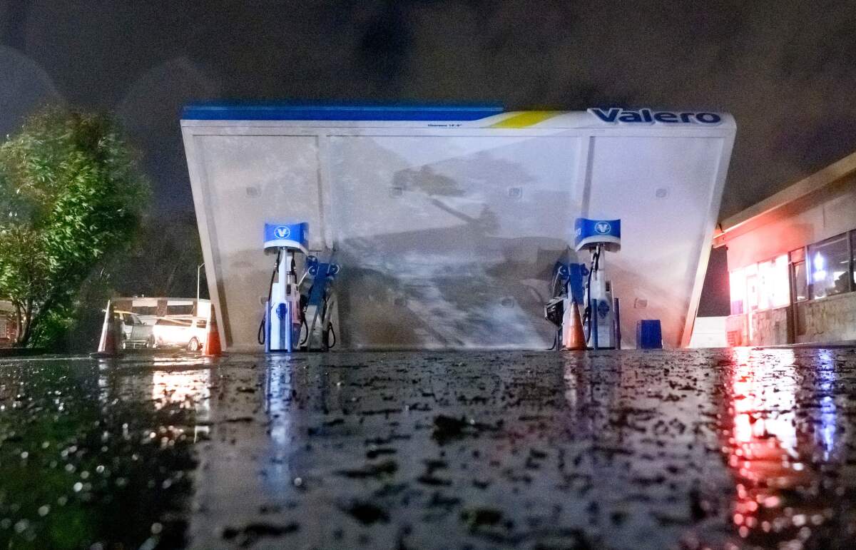
The intense downpours — coming after an earlier deluge days ago — pushed some rivers toward flood stage, prompting a string of evacuations, from towns along the Russian River to communities in Santa Cruz County and beyond. The force of the wind left tens of thousands without power and knocked over a gas station canopy in South San Francisco.
In Sonoma County, a child who was believed to be younger than 2 was killed by a falling tree in the creekside community of Occidental, the Press Democrat reported. The child died after the tree struck a double-wide trailer. Occidental Volunteer Fire Department Chief Ronald Lunardi said paramedics tried to resuscitate the injured toddler but declared the child dead at the scene, according to the news organization.
Communities along swelling rivers faced the most pressing concerns. Sonoma County issued an evacuation warning for residents living near the Russian River, including those in Guerneville, Monte Rio, Rio Nido and downstream of Healdsburg. Officials warned the river would crest at 33 feet Thursday night and flood again at 40 feet Sunday night.
Evacuation orders or warnings were in place for wide swaths of coastal towns east of Santa Cruz, including Soquel, Rio del Mar, Seacliff and Capitola, a popular tourist resort bisected by Soquel Creek.
In San Jose, authorities were closely watching possible flooding that could affect populated areas, including along Ross Creek at Cherry Avenue, Upper Penitencia Creek at Mabury and King roads, and Guadalupe River at West Alma Avenue. Elsewhere in Santa Clara County, officials issued evacuation warnings around the Pacheco Pass River Basin and Uvas Reservoir.
In northwestern San Benito County, officials warned that high water levels might pour over a dam’s spillway. If the dam is overtopped by waters, flash flooding could occur in sparsely populated areas downstream, causing water levels to rapidly rise in Pacheco Creek near Lovers Lane.
The northbound lanes of Highway 101 in Mendocino County were closed late Wednesday night as crews worked to remove a slide of rocks and debris on the roadway that had caused a crash around 8:30 p.m., according to the California Highway Patrol.
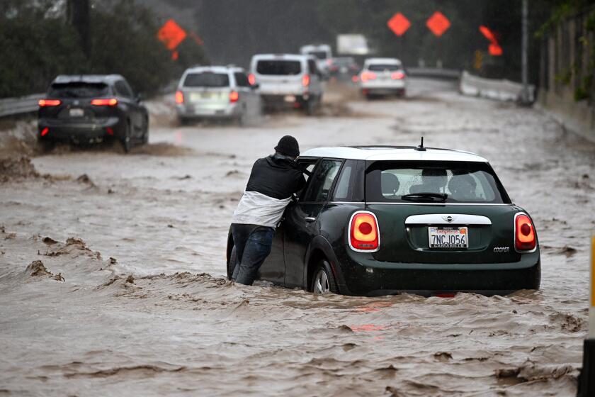
The extent of the flood risk was not yet known. But the rain and wind can bring deadly peril; at least four people were killed during the earlier storms, according to officials and local news reports. A 72-year-old was struck by a falling tree in Santa Cruz. Two bodies were found near where the Cosumnes River flooded in Sacramento County, inundating Highway 99, and another body was found farther south, west of Galt.
This week’s moisture-rich atmospheric river — fed by a plume of subtropical water vapor at the lower and middle levels of the atmosphere — brought gusts of up to 85 mph in the Bay Area and was expected to bring more than 6 inches of rain in some parts of the Bay Area through Thursday. The Sacramento Valley was expected to get up to 4 inches of rain, and up to 6 inches was forecast for some areas in the foothills.
Wednesday’s storm is the third atmospheric river that’s hit California in the last two weeks. The successive storms have brought a deluge of water to the drought-stricken state, prompting Gov. Gavin Newsom to declare a state of emergency to “support response and recovery efforts.”
The powerful storm that knocked out power, toppled trees — including one that killed a toddler — and flooded homes along the coast in Santa Cruz continued its march through the region.
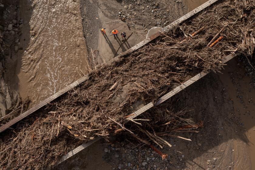
The weather service warned of rapid rises in creeks, streams and rivers across the region, as well as gusty winds that brought trees and branches down, causing “localized damming of waterways.”
Flash flood watches have also been issued in several burn areas, including the area of the August Complex fire, the River Complex fire, the Mosquito fire and the western region of the Dixie fire.
“The strong winds we’re expecting today on already-saturated soils and additional rainfall expected in the next 24 to 48 hours are really going to exacerbate the flooding concerns and the potential for wind damage and downed trees,” said Roger Gass, a meteorologist with the Bay Area National Weather Service.
In Palo Alto, the rain didn’t really begin until about 5 p.m. Wednesday, just as commuters began making their way home. High winds scattered twigs, branches, pine and redwood needles across narrow suburban streets, as road crews worked to keep the gutters clean.
“It feels like a losing battle,” said one street cleaner, who declined to provide his name.
As night fell, Menlo Park and Palo Alto police cars drove slowly along the streets paralleling the San Francisquito River, which flooded during the New Year’s Eve storm — and was expected to swell again Wednesday night.
Concerns remain high about the threat of landslides, which can still happen days after the rain ends. A hillside next to homes in Richmond was being closely monitored by officials.
The U.S. Geological Survey said it had recorded 13 preliminary record-high streamflow measures across Northern California in recent days.
Strong winds caused delays and more than 70 incoming and outgoing flight cancellations at San Francisco International Airport on Wednesday afternoon. Gusts and soggy soils downed many trees across the region, including one that struck a car near San Francisco City Hall. Firefighters were able to rescue the family inside.
A portion of the city of Watsonville in Santa Cruz County was ordered to evacuate Tuesday night. With the incoming rain, authorities became concerned that a culvert under a major street that was damaged in a previous storm could fail, making the roadway impassable for medical and law enforcement resources, according to the Santa Cruz County Sheriff’s Office.
Santa Cruz County has already suffered $10 million in damage from recent storms. The sheriff’s office also issued evacuation warnings in the northern rural areas of the county, which was burned by the CZU Lightning Complex fire in 2020, one of the most destructive fires in state history.
Rural southern coastal areas of San Mateo County are also under an evacuation advisory. The area is at risk of mudflows and landslides, authorities say.
President Biden will be visiting California this week following the winter storm that left the state with closed roads, freezing temperatures and a Venture County city evacuated.
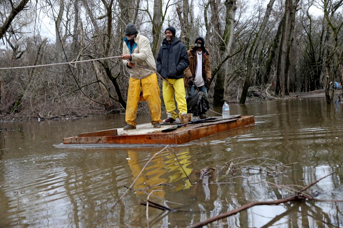
In San Jose, officials were working to evacuate unhoused people staying near creeks. A similar effort was underway in Sacramento where officials were trying to convince unhoused people living along the American River to relocate in advance of the storm.
But as clouds gathered Wednesday afternoon, marking an end to the brief respite between deluges of rain, some said they had no plans to do so.
Mark, who declined to give his last name, said he had spent several days trying to weatherize his camp so it would make it through the storm. The 58-year-old had erected it right next to a levee adjacent to the American River near downtown.
“It’ll hold up,” he predicted, adding that he wasn’t worried about rising water in the river because he believed he was high enough to avoid inundation.
Trent, 53, who declined to give his last name, has been unhoused for more than a year, living out of hotel rooms and his car in Sacramento County and working during the day. After braving the deadly storm last weekend in his car, he found out about an evacuation center in Elk Grove and arrived Wednesday morning.
“The wind and the way that is, you’ve got to worry about stuff coming into your car,” he said that night. “Downed trees, you know, and debris. That’s the biggest worry.”
On Wednesday morning, Land Park, near the state Capitol, was filled with the sound of wood chippers as crews worked to remove trees damaged by the last storm, some of which leaned at precarious angles with their roots exposed. Dozens of trees were toppled in recent days, and more are expected to fall during the evening, when winds are anticipated to become more severe.
San Francisco Mayor London Breed said the city was “preparing for a war” as officials passed out sandbags and residents braced for perhaps another week and a half of rain, which would extend into the Martin Luther King Jr. holiday weekend.
“The cumulative effects of these storms could be quite debilitating,” the weather service said.
The San Francisco Bay Ferry suspended service Wednesday on lines serving South San Francisco and Harbor Bay in Alameda, citing strong winds in the forecast. A number of schools said they would be closed Thursday, citing the storm.
Several businesses across the Bay Area, including Apple Stores and the East Bay SPCA animal shelters in Oakland and Dublin, closed early ahead of the storm.
Tens of thousands of Pacific Gas & Electric customers lost power Wednesday, and the utility has deployed additional crews to deal with outages.
Wednesday’s so-called Pineapple Express storm comes on the heels of a New Year’s Eve system that dumped more than 5 inches of rain in San Francisco. It was the area’s second wettest day in more than 170 years of records, officials said.
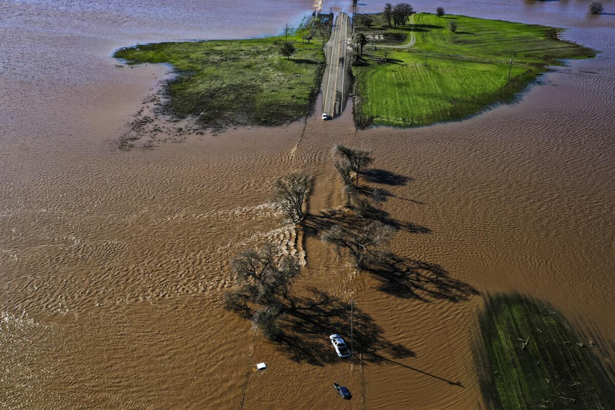
The series of atmospheric rivers that started toward the end of December was somewhat surprising after one of California’s driest years on record, which left reservoirs drained and soils parched.
“California is an extraordinary state and we experience extraordinary weather,” Wade Crowfoot, the secretary of the California Natural Resources Agency, said during a news conference Wednesday. “At the same time, we know that climate change is supercharging this extreme weather.”
Crowfoot noted that despite the heavy snowfall and rain, the state remains in the third year of an intense drought. It has marked the driest three-year period in the state’s history, he said.
“We’re still in the first half of the game. We’ve got major points on the board in terms of precipitation, snow and rain,” he said. “That will be helpful in coming dry months, but we’re a long way from understanding how this wet season impacts our overall drought.”
Experts say while the system is expected to bring heavy rain, it’s not simply the strength of this storm on it’s own that has prompted damage concerns, but instead the culmination of all the recent storms.
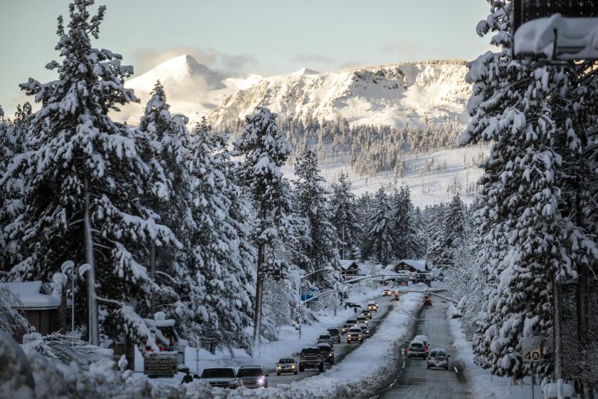
California snowpack is 174% of average for this time of year, but state officials caution that the drought isn’t over.
In October 2021, a similarly strong atmospheric river brought significant rainfall to the state but did not cause nearly the same amount of damage because the conditions leading up to it were more dry, said Daniel Swain, a climate scientist at UCLA.
Now, “it’s going to take a much lesser storm to produce much greater impacts given how wet it is,” he added.
Karla Nemeth, director of the California Department of Water Resources, said the latest series of storms is the most powerful set since 2017. Storms that year nearly caused the failure of a retaining wall in California’s second largest reservoir, Lake Oroville, and brought an end to California’s prior long lasting drought emergency.
“The most vulnerable places in California right now are rural levees — they are not required to meet the same standards as the levees that protect our our more urban communities,” Nemeth said.
Times staff writers Susanne Rust in Palo Alto, Christian Martinez and Hayley Smith in Los Angeles and Anita Chabria in Sacramento contributed to this report.
More to Read
Sign up for Essential California
The most important California stories and recommendations in your inbox every morning.
You may occasionally receive promotional content from the Los Angeles Times.
