Is there rain in store for Southern California after this warm week?

Spring is off to a warm start in Southern California, with temperatures expected to be 15-20 degrees above normal through Wednesday, forecasters say. But after that, cooler readings and some rain ŌĆö something that has been scarce since December ŌĆö are expected early next week.
ŌĆ£There remains plenty of uncertainty with the rain early next week,ŌĆØ said Eric Boldt, a meteorologist with the National Weather Service in Oxnard. ŌĆ£We had 0.18ŌĆØ on Jan. 17th in downtown L.A., so anything over that would exceed any storm since Dec. 30th.ŌĆØ
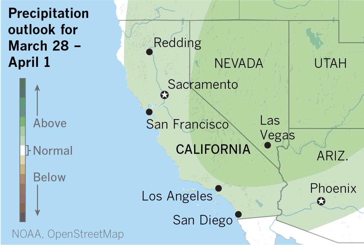
The extended outlook from the National Oceanic and Atmospheric Administration for March 28 to April 1 favors somewhat above-average precipitation for almost all of California and the Southwest.
Possible rainfall amounts forecast for the L.A. region range from a quarter of an inch to an inch and a quarter, Boldt said. ŌĆ£The good news is that itŌĆÖs likely to rain, but not enough to make any difference in the drought.ŌĆØ

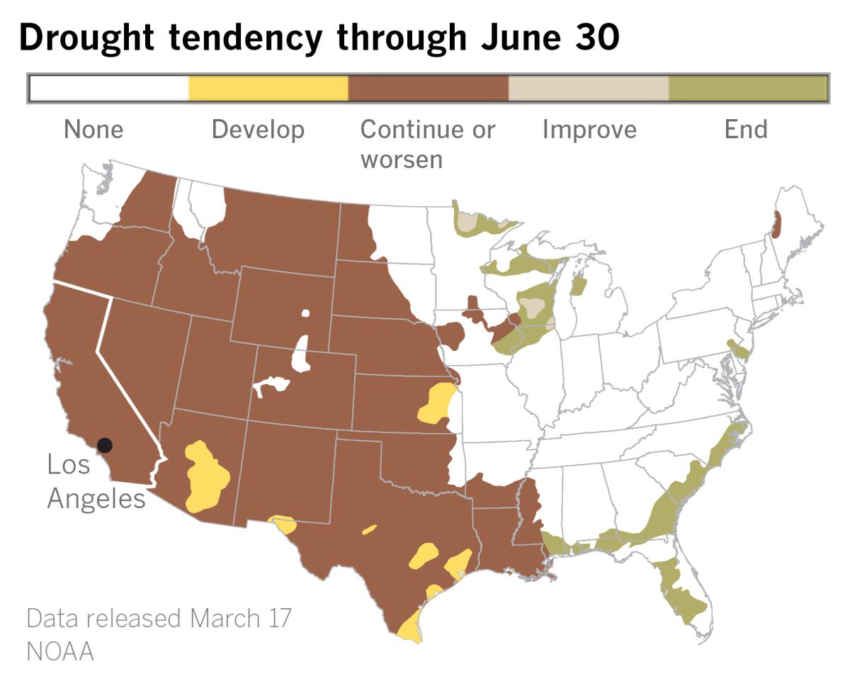
In fact, the spring outlook issued by NOAA on Thursday predicts that the drought will expand with warmer conditions across the West.
The latest U.S. Drought Monitor data, also released Thursday, shows most of California in severe drought, and big chunks of Northern California and the San Joaquin Valley slipping back into extreme drought.
ŌĆ£Severe to exceptional drought has persisted in some areas of the West since the summer of 2020 and drought has expanded to the southern Plains and Lower Mississippi Valley,ŌĆØ said Jon Gottschalck of NOAAŌĆÖs Climate Prediction Center. ŌĆ£With nearly 60% of the continental U.S. experiencing minor to exceptional drought conditions, this is the largest drought coverage weŌĆÖve seen in the U.S. since 2013.ŌĆØ
This spring, more than half of the U.S. is also forecast to have above-average temperatures, according to NOAA.
That would be a continuation of the hot, dry pattern experienced this winter by Southern Californians, when a strong ridge of high pressure held sway much of the time over the West Coast. January and February were the driest first two months of the year on record across much of California. Those months should normally be the wettest of the year.
The first three months of 2022 turned bone dry after an extraordinarily wet December. That month saw record snow at Lake Tahoe and heavy rain in Southern California, which tapped into three atmospheric rivers. That was the result of the high pressure shifting to the west by about 700 miles, allowing storms to come down from the north, explained Alex Tardy, a meteorologist with the National Weather Service in San Diego.
When the high shifted back eastward into its blocking position, the pattern provided a perfect setup for repeated episodes of Santa Anas, the hot, dry, down-sloping winds that blow from the Great Basin toward the ocean. These offshore winds can often be counted on to heat up coastal Southern California.
Out-of-town visitors were welcomed to Los Angeles for Super Bowl week in February amid record-challenging heat.
The high pressure area over California this week is not as strong or as long-lasting as the February heat wave, said Boldt. But, he says, ŌĆ£We are reaching record highs, so that makes it unusual in my book.ŌĆØ
With high pressure dominating , March isnŌĆÖt likely to go out like a lion, and a drought-busting ŌĆ£March MiracleŌĆØ is completely out of the question, but even though models disagree on timing, forecasters do expect beneficial rain for the end of the month.
In the face of this multiyear drought, any news such as that is welcome.
More to Read
Sign up for Essential California
The most important California stories and recommendations in your inbox every morning.
You may occasionally receive promotional content from the Los Angeles Times.


