Southern California to see elevated fire weather, possible monsoon storms this week

- Share via
Monsoonal thunderstorms loom this week, bringing the potential for dangerous lightning strikes and elevated fire conditions, forecasters said.
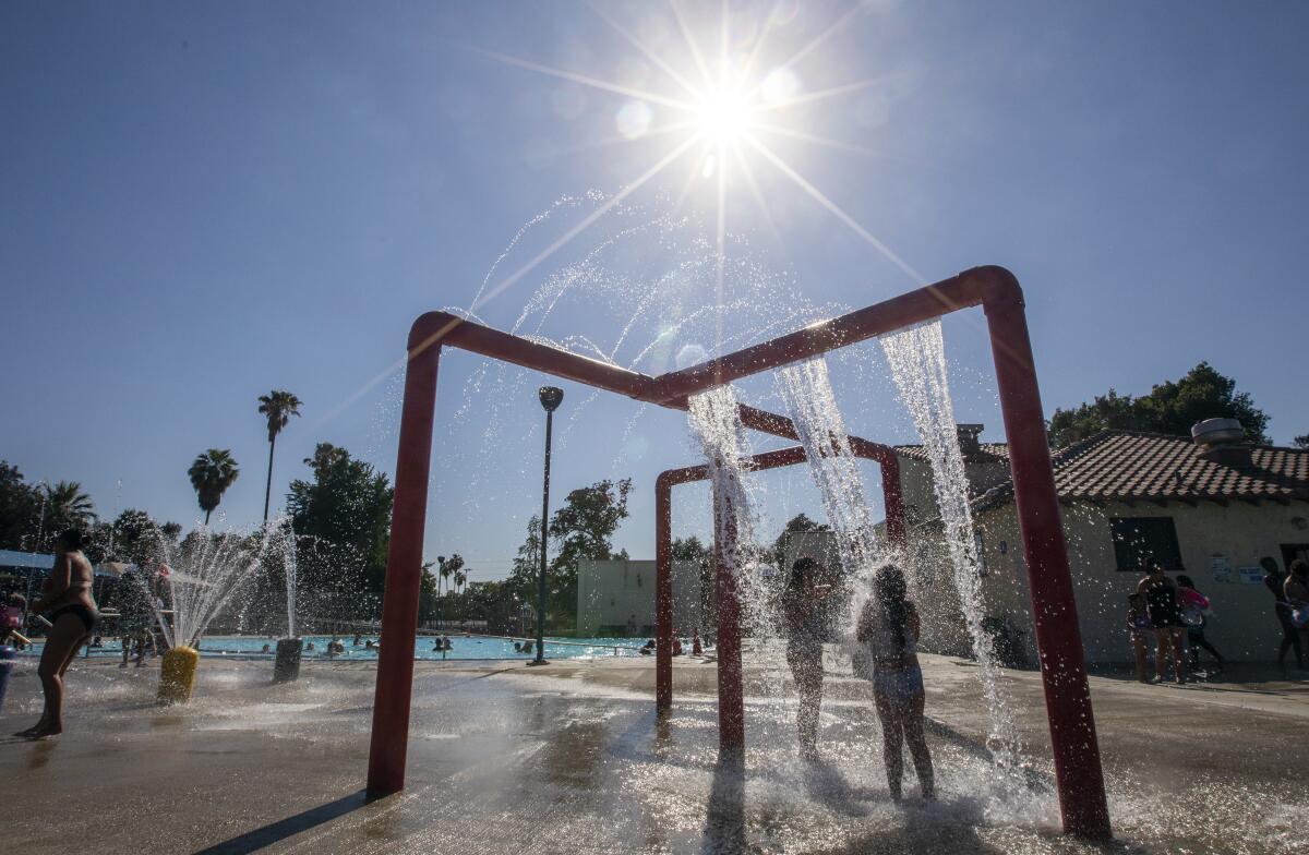
The high temperatures of the last several days were expected to peak Monday before tapering off later in the week, meteorologists with the National Weather Service said.
Much of the region was under excessive heat warnings until 9 p.m. Monday. Temperatures climbed into the triple digits Monday in several cities, including Palm Springs (117) and Indio (113).
Portland, Ore., reached 112 degrees Fahrenheit on Sunday.
The weather service said downtown Los Angeles reached 81 degrees Monday, while a high of 84 was recorded in Anaheim and Burbank. The coastal area was cooler, with a high of 70 at the Santa Monica Pier.
Lancaster reached 109 — one degree less than on Sunday, when it tied a record set in 1956.
Several other heat records were tied or broken Sunday, the weather service said. Sandberg hit 107, breaking its previous high of 106, set in 2013. Palm Springs came in at 121, breaking its previous daily record of 120, set in 1979. Palmdale tied its record-high temperature of 109, set in 1973; Campo tied its 1994 record of 106; Idyllwild tied its 1956 record of 94; and Palomar Mountain tied its 1994 record of 94.
Forecasters warn that monsoonal thunderstorms could follow the feverish temperatures between Tuesday and Thursday, with the worst expected Wednesday. The thunderstorms could bring isolated lightning strikes, erratic wind gusts and brief, heavy downpours, with the possibility of flash flooding. The National Weather Service recommended that campers and hikers keep a close watch on forecasts before venturing out.
“To develop thunderstorms, you need moisture,” said Kathy Hoxsie, a meteorologist with the National Weather Service in Oxnard. “It is adding basically the two missing elements, which are moisture and instability.”
The erratic weather is causing an elevated fire risk through Thursday, forecasters said. With the heat and drought, stray lightning or other sparks could ignite a fire. The weather service advised extreme caution when using flammable materials.
The high temperatures — coming barely a week after a blistering early-season heat wave — underscore the likely danger of this year’s wildfire season, which is coming earlier and promises to spread faster than in previous years. Southern California fire officials warned last week that conditions are already comparable to August and September in typical seasons.
“Last year was the worst fire season we’ve seen in California,” said Glenn Barley, assistant region chief for the California Department of Forestry and Fire Protection’s southern region. “At this point this year, we are ahead of those numbers for last year, both in terms of number of fires and number of acres burned.”
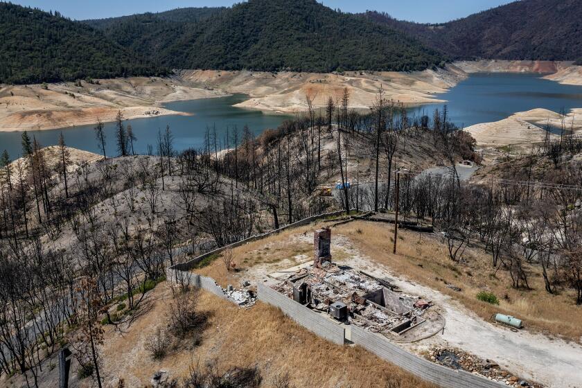
State leaders in climate change and water resources warn that California’s drought is already causing dire conditions for people, plants, animals and land.
Additionally, a drought is plaguing the state and much of the rest of the Western U.S., enhancing the extreme weather conditions. In California, there has been record-high evaporation and record-low runoff into streams and reservoirs this year, state climate leaders said. Some rivers are so low they’ve begun to heat up, becoming uninhabitable for many fish species, according to the Department of Fish and Wildlife.
As temperatures rise, so too does evaporation, said Benjamin Zaitchik, a professor in Johns Hopkins University’s Earth and Planetary Sciences Department. Because the ground is so parched, there isn’t as much cooling, he explained, so temperatures ramp up and, in turn, create a cyclical effect: Hotter temperatures cause increased evaporation, more evaporation leads to drier climates, and a drier climate spawns hotter temperatures.
“You have these sunny, high-pressure, hot conditions that are drying up the surface, and in this case, the surface was already dry,” Zaitchik said. “You’re seeing a really reinforcing feedback where the fact that it’s so dry, there’s not a lot of moisture that can be evaporated into the atmosphere instead of dry heat.”
Californians can expect the cycle of heating and drying to occur more frequently and at greater extremes in the coming years, Zaitchik said.
“Nothing that we’re seeing right now is a surprise in the statistical sense. ... It’s always a surprise in the living-through-it sense,” he said. “This is entirely within the bounds of what’s been projected.”
To beat the heat, officials say, people should stay in cool areas, drink plenty of water and refrain from strenuous activity during the hottest parts of the day. Zaitchik encouraged also checking on family, friends and neighbors who may be vulnerable.
“Heat is the deadliest form of weather-related disasters in the U.S.,” he said. “It doesn’t feel like it, because it just feels like a slog. But it kills a lot of people. And yet heat stress and the potential for heat stress is so easy to treat.”
Libraries and senior and community centers are open for visitors to take advantage of air conditioning. Some facilities, such as Lancaster Library, Quartz Hill Library and Acton Agua Dulce Library, will be open until 10 p.m. Monday to serve as cooling centers.
A list of other cooling centers can be found at L.A. County’s emergency preparedness website.
Times staff writers Alex Wigglesworth and Leila Miller contributed to this report.
More to Read
Sign up for Essential California
The most important California stories and recommendations in your inbox every morning.
You may occasionally receive promotional content from the Los Angeles Times.


