Dry, sunny days in January have taken a toll on California’s snowpack

- Share via
All of those dry January days have taken a toll on California’s snowpack, but officials say it’s too early to worry about drought conditions.
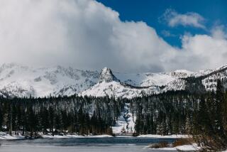
Surveyors with the California Department of Water Resources trekked through a snow-covered field Thursday at the department’s Phillips station, above Lake Tahoe, to take the second seasonal measurement that serves as an important marker for the state’s water supply.
The result — 40.5 inches deep — is 79% of average for the time of year at that location. If all the snow were to melt at once it would amount to about 14.5 inches of water, said Sean de Guzman, chief of the agency’s snow surveys and water supply forecasting section.
The measurement taken on Jan. 2 was a few inches shallower — 33.5 inches — but amounted to a promising start at the time, according to water managers. Then storm activity slowed considerably.
“Snow and precipitation statewide were well below average [in January],” de Guzman said. “But we still need to wait and see what the next few months will bring us.”
The snow season typically begins in December and ends on the first day of April, when the snowpack is normally at its highest. However, surveyors will continue to measure the pack as long as there’s snow on the ground, often through May. How much snow falls during this period is critical to California’s annual water outlook and is watched closely by state water managers. Thursday’s reading at the Phillips station was 58% of the April 1 average for that location.
The snowpack provides about 30% of the annual freshwater supply for the state. Its spring and summer runoff feeds rivers and reservoirs, and part of it is distributed to water agencies for farm irrigation, landscaping and urban drinking supplies. The good news, officials say, is that the state’s reservoirs are either at or above their averages for this time of year, thanks in part to solid rainfall last winter.
The Phillips station, 30 miles west of Tahoe, was grassy and dry when surveyors attempted to measure the snowpack in January 2018. In 2019, conditions were significantly better, with the January snowpack measuring 25.5 inches, or 80% of average for the date.
That 2019 snowpack — which picked up later in the winter, boosted by a series of atmospheric rivers paired with cold fronts that pounded the state — was ultimately the fifth best in recorded history.
“It just shows how unpredictable snow and precipitation are here in California and how just a few atmospheric rivers can really drastically change a water year,” de Guzman said.
Thursday’s lackluster snowpack measurement comes as Southern Californians are preparing for a winter warm-up heading into February.
Strong winds that have blown through the region this week began to diminish Thursday, making way for toasty temperatures through Saturday. Highs of 5 to 10 degrees above normal are expected before dipping quickly back down on Sunday, said Jayme Laber, a hydrologist with the National Weather Service in Oxnard.
“It’s not going to be hot by summer standards, but for this time of year, we’re definitely going to be warm,” he said.
Temperatures in downtown Los Angeles are expected to be in the low 80s Friday and Saturday. Inland areas of L.A. and Orange counties — including Pasadena, Glendale, Santa Ana and Irvine — will see similar temperatures. Forecasters are predicting more mild temperatures in the mid-70s for coastal cities in the two counties.
A wetter-than-normal November and December had pushed the region above average for rainfall tallies for the water year, which runs from October through September. But precipitation in January was meager, with only a few storms bringing just a smattering of rain to the region, Laber said.
“It’s been dry enough that it’s brought us down into the normal range for the water year,” he said. “If the drying trend continues, it’s going to be a long shot to stay in the normal range.”
February is typically the state’s wettest month, but current forecast models are showing mostly dry weather for the next couple of weeks. One model predicts a slight chance of showers Sunday night, but it’s still too early for forecasters to say whether Los Angeles will see much, if any, rain from that system, Laber said.
Temperatures for the start of this February contrast starkly with the same time last year. In February 2019, the mercury did not reach 70 degrees in downtown Los Angeles for the entire month. It was the first time since forecasters began recording data — at least 142 years — that the region failed to top 69 degrees. That threshold will be breached hours after the calendar flips this year.
More to Read
Sign up for Essential California
The most important California stories and recommendations in your inbox every morning.
You may occasionally receive promotional content from the Los Angeles Times.


