Dangerous fire weather conditions return Sunday to Southern California

For the first time in two weeks, dangerous fire weather is forecast to return to Southern California on Sunday as dry, strong Santa Ana winds ŌĆö with gusts of up to 50 mph ŌĆö are expected to return from the desert.
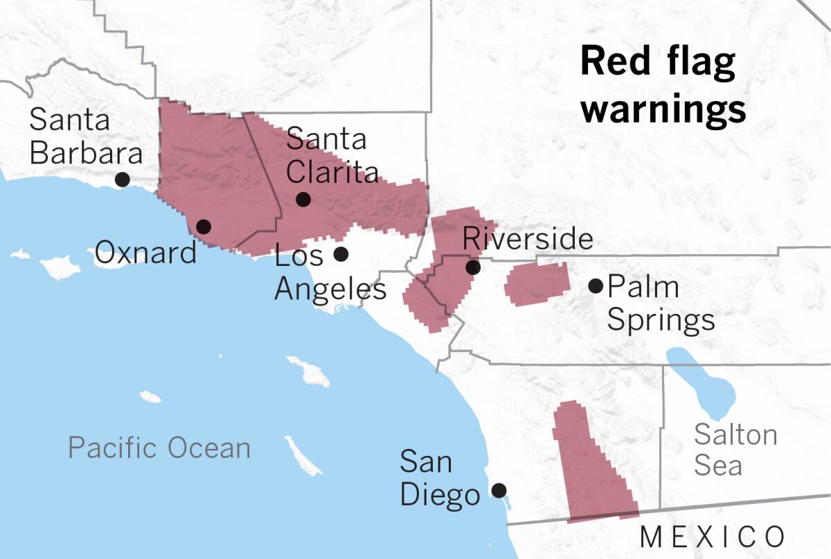
Red flag warnings will be in place Sunday for a broad stretch of Southern California, from Ventura County through parts of Orange County, the Inland Empire and San Diego County, according to the National Weather Service. The mountains of Los Angeles County and the San Fernando and Santa Clarita valleys are also at high fire weather risk.
The air is expected to be quite dry, with minimum relative humidity forecast to dip perhaps below 10%, forecasters said. Meanwhile, the weather is expected to be hot, and maximum temperatures for this time of the year could be broken in downtown L.A., at Los Angeles International Airport and in Long Beach, as highs top out in the 80s and 90s.
Red flag warnings will begin at 1 a.m. Sunday. ŌĆ£If fire ignition occurs, conditions may be favorable for extreme fire behavior which would threaten life and property,ŌĆØ the weather service warned. Vegetation remains tinder dry, with Los Angeles receiving zero inches of rain since Oct. 1; the average rainfall for this time by Nov. 15 is a little more than 1 inch of rain.
The National Weather ServiceŌĆÖs Storm Prediction Center said areas with the most critical fire weather risk are in the Santa Clarita Valley and Ventura County.
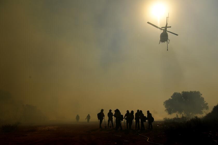
Both regions have been affected by large wildfires in recent weeks; the Tick fire in Santa Clarita burned more than 4,600 acres and destroyed 29 structures; the Easy fire in Simi Valley that chewed through brush near the Ronald Reagan Presidential Library burned more than 1,800 acres, and at least two structures were destroyed. Both fires have been fully contained.
Critically dry weeds and grasses that grew after the last relatively wet rainfall season, which ended June 30, combined with dead vegetation from years of drought, are of special concern during such weather conditions.
Most of California is either abnormally dry or in moderate drought, according to the U.S. Drought Monitor. All of coastal Southern California is deemed to be abnormally dry, according to data released Thursday.
On Saturday afternoon, a brush fire broke out in Topanga, near 1200 North Topanga Canyon Blvd., and was quickly brought under control by firefighters after burning about four acres.
Farther north, meteorologists in the San Francisco Bay Area warn that there may be elevated fire weather starting Wednesday afternoon, as dry, gusty Diablo winds from the northeast return.
In Southern California, the first rain of the season could arrive midweek, followed by a period of cloudy, cool, damp conditions by the end of the week.
Low pressure dropping south along the West Coast on Tuesday is forecast to switch the wind pattern and send cooler sea breezes across Southern California, lowering temperatures and increasing clouds from north to south later in the day.
Some locations west of the mountains could see a 30-degree drop in temperatures from Sunday to Wednesday. Downtown Los Angeles, for example, which could see temperatures in the low 90s on Sunday, will probably see a high in the low to mid-60s on Wednesday.
The best chance of moisture may arrive Wednesday and linger into Thursday.
More to Read
Sign up for Essential California
The most important California stories and recommendations in your inbox every morning.
You may occasionally receive promotional content from the Los Angeles Times.


