High-Tech Wildcatter Puts Finger on Oil Pockets
ANCHORAGE, Alaska â Stephen Lewis has struck oil. Again. He can do it a dozen times--before lunch.
âIf we extend along the shale cap and then take the well down through it,â the BP Explorations geophysicist explains, zigzagging through 100 million years of geology beneath Alaskaâs North Slope, âwe should hit more oil.â
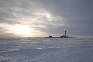
Energy hasnât always been so easy to find. In the old days--the 1990s--a typical wildcat driller, bundled in coveralls and reeking of crude, might celebrate a gusher once every 10 or 20 test wells. At Prudhoe Bay, they drilled 100 times before hitting âpay.â
At $4 million per, punching holes blindly into the Earthâs crust is what makes the oil business more roulette than science.
Then there is Lewis, with his carefully brushed mane of white hair and shiny loafers. Snug in a suburban office building 800 miles from the frigid Arctic, he peers through distant ice and bedrock to find pockets of unexploited hydrocarbons.
Lewis doesnât have x-ray vision. Rather, he revs up a sophisticated imaging computer and dons a pair of tan goggles.
The $1-million Highly Immersive Visualization Environment, or HIVE, enables him to digitally âseeâ for miles underground, where grinding pressures bake rocks at 300 degrees Fahrenheit and make fluids fizz like soda pop.
The HIVE resembles a large home theater, minus the cup holders and popcorn.
A large curved screen embraces the audience. The room is painted black to eliminate glare and distractions.
With the 3-D glasses to enhance the image, you plunge down the borehole and into the reservoir, augering past, around and through a maze of hidden faults, mountains, valleys, stream channels and other buried geologic features.
Complex software enables Lewis to unpeel layers of rock deposits for likely pockets of energy overlooked by conventional analysis. Often heâs able to tap the reserves by extending existing wells.
âItâs like guiding rockets,â Lewis said. âThe target might be 9,000 feet down and seven miles away, and the box weâre aiming at is 20 feet long. We can put a well exactly where we want it.â
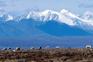
HIVE and other technologies could be crucial to pinpointing oil reserves beneath sensitive areas like the Arctic National Wildlife Refuge. That could reduce the number of new wells drilled, as well as the extra roads and pipelines connecting them.
âItâs all about footprint,â Lewis said. âOptimizing every well bore would mean smaller drill pads and less infrastructure in the refuge.â
HIVEâs sophisticated images are generated from millions of pages of data from several sources--satellite data, drilling logbooks from nearby wells and, especially, three-dimensional seismic.
This improved seismic method uses vibration equipment rather than old-fashioned dynamite blasts. The acoustic returns are collected with a complex network of receivers, including sensors lowered below ground to add details collected at different levels.
3-D seismic canât see oil directly. Scientists must still interpret the images of the Earthâs structure to guide the drill. Some compare it to a blurry sonogram of a baby in the womb.
âIf you canât imagine oil, youâll never find it,â said Catherine Hanks, a research geologist at the University of Alaska-Fairbanks. âDoing 3-D at the refuge would be very useful.â
A 3-D survey at the refuge would cost millions. Oil companies are unlikely to bear that cost unnecessarily, so the political decision to drill there most likely would have to occur first.
âYou donât run 3-D on somebody elseâs acreage,â said Anchorage geologist Arlen Ehm, who directed a two-dimensional seismic survey at the refuge 20 years ago. âItâs so expensive [that] you only run it on a sweet spot where itâs already been determined there is oil.â
More to Read
Sign up for Essential California
The most important California stories and recommendations in your inbox every morning.
You may occasionally receive promotional content from the Los Angeles Times.


