Signs Indicate Wettest Winter in 50 Years
WASHINGTON ŌĆö Ocean conditions thousands of miles west of Los Angeles indicate that next winterŌĆÖs storms may be among the worst in half a century, the governmentŌĆÖs top long-range weather forecaster said Tuesday.
Building its predictions on such seemingly small anomalies as a rise of 2 degrees Celsius in the temperature of the normally chilly central PacificŌĆÖs surface waters, the federal government said that the anticipated El Nino storms could rival those that brought havoc to the West Coast in 1982 and 1983.
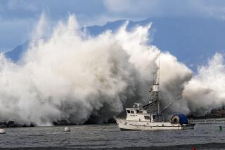
Those storms lashed the coast with giant waves and high tides, sending homes from Malibu to Santa Barbara sliding into the ocean, along with a large chunk of the Santa Monica pier. Worldwide, the disruption to weather patterns was blamed for 1,500 deaths and $8 billion in damage.
TuesdayŌĆÖs predictions are more alarming than earlier forecasts, which were built on initial consideration of satellite observations and suggested merely a worse-than-normal winter.
ŌĆ£If you look through the recent history, of the past 50 or 60 years, what weŌĆÖre seeing out there equals the top three,ŌĆØ said Ants Leetmaa, director of the U.S. Climate Prediction Center.
And over the course of the typical summer, he said, the El Nino-producing conditions only get worse.
Speaking with the caution inherent in those who make long-range weather predictions, he added: ŌĆ£WeŌĆÖre pretty concerned.ŌĆØ
Beyond California, the shifting weather pattern also can create fierce conditions and have a devastating long-range impact. In southern Asia, for example, where monsoons replenish moisture-deprived farmlands, an El Nino could shift life-giving rains eastward, creating the prospect of famine-driven drought in India and Indonesia. The shift could also bring drought to South Africa, Australia and the agricultural lands of northern Brazil.
El NinoŌĆÖs only potentially significant benefit is a reduced likelihood that hot, dry Santa Ana winds would threaten Southern California with brush fires.
ŌĆ£ItŌĆÖll be so wet they wonŌĆÖt matter,ŌĆØ should the winds arrive later than normal and occur during the winter, Leetmaa said. And, he added, the anticipated winter precipitation is likely to increase the snowpack as far east as the Rockies.
The governmentŌĆÖs predictions came barely two weeks after scientists at the Jet Propulsion Laboratory in Pasadena culled satellite data and offered a tentative warning that the winter rainy season could be worse than usual. The conditions that trigger the storms and drought are named El Nino, or ŌĆ£the little boyŌĆØ in Spanish, after the Christ child because they generally arrive in December.
The JPL predictions were the first such forecasts made so far in advance and took advantage of increasingly sophisticated climate models and high-speed computer processing.
In terms of West Coast weather, the El Nino condition of 1982-83 was ŌĆ£the event of the century,ŌĆØ JPL oceanographer Bill Patzert said Tuesday. The Climate Prediction Center, a division of the National Oceanic and Atmospheric Administration, was able to take the JPL data and apply it to more sophisticated weather models, leading to forecasts that are potentially more accurate--and in this case also more alarming, he said.
Patzert said forecasters are seeing the same indications that occurred before the 1982-83 storms.
Those indications include not only the increase in water temperature in the central tropical Pacific but a 4 degrees Celsius rise in water temperatures off Baja California, Ecuador and Peru. And, he said, the presence of albacore tuna relatively close to San Diego rivaled the appearance of the sport fish in the spring before previous stormy winters.
The increased water temperature, although barely noticeable to the touch, is dramatic enough to shift wind and rain patterns across a swath of the globe stretching from southern Asia at least across the northern United States as far east as the Great Lakes region, where warmer-than-normal weather would result.
The shift occurs when warm, moist air rises from the surface of the Pacific and disrupts the weather-steering jet stream in the upper atmosphere, where weather systems develop.
But--as dicey as five-day weather forecasts still can be from time to time--looking at current conditions and leaping to predictions claiming anything more certain than a likelihood is a particularly uncertain course, oceanographers and meteorologists said.
More to Read
Sign up for Essential California
The most important California stories and recommendations in your inbox every morning.
You may occasionally receive promotional content from the Los Angeles Times.


