On Opposite Sides of Petroglyph Point
TULELAKE, Calif. â Carved into the soft side of a ridge that soars high above surrounding farmland, ancient Indian petroglyphs are disappearing beneath a blanket of modern graffiti.
Archeologists say the circles, dots, lines and squiggles at Petroglyph Point are spiritually laden symbols that were carved by Modoc Indians centuries before they were driven from this remote corner of northeastern California by the U.S. Army in 1873.
Federal park rangers say the modern initials, names and slogans threatening to obliterate the ancient carvings also are symbols--of the hostility the local community feels toward the federal agencies that control huge tracts of land in Tule Lake Basin.
Over the years, local residents and the occasional tourist have cut their initials beside the petroglyphs, chipped whole chunks of them out of the rock, even used them for target practice, says Craig Dorman, superintendent of Lava Beds National Monument, a 46,500-acre expanse that includes the point.
âPetroglyph Point is a disgrace,â says Dorman, who has been in charge of Lava Beds for four years, a wild place strewn with black lava rocks and riddled with miles of subterranean caves.
Although many Native American petroglyphs are found in California and other states, those on Petroglyph Point are rare because they are so plentiful, so densely placed and so geometric. Only Modoc Indians restricted their carvings to geometric shapes.
âPeople who study rock art come from all over the world to see these, because there are none like them anywhere else,â says Gary Hathaway, the parkâs chief interpreter.
âBut just as it was a cultural thing for the Modocs to carve these spiritual symbols, it is a cultural thing now for people to drink beer, chew tobacco, carve their initials into the point. Itâs disgusting.â
Over the years, the impact of the graffiti has been compounded by topsoil blowing against the point from neighboring farmland--in effect sandblasting the ancient carvings.
Dorman blames the vandalism partly on the National Park Serviceâs failure to combat a sense of alienation by the community from the national treasures in their midst.
âA lot of people in this basin have a possessory feeling about Lava Beds, and they feel that they were disenfranchised years ago,â Dorman says. âThis park dropped out of the community because of budget cutbacks or whatever. We stopped going out to the schools, stopped inviting the community here, stopped making them feel welcome.â
The result, he says, has been increasing friction between locals and park rangers whenever they do cross paths.
Residents and Rangers at Odds
Over the years, rangers have seen the monumentâs directional signs ripped out or riddled with bullets, found residents flouting prohibitions against carrying loaded weapons or collecting Indian artifacts and caught them speeding along its miles of narrow, winding roads or using the park without paying entrance fees.
The residents complain of gun-toting rangers treating them with disdain. They talk of being pulled over and cited for minor infractions that are often overlooked if the driver is an out-of-towner. They speak bitterly of federal officials choosing to live on monument property or up the road in Oregon rather than in tiny Tulelake.
For many residents of Tule Lake Basin--a place where neighbors might belong to an anti-government militia or believe federal income taxes are unconstitutional--the sight of armed federal agents is galling.
All told, a half-dozen federal agencies police and manage the Lava Beds, a national forest, two national wildlife refuges, thousands of acres of farm and range land and a massive irrigation project that lie within Tule Lake Basin or touch its borders.
Stretching south from the Oregon border, the basin is edged by the Lava Beds to the west and Modoc National Forest to the east and south.
Some 400 square miles of high desert, the basin--with only 1,500 people--is âa gem tucked into the brush,â said Siskiyou County Agriculture Commissioner James Massey Jr.
âWe are proud of the fact that there are more cows than people up here,â Massey said. The farms, most of them small, family-owned and located partly on federal land, grow some of the nationâs finest potatoes and horseradish.
Many of the folks who farm here are the children of World I or World War II veterans, fiercely self-reliant people who love the uncrowded roads, big skies and the majestic view of snow-capped Mt. Shasta crowning the Cascades.
âItâs like âCheers,â â said Tulelake Mayor Mike Bunch, 39, a native son who owns the townâs only auto parts store. âEverybody knows your name.â
Everybody, that is, except the federal agents who rotate through the basin every few years.
âThese parks are not for the people anymore, they are for the bureaucrats who run them,â says David Porter Misso, a local newspaper columnist who often highlights the alleged transgressions of federal agents. âI know we need a federal government, itâs just the way that they treat us. There is almost an arrogance there.â
On the highway near his cabin, 10 miles south of Tulelake and in sight of Petroglyph Point, the orange-bearded Misso has fashioned his own hand-lettered billboard: âThis Land Belongs to You, Not the Feds.â
Misso put up the sign, he says, to protest the seemingly endless, sometimes conflicting regulations that stream from the federal agencies and get in the way of the people who live in the basin.
There are regulations on pesticides, the number of ducks hunters can shoot, the kind of bullets they can use. There are limits on the amount of firewood that may be chopped for the wood-burning stoves that heat many homes. There is a law against picking wildflowers and another law against removing Indian arrowheads.
Some of the regulations change from one year to the next.
A sympathetic Dorman says that sometimes locals âcanât tell where one federal agencyâs turf ends and anotherâs begins, and sometimes we donât know which rules apply where, and weâre supposed to know these things. I think that three-quarters of the mistakes people make are just that, mistakes.â
The undercurrent of mutual suspicion came bubbling painfully to the surface a little more than a year ago, when a ranger came across 90-year-old Burris Short, one of the basinâs most beloved old-timers.
A slight, soft-spoken man with a deeply weathered face, Short has farmed in Tulelake for more than 50 years. No one can recall his ever tangling with a neighbor, much less a federal law enforcement official.
But on the New Yearâs Eve before last, Short packed his lunch, grabbed a beer and drove 15 minutes west to Lava Beds to picnic and bird-watch.
After eating and taking a swig of beer, he started home. Still inside Lava Beds, he stopped to say hello to a ranger, a man less than half Shortâs age and twice his size.
The ranger spotted the open beer can and started asking questions. The elderly farmer says he panicked and drove off, tossing the beer can out his window. Speeding after him, the ranger ordered Short out of the truck and pulled his gun on him when the farmer didnât move fast enough.
He spread-eagled the old man against the pickup, frisked him and twice gave him a Breathalyzer test, each one showing Short was within legal blood-alcohol limits. Then the ranger pulled Shortâs arms behind his back and handcuffed him.
It was his first arrest, âand I hope it will be my last,â Short said recently. Word of the incident spread like a hungry brush fire.
âI guess you could say it was the straw that broke the camelâs back after years of bad relations between the locals and the Feds here,â says Dorman.
More than 100 residents signed petitions in protest, dispatching them to President Clinton, the stateâs two senators and their congressman. Dozens of angry people turned out at two consecutive public planning hearings for Lava Beds to denounce the rangers. A special agent from the National Park Service was sent to investigate the affair.
Ultimately, Dorman personally apologized to Short. All citations against the farmer--for littering, evading arrest and driving with an open container--were dismissed.
But the sense of outrage remains.
Troubling as the Burris Short affair was, no manifestation of the tension between the locals and federal agents has been more devastating than the damage to Petroglyph Point.
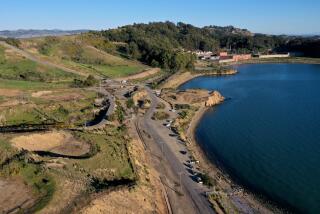
When the Modocs lived on the banks of Tule Lake, before the federal government drained it to a tenth of its size, Petroglyph Point was an island. It was regarded as sacred.
âThey buried their dead there,â says archeologist Georgia Lee, who in 1988 studied and photographed Petroglyph Point for the Park Service. âAnd when they boated to the island, there was this enormous white wall rising above them. It was like a huge chalkboard, sort of irresistible.â
Drawings Are Unique
Unlike carvings left behind by other California Indians, those on Petroglyph Point depict neither animals nor people. âIt was not Indian graffiti,â Lee says. âThey didnât do this for the hell of it. They had a purpose. I tend to believe the carvings have a spiritual significance. So when people carve graffiti on that cliff, it is just as if somebody were to obliterate a church.â
Starting just a foot above ground, thousands of carved circles--some with lines emanating outward, others with crossed lines slashing through them--flow with smaller symbols in staggered rows for hundreds of feet.
Lee estimates that the oldest carvings, now 20 feet above ground, date back more than 6,000 years. For years, they were protected by the lakeâs waters.
But as the Bureau of Reclamation drained the lake for farmland, the entire point was exposed, left vulnerable to sand blown from the plowed fields and to vandals.
By the 1930s, enough damage had been done to prompt the Park Service to erect a five-foot-high chain-link fence, topped with barbed wire, around much of the point.
Vandals were undeterred. Graffiti, with dates going back to the 1960s, is as clear behind the fence as outside it.
Names and initials stagger on, hundreds of them, weaving in and out, some over the petroglyphs.
â1965 Brownie,â says one large carving. âBob Syla, 1949,â says another. Outlined boldly with a box carved into the cliff face are âLinda S and Ricki I 68.â
Making matters worse, people also have robbed Indian graves at the point, Dorman said, even though grave robbing and defacing the petroglyphs are federal crimes.
The Park Service cannot afford 24-hour guards, he said. Lava Beds is so vast that the nearest ranger station is more than 15 miles from the point.
The only way to save the carvings, Dorman said, is to convince local residents that they are worth preserving.
âWe have been our own worst enemies in many ways,â he says of the Park Service.
Since he became the superintendent at Lava Beds, Dorman has worked to repair relations with the community, holding frequent public hearings on the general plan for Lava Beds and incorporating residentsâ ideas.
Last year, when residents protested after rangers erected an additional 100 feet of chain-link-and-barbed-wire fence at the point, Dorman ordered it torn down.
The locals give Dorman high marks for his effort, but both sides agree that learning to trust one another could take years.
âOf course, itâs not right to deface something of that nature,â Tulelake Mayor Bunch says of the petroglyphs. âThatâs an irreplaceable part of art history. But people are funny.â
More to Read
Sign up for Essential California
The most important California stories and recommendations in your inbox every morning.
You may occasionally receive promotional content from the Los Angeles Times.


