Strong Storm to Bring Threat of Mudslides
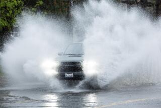
A strong and complex storm system was poised to strike the coast of Southern California before dawn today, raising fears of more destructive landslides in areas stripped of vegetation during last fallŌĆÖs devastating brush fires.
The National Weather Service issued a flash-flood watch for the burn areas from midnight until noon today.
Forecasters said that up to 2 inches of rain could fall in the coastal areas and up to 4 inches in some foothill communities before the system--combining a cold storm from the Gulf of Alaska with warm, moist air from the tropical Pacific--moves to the east sometime this afternoon.
ŌĆ£This system has the potential to cause significant flooding problems, especially in the burn areas,ŌĆØ the National Weather Service said in a special statement issued Wednesday afternoon. ŌĆ£In addition, strong gusty winds are expected.ŌĆØ
Despite the expenditure of more than $450,000 by the city of Malibu on erosion control after last OctoberŌĆÖs fires, a similar storm system last week set off mudslides that surged through at least 25 homes in the exclusive beachfront community. About a dozen residents were stranded by mudslides in Altadena, another neighborhood hit hard by the fires.
ŌĆ£ItŌĆÖs been a very busy fall and winter,ŌĆØ Inspector Jack Pritchard, a spokesman for the Los Angeles County Fire Department, said Wednesday. ŌĆ£Right now, everythingŌĆÖs fine, but if the forecast holds true, heavy bursts of rain could mean more trouble in Malibu, or Altadena, or any of the other burn areas.ŌĆØ
Because of the threat of flash floods, the department has deployed its swift-water rescue teams, both in helicopters and on the ground. Extra fire crews have been sent to Malibu and Altadena and heavy equipment--including bulldozers, dump trucks and skip-loaders--has been moved into position.
ŌĆ£Sandbags are available at fire stations in the affected areas, but most of the sandbagging is pretty much done,ŌĆØ Pritchard said. ŌĆ£People have been out there all day getting ready. I guess theyŌĆÖre pretty much as prepared as they can be.ŌĆØ
Curtis Brack, a meteorologist with WeatherData Inc., said the main cold front from the Alaskan storm will move across Southern California this morning or early this afternoon.
ŌĆ£Accompanying the storm is a flow of tropical moisture from near Hawaii,ŌĆØ he said. ŌĆ£The two elements are coming together over California, and the result will be some locally heavy rain and some thunderstorms. I think there will be some problems.ŌĆØ
Brack said that in Southern California, the heaviest rain probably will fall late this morning and early this afternoon, with scattered showers lingering until Friday. The snow level in local mountains is expected to start at about 8,000 feet, dropping to about 4,000 feet after nightfall.
ŌĆ£It looks like variable cloudiness will continue through the weekend,ŌĆØ Brack said. ŌĆ£And there may be some like scattered showers again on Sunday and Monday.ŌĆØ
High temperatures in the Los Angeles metropolitan area for the next few days should range from the upper 50s to the middle 60s, with lows mostly in the upper 40s.
The top reading at the Los Angeles Civic Center on Wednesday was 69 degrees, after an overnight low of 57. Total rainfall for the season stood at 3.37 inches, which is about a third of the normal total of 9.6 inches for the date and about one-sixth of last yearŌĆÖs total by Feb. 16 of 19.82 inches. The rainfall season is measured from July 1 through June 30.
More to Read
Sign up for Essential California
The most important California stories and recommendations in your inbox every morning.
You may occasionally receive promotional content from the Los Angeles Times.


