Heading up the 395? Stopping to scope out the sights is time well spent
Weâve all probably done it. We load up the car and head north for Mammoth Lakes as quickly as possible.
Iâve finally learned that the 300-plus-miles drive mostly on U.S. Highway 395 can be as enjoyable, informative and enlightening as the time spent in that great mountain community.
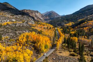
And this time of year, the turning of the foliage enhances the experience.
Hereâs a look at 10 worthwhile side trips on that route through the high desert and Eastern Sierra. Except for Red Rock Canyon State Park, which has a daily-use fee, there is no cost for any of these spots, though donations are accepted at those with visitor centers.
Red Rock Canyon State Park
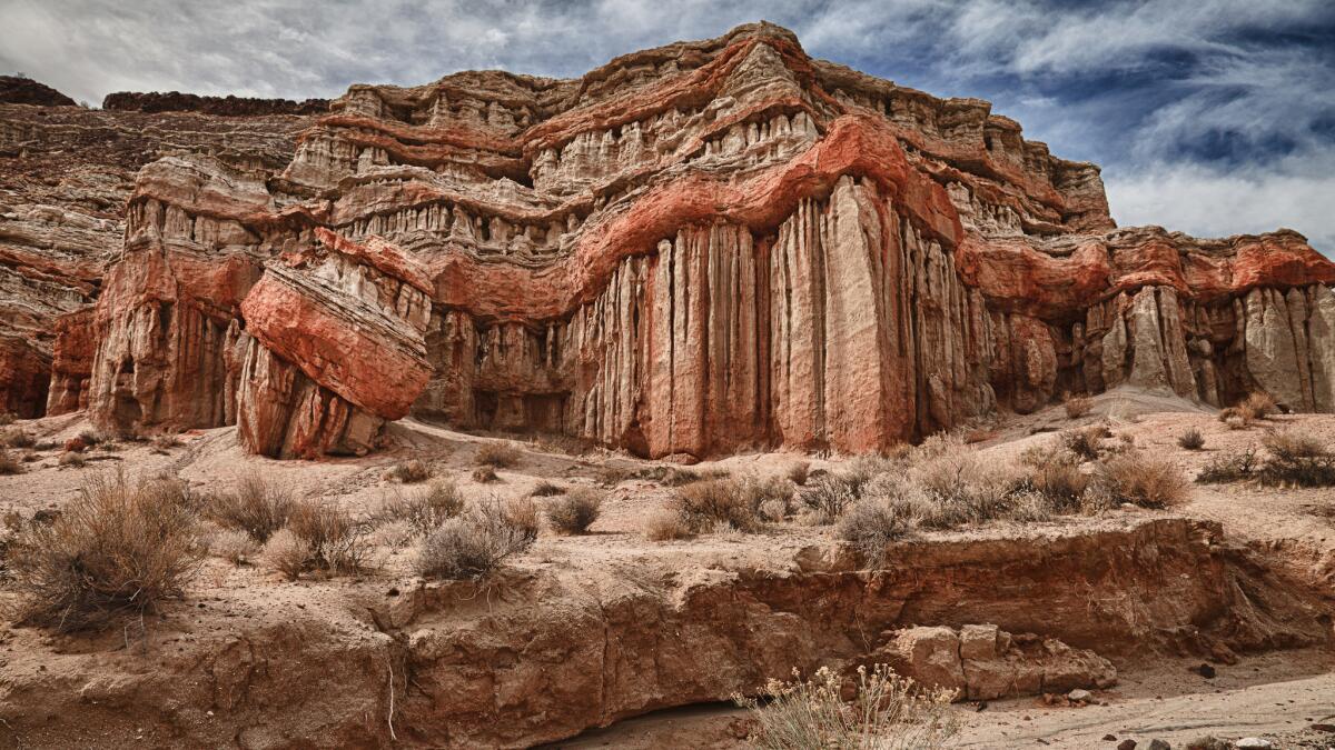
About 25 miles north of Mojave on California 14, 24 miles south of the intersection with 395. You can see some of the dramatic rock formations from the highway, with white, red, pink and brown bluffs and cliffs at the western edge of El Paso Mountain range and southern tip of the Sierra.
The parkâs visitor center is on the west side of the highway, but most of the parkâs 27,000 acres are on the east side.
There are ample hiking trails that were ancient trade routes for Native Americans and in the late 19th and early 20th centuries routes for mining operations throughout the region.
The cliffs look almost as though theyâve been painted in horizontal stripes and are even more colorful in early evening or early morning light.
Info: Red Rock State Park
Randsburg
One mile west of 395, 25 miles east of Red Rock Canyon, 75 miles north of the intersection of Interstate 15 and U.S. 395.
In the early 1900s the Rand Mining District was the main producer of gold in California and one of the stateâs primary mining areas.
Minimal mining continues, and vestiges of that once-thriving operation linger in this living ghost town, population 69, according to the most recent census.
The general store has its still-working soda fountain built in 1904 and is a good place to get material about the history of the area and information from the locals.
A little more than a mile east is Johannesburg, the now mostly abandoned support town for Randsburg, both named for the mining districts in South Africa that supplied much of the early labor force.
Info: Randsburg
Fossil Falls
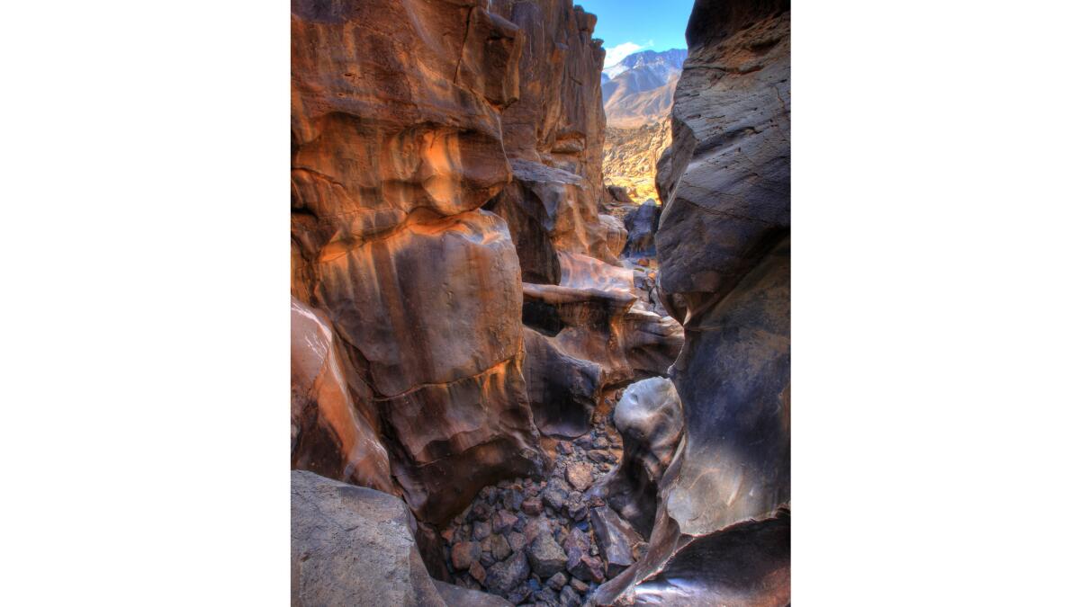
50 miles north of Johannesburg, just east of 395. Not long after the Sierra comes into view is an inconspicuous sign for Fossil Falls. Itâs well worth making the right turn and taking the short hike from the parking area.
On the flanks of the Coso Range to the east are large lava flows that reminded me of Hawaii Island.
But the real attraction is the volcanic rock that was sculpted by intense runoff from the Sierra as the Ice Age came to an end. The rushing water was so forceful that it smoothed the rock into oddly shaped forms that, as my wife, Jane, remarked, now resemble an enormous Henry Moore exhibit.
Info: Fossil Falls
Manzanar
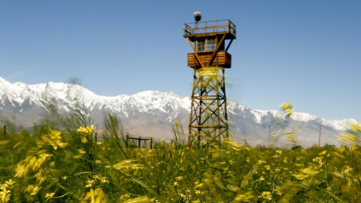
West side of 395, 56 miles north of Fossil Falls. The former Japanese American internment camp from World War II is now a national historic site.
It was one of 10 camps across the country where more than 110,000 Japanese Americans and others of Japanese descent were involuntarily relocated from 1942 to 1945.
It provides a frank and often uncomfortable look at how more than 10,000 internees at Manzanar were treated and the exceptional lengths they went to to try to create as normal an existence as possible.
The visitor center offers a film on the history of the camp and various exhibits that are as relevant today as they were generations ago. You can take a three-mile driving tour or design your own tour on foot.
Info: Manzanar
Alabama Hills
West of 395 near Lone Pine. The Alabama Hills, on Mt. Whitney Portal Road, are a collection of spectacular, rounded rock formations, including several large arches weathered and shaped for 85 million years.
The location has been a favorite for western TV shows and movies as far back as the silent era, as well as such films as âStar Trek Generationsâ and âIron Man.â
It doesnât take much imagination to envision Clayton Moore and Jay Silverheels on horseback, emerging from behind rounded boulders and scanning the horizon in their never-ending effort to rid the West of outlaws, ruffians, cattle rustlers and others up to no good. (Clayton Moore and Jay Silverheels? Google them.)
You can continue along the Portal Road to the base of Mt. Whitney, the tallest peak in the contiguous United States.
In the fall youâll spot the odd cottonwood with its honey-colored leaves in the Alabama Hills and much denser foliage as you near the roadâs end.
There are plenty of hikes in that area, and in the spring there are dramatic waterfalls filling the creeks, but hiking on the Mt. Whitney trail requires a permit.
You can make the five-mile round trip to Lone Pine Lake from the Portal without a permit, though.
Info: Alabama Hills
Mt. Whitney Hatchery
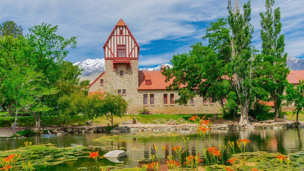
Just west of 395, two miles north of Independence. The fish hatchery, built in 1917 out of local granite with walls 2 to 3 feet thick, produced millions of rainbow trout eggs annually before flooding in 2008 destroyed four buildings and the fish-rearing ponds.
But the main structure is standing and open to the public for free and offers a historic look at the area, including the days before most of the water from the Owens Valley was diverted to Los Angeles.
Info: Mt. Whitney Hatchery
Inyo County Courthouse
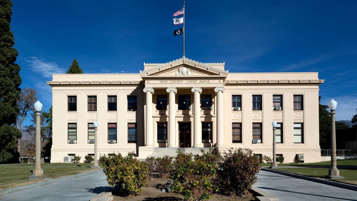
Seven miles north of Manzanar in Independence. The courthouse, built in 1921, is where Charles Manson was held on charges of possessing stolen property and arson before being indicted for the murders of Sharon Tate and several others.
Info: Inyo County Courthouse
Ancient Bristlecone Pine Forest
25 miles east of 395 at the northern end of Big Pine. This is my favorite side trip on the trek to Mammoth.
It takes almost an hour to get here from the highway, but the winding roller-coaster of a two-lane road is nearly as much fun as getting to the bristlecones â for the driver at least. Passengers in the back seat might disagree.
Along the way are spectacular views of the Sierra and valley below, but the pines themselves are breathtaking.
Several are more than 4,000 years old, the oldest living trees on Earth, in Schulman Grove near the visitor center, and Patriarch Grove, another hour on an unpaved road.
The forest starts at 7,000 feet, so itâs closed in winter and this year well into spring. There are three easy walking trails near the visitor center, where you can stroll among gnarled, richly hued trees, some of which were saplings when the first pyramids were built in Egypt.
A footnote: From the one-mile Discovery Trail, you can look across the vast basin to the Sierra Nevada and see the two southernmost glaciers in North America, the last remnants of the Ice Age.
Info: Ancient Bristlecone Pine Forest
Owens River Gorge
East of 395, 12 miles north of Bishop. The steep-walled, deep gorge runs for 10 miles and is a world-class rock-climbing destination as well as an enjoyable hiking spot.
Take a left at the T after turning on Gorge Road (the sign on 395 is small, so keep an eye out) and drive about three miles before parking.
The hike into the gorge begins past a gate. The hike is steep in places, but the bottom of the gorge is a ribbon of green around the Owens River.
Itâs an entirely different atmosphere from the desert-like surroundings above, sort of like being in another world.
For the fall, hereâs a side trip off the side trip: Head north on 395 for 11 more miles or so and take a left at Tomâs Place to Rock Creek Road. Itâs a scenic 10-mile drive through canyons carved by glaciers and flanked by stands of aspen.
This time of year, thereâs plenty of gold in those hills.
Info: Owens River Gorge
Convict Lake
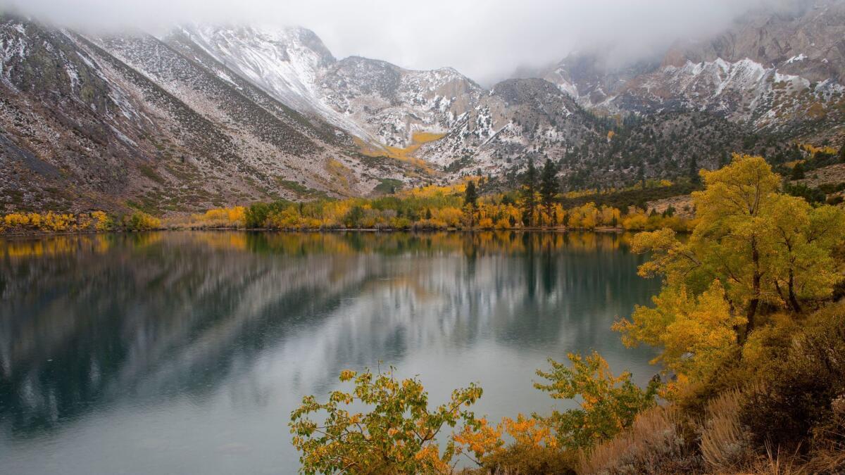
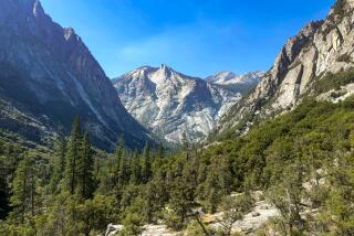
Two miles west of 395, about 18 miles north of Gorge Road. This is one of the most beautiful spots in the Eastern Sierra, where a serene mountain lake is framed by steep, craggy peaks.
In the fall quaking aspen and willows create a spectacular golden ribbon circling the lake.
In 1871 a group of convicts escaped from the Nevada State Penitentiary at Carson City and were cornered by a posse at what is now known as Convict Creek.
Robert Morrison, a member of the posse, was killed in the gunfight; Mt. Morrison, towering over the lake at more than 12,000 feet, is named for him. Mono Jim Peak, at nearly 11,000 feet, is nearby, named after Mono Jim, a Paiute guide also killed in the fight.
A three-mile hike around the lake is a nice respite once the snow clears. Also, the Restaurant at Convict Lake has a menu thatâs well worth the 15-minute drive south from Mammoth Lakes.
Info: Convict Lake
More to Read
Sign up for The Wild
Weâll help you find the best places to hike, bike and run, as well as the perfect silent spots for meditation and yoga.
You may occasionally receive promotional content from the Los Angeles Times.
