Op-Ed: We mapped the warehouse takeover of the Inland Empire. The results are overwhelming
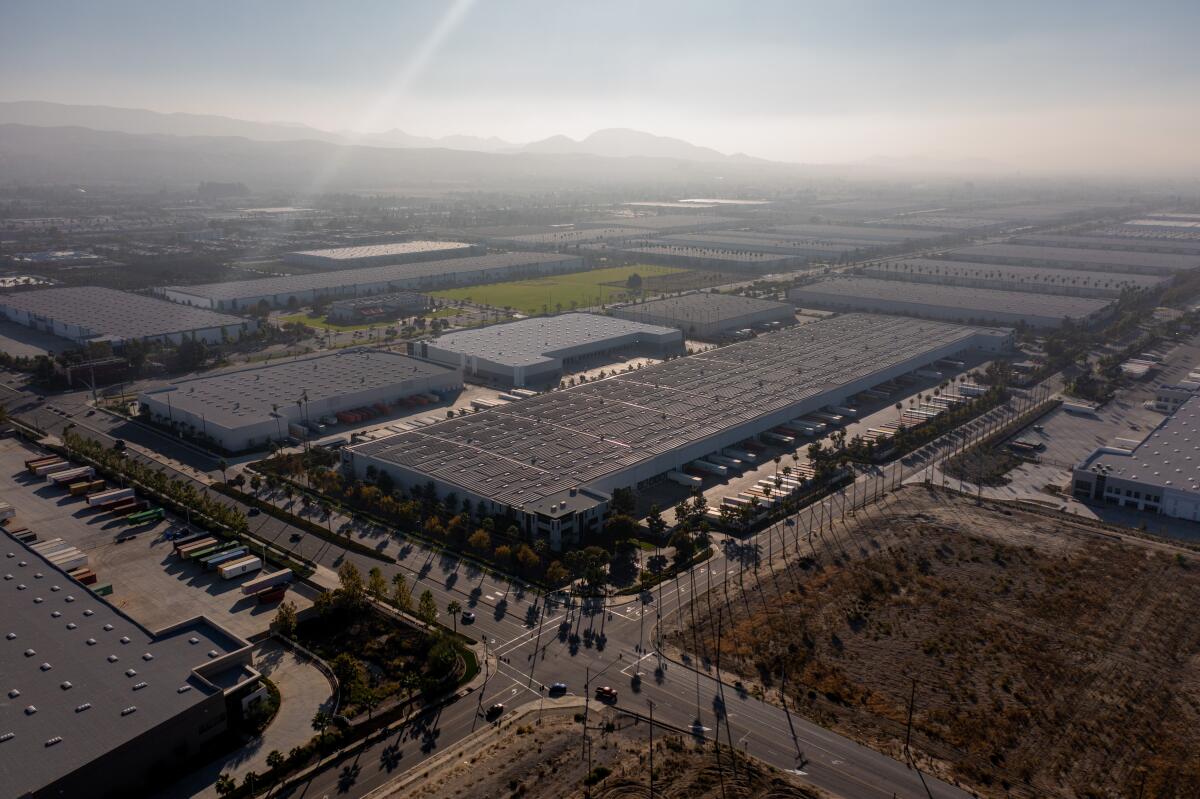
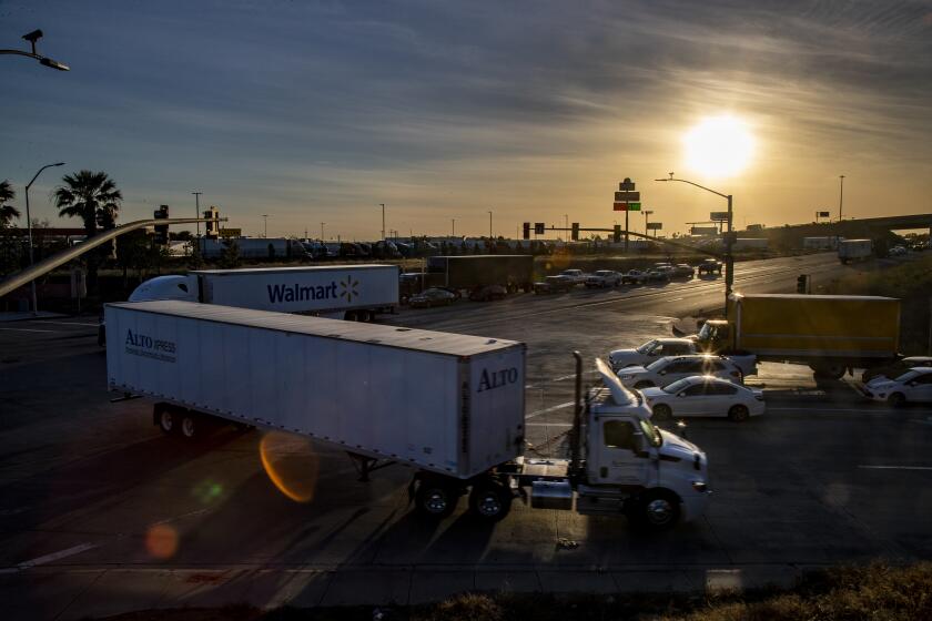
Over the last 20 years, Iâve watched open land and farmland in the Inland Empire become a gridlocked sea of warehouses. These giant boxes have worsened traffic, air quality, cancer rates and chronic health problems in the region and have cemented poverty here. The industry once touted as a blue-collar miracle is instead filled with temp jobs rife with health and safety issues, wage theft, little job security and a future in which robotic workers are predicted to reign supreme.
The Inland Empire is at a breaking point. More than a dozen groups throughout its vast 27,000-square-mile region are attempting to pass moratoriums on warehouse construction. But conservative politics and development money continue to win out. City councils in what are known as âdiesel death zonesâ routinely sacrifice the health of residents for economic benefit in areas that often have Black and Latino populations.
Last year the Robert Redford Conservancy for Southern California Sustainability at Pitzer College, which I oversee, began creating an animated map of warehouse growth in the Inland Empire that reaches back to 1975. Recently published, the map makes warehouses in the Inland Empire look like the spread of a disease. What began at a couple of World War II military logistics sites in San Bernardino and Mira Loma, a town in Riverside County, has grown into a behemoth with millions of square feet of warehouse space.
Strategic land acquisitions near airports and rail yards created an Inland Empire logistics hub that is visible from space. By the 1980s, agriculture was considered a relic industry and the Inland Empire region had been deemed to be âdirt cheap.â The abundance of land combined with a large immigrant population of low educational attainment made for a narrative that warehousing was a natural fit. Besides, the nationâs largest port complex is an acceptable drive away. With the emergence of online shopping in the 1990s, warehouse construction began to skyrocket.
Forty percent of the nationâs goods now travel through the Inland Empire, mainly in diesel trucks but also via trains and planes. Their combined emissions caused the Riverside-San Bernardino-Ontario area to have the worst air quality in the United States as of 2019. This means we have more days of high ozone and particulate matter exposure than most places in the country.
Southern California air quality officials are set to vote on rules that seek to cut pollution from trucks at 3,000 warehouses.
The continuing warehouse construction despite these harms inspired students and staff at the Redford Conservancy to create a map that local groups, planners and residents could use to advocate for change in their own communities. After contacting San Bernardino County and Riverside County to obtain parcel data, we worked with a geographic information systems specialist to develop a mapping method â and then realized the data were flawed. In some cases, we couldnât show square-footage or indicate construction dates.
Even so, the collective footprint is astonishingly massive: As of 2021, the warehouses of the Inland Empire accounted for more than a billion square feet. There are more than 3,000 warehouses in San Bernardino County and nearly a thousand more in Riverside County. They cover almost 37 contiguous square miles. This growth shows no signs of slowing.
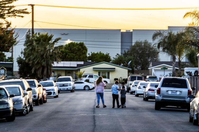
Today, each new warehouse â each new dot on the map â represents a new group of people struggling to have their voices heard. Senior citizens in Banning. Community members in Fontana, Colton or San Bernardino. Concerned neighbors in nearby Bloomington. Residents in Moreno Valley. Farmers and families in Ontario.
In the semirural area of Bloomington, for example, a 3-million-square-foot Bloomington Business Park Specific Plan has been proposed adjacent to three schools. It would require razing 200 homes.
Ontario, with about 625 warehouses, is already one of the areas in the state most burdened by pollution. The recently approved South Ontario Logistics Center Specific Plan is just one of several proposed warehouses that will pave over some of the last prime farmland in the area. The land could be used for regenerative agriculture as well as innovative housing models or net-zero energy communities.
The revenue warehouses generate almost guarantees their construction despite significant environmental and health impacts and the counter-efforts of community members and environmental groups.
As it stands, a major disconnect exists between how individual warehouses are approved and how their regional impact is evaluated. This makes planning for a climate-challenged future difficult, if not impossible.
The Inland Empire is economically overdependent on the movement of goods. Such dependency on a single economic sector leaves the region vulnerable to catastrophic events at home and abroad. Because warehouses and ports are connected to locations around the globe, a terrorist attack or a tsunami can occur far away yet have devastating consequences locally. The countless smaller supply chain disruptions that have occurred since the pandemic will likely be amplified by sea-level rise and extreme weather patterns in the coming years.
It would be misguided to continue to invest in logistics infrastructure in the Inland Empire, regardless of the potential financial gains.
Warehouses bring millions of dollars to cities, allowing them to build infrastructure as well as providing the fiscal capacity for additional projects. Environmental impact reports for these projects universally describe significant and unavoidable environmental detriments, whether that means greenhouse gas emissions, increases in the urban heat island effect, habitat destruction, loss of farmland, increased traffic or worsening air quality.
Itâs a slow form of violence, like a Love Canal in the air. The Inland Empire has always captured smog. Residents and community groups have argued for an indirect source rule that makes warehouses responsible for the pollution generated by trucks that visit their docks.
Aside from that, the battle is seemingly waged in a hundred places at once, with little room for coalition-building despite widespread regional opposition to warehouse growth.
Southern California air quality officials are imposing new rules on nearly 3,000 warehouses, citing increased pollution from diesel truck traffic.
The airshed is our last commons. To protect it, existing warehouse infrastructure should be made environmentally efficient through solar and electrification. New construction of warehouses should be minimized if not eliminated. Community participation in the planning process should become a priority.
Creating a regional commitment to the principles of national and state legislation to conserve 30% of open and working lands, and coastal waters, by 2030 could make the Inland Empire a keystone region for nature-based solutions to climate change.
Our mapping project documents the warehouse takeover of the Inland Empire and, indirectly, the pressing need for the greater community to come together and find a more sustainable way forward.
Susan A. Phillips is professor of environmental analysis and director of the Robert Redford Conservancy for Southern California Sustainability at Pitzer College.
More to Read
A cure for the common opinion
Get thought-provoking perspectives with our weekly newsletter.
You may occasionally receive promotional content from the Los Angeles Times.
