WhereŌĆÖs the rain? Chilly winter storm is creeping south toward L.A.

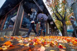
Break out the cozy blankets and find a spot by the fireplace Thursday evening because a chilly winter storm is set to arrive in Southern California, bringing rain and snow to the region.
The storm, which originated south of Alaska and is moving slower than forecasters expected, was lingering in San Francisco on Thursday morning, meaning Los Angeles will have to wait a few more hours for any significant rainfall. The storm is expected to creep down the coast throughout the day before reaching Los Angeles County about 8 p.m., said Ryan Kittell, a meteorologist with the National Weather Service in Oxnard.
ŌĆ£Thankfully, most people will be home by then,ŌĆØ Kittell said. ŌĆ£The rain should continue into Friday morning until about 3 a.m., and then it should be pretty much done.ŌĆØ
The storm is expected to dump a quarter to three-quarters of an inch of rain along the coast and in the valleys. The foothills will see a little more precipitation, with three-quarters to 1┬Į inches falling overnight, Kittell said.
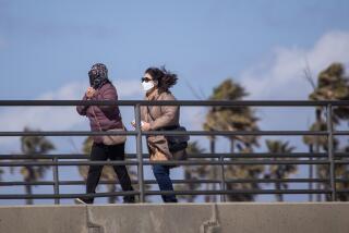
Cold winds are also blowing in, with 15- to 25-mph breezes expected along the coasts. That will keep temperatures in the 40s overnight and the low 60s during the day Thursday and Friday.
The system also is set to drop snow levels considerably in the region, down to 3,500 feet by Thursday night, meaning the Interstate 5 corridor through the Grapevine will likely get a couple of inches of fresh powder. Elevations 5,500 feet and higher could see 4 to 8 inches of powder, while areas at 4,500 to 5,500 feet are expected to get 2 to 4 inches.
ŌĆ£If youŌĆÖre traveling this evening, you should be fine, but anytime after midnight, thereŌĆÖs a chance for some snow to accumulate,ŌĆØ Kittell said. ŌĆ£It shouldnŌĆÖt be enough to close the Grapevine, but it will certainly cause some slowdowns.ŌĆØ
The storm has already spurred the weather service to issue winter storm warnings for much of the Sierra Nevada range in Northern California, warning of major travel delays, road closures and whiteout conditions through early Friday. Up to 2 feet of snow are expected at elevations above 2,000 feet, according to the National Weather Service in Sacramento.
The fresh snowfall will be good news for the stateŌĆÖs plush snowpack, which provides about 30% of the annual water supply for the state. The spring and summer snowmelt feeds rivers and reservoirs and eventually is distributed to various water agencies for farm irrigation, landscaping and urban drinking supplies.
After a likely dry weekend, forecasts are suggesting a chance of light rain Monday and Tuesday, but on the heels of a wet December, January has been mostly dry.
ŌĆ£WeŌĆÖre still looking good for the season even though January has been a little drier than normal,ŌĆØ Kittell said. ŌĆ£Usually February is our wettest month, so we have plenty of reason to hope for more rain.ŌĆØ
More to Read
Sign up for Essential California
The most important California stories and recommendations in your inbox every morning.
You may occasionally receive promotional content from the Los Angeles Times.


